Download
1 / 25
250 likes | 275 Vues
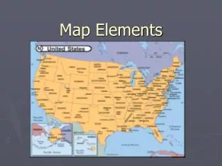
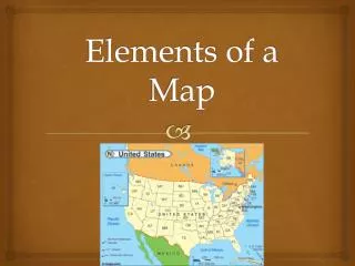
Map Elements. Ms. Hall. Learner Expectation. Content Standard: 3.0 Geography 3.01 Understand how to use maps, globes, and other geographic representations, tools, and technologies to acquire, process and report information from a spatial perspective. In this activity you will:.

E N D
Map Elements Ms. Hall
Learner Expectation • Content Standard: 3.0 Geography • 3.01 Understand how to use maps, globes, and other geographic representations, tools, and technologies to acquire, process and report information from a spatial perspective.
In this activity you will: • Learn about the elements of a map: latitude, longitude, the hemispheres, directions, time zone, scale, and map legends. • Write a paragraph describing the parts of a map. Tell the function of each part in reading a map.
Latitude and Longitude • The earth is divided into lots of lines called latitude and longitude.
Lines • Longitude lines run north and south. • Latitude lines run east and west. • The lines measure distances in degrees. Latitude Longitude
Where is 0 degree? • The equator is 0 degree latitude. • It is an imaginary belt that runs halfway point between the North Pole and the South Pole. Equator
P R I M E M E R I D I A N Where is 0 degree? • The prime meridian is 0 degrees longitude. This imaginary line runs through the United Kingdom, France, Spain, western Africa, and Antarctica.
Latitude and Longitude Resources • Latitude & Longitude Activity • A Printable Latitude & Longitude Map of the World • Latitude & Longitude Map Making • Latitude and Longitude Quiz
Hemispheres • By using the equator and prime meridian, we can divide the world into four hemispheres, north, south, east, and west.
Compass • A compass is a tool that helps the user know what direction one is headed. • On a map, a compass or a compass rose helps the user locate these directions.
Compass Rose • The needle on a compass is magnetized to point to the earth's north magnetic pole. Thus with a compass, a person can roughly tell which direction they are headed. • There are four major or cardinal directions on a compass- north, south, east & west. In between are the directions northeast, northwest, southeast, southwest. • Direction Quiz Source: http://aerocompass.larc.nasa.gov
Directions • The cardinal directions are north, south, east, and west. • The intermediate directions are northeast, southeast, southwest and northwest. • They help describe the location of places in relation to other places.
Scale • Maps are made to scale; that is, there is a direct connection between a unit of measurement on the map and the actual distance. • For example, each inch on the map represents one mile on Earth. So, a map of a town would show a mile-long strip of fast food joints and auto dealers in one inch.
Time Zones • The Earth is divided into 24 time zones, corresponding to 24 hours in a day. • As the earth rotates, the sun shines in different areas, moving from east to west during the course of a day. • Places that have the same longitude will be in the same time zone.
Religions Legend Map Legends • The legend is the key to unlocking the secrets of a map. Objects or colors in the legend represent something on the map.
Legend Age Expectancy
Legend Reading Activities • What You Can Learn From A Map • What do Maps Show Activity • Road Map • Road Map Legend • Road Map of Salt Lake City Region • Map Worksheet
Sites to visit • Look up Latitude and Longitude for US Cities • Maps and Map Skills Degrees, Latitude, & Longitude Worksheet • Latitude and Longitude Map (lesson plan) • Scale • Time Zones • Anchors Aweigh (a map adventure) • Map Quiz • Make Your Own Map • Topography Maps • U. S. Map Collection • GeoSpy Game • Globe Projector • GeoGame
Additional Sources • Atlas - World (Holt, Rinehart and Winston) • Outline Map of US • Maps & Globes
Writing Activities • Write a paragraph describing the parts of a map. Tell the function of each part in reading a map. FCA’s • Strong Topic Sentence 7 • Use and define 7 terms 35 • Proper GUM 8 • TOTAL. 50