Download
1 / 12
120 likes | 145 Vues
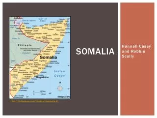
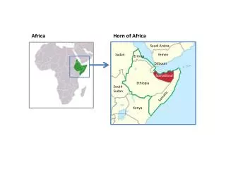
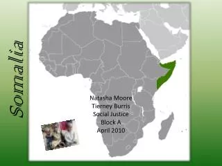
PRIOR KNOWLEDGE CHECK. SOMALIA. Where is Somalia?. AF2 – plot information accurately onto a map AF3 – describe the location and climate of Somalia using map evidence. LINES OF LATITUDE. N. S. COPY: 1. Lines of latitude go across, marked north and south. LINES OF LONGITUDE. W. E.

E N D
PRIOR KNOWLEDGE CHECK... SOMALIA
Where is Somalia? AF2 – plot information accurately onto a map AF3 – describe the location and climate of Somalia using map evidence
LINES OF LATITUDE N S COPY: 1. Lines of latitude go across, marked north and south.
LINES OF LONGITUDE W E COPY: 2. Lines of longitude go down, marked west and east.
Latitude and Longitude Find the latitude and longitude for locations A-J on the map.
Distances & Direction = SCALE BAR Using a ruler and the scale bar, measure the following distances and directions in FULL SENTENCES: What is the distance in KILOMETRES from Mogadishu to Boosaaso? What direction is Boosaaso from Mogadishu? What is the distance from Eyl to Hobyo? What direction is Hobyo from Eyl? What is the distance and direction from Mogadishu to the border with Kenya? What is the approximate distance of the Somalian coastline?
Where is Somalia? Describe the location of Somalia SUCCESS CRITERIA FOR PEER ASSESSMENT WTE – Described the continent and country, may be a surrounding country ME – Described the above and the surrounding countries with directions, relation to equator ME+– Described all the above and included names of places, cities, seas, their location, directions etc… EE– Describe all the above and included latitude and longitude, and distances Use these maps and the Atlas to find map evidence! Somalia is located…
Somalia AF2 – plot information accurately onto a map • Use the Atlas to plot the following information: • Capital of Somalia: Mogadishu • Jubba River • Gulf of Aden and the Indian Ocean • Karkaar Mountains • EQUATOR • Surrounding countries – Ethiopia, Dijibouti, Kenya. Make sure the map is complete!
Somalia’s Climate AF3 – describe Somalia’s climate COPY: Climate = the normal weather conditions (temperature and rainfall) Describe the climate of Somalia. (What’s the general pattern? Is it the same throughout the country? Uneven? Is it hot/cold? High/low precipitation?) Good descriptions include DATA – quote data/manipulate if you can! What issue is the climate creating in Somalia? Why? What could be making it worse? How do you know?
POST KNOWLEDGE CHECK... SOMALIA
AF3 –compare life in Somalia with UAE Using the data, answer the following: What would be better about living in Somalia than UAE? What would be worse living in Somalia than UAE? Where would you prefer to live? Why?
Somalia’s Climate AF2 – plot information accurately onto a map Create a choropleth map for Somalia to show its climate. Use 3 shades of colour for rainfall and temperaure. Complete one map for precipitation and one map for temperature. REMEMBER TO USE A KEY! Use the maps to answer the following: What’s the climate like in Somalia? What issue is this creating in Somalia? Why? What could be making it worse? How do you know?