Download
1 / 27
280 likes | 458 Vues
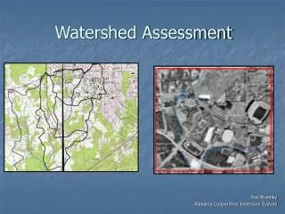
Watershed Assessment (ENSC 202). Phase 1 – Steps 6-10 Extracted from Vermont ANR Stream Geomorphic Assessment Protocols Handbook - Introduction. Step 6 Floodplain modifications. 6.1 Berms and Roads 6.2 River Corridor Development 6.3 Depositional Features

E N D
Watershed Assessment (ENSC 202) Phase 1 – Steps 6-10 Extracted from Vermont ANR Stream Geomorphic Assessment Protocols Handbook - Introduction ENSC 202 – 2004 Phase 1 Steps 6-10
Step 6 Floodplain modifications • 6.1 Berms and Roads • 6.2 River Corridor Development • 6.3 Depositional Features • 6.4 Meander Migration / Channel Avulsion • 6.5 Meander Width Ratio • 6.6 Wavelength Ratio ENSC 202 – 2004 Phase 1 Steps 6-10
Rationale for Step 6 • Streams need floodplains for adjustment • Development often constrains the floodplain • Floodplain constraint can increase stream power • Increased power can move larger particles, leading to degradation ENSC 202 – 2004 Phase 1 Steps 6-10
Step 6.1 Berms and Roads • Rough percentages in the river corridor • Does not include crossings • Impact rating I-89 along Winooski River ENSC 202 – 2004 Phase 1 Steps 6-10
Step 6.2 River Corridor Development • Houses, fill (including bridge and culvert fills), parking lots or other development • Impact rating ENSC 202 – 2004 Phase 1 Steps 6-10
Step 6.3 Depositional Features • Un-vegetated ‘bars’ • Impact rating ENSC 202 – 2004 Phase 1 Steps 6-10
Step 6.4 Meander Migration/Channel Avulsion • Best done by difference analysis with orthophotos • GIS or tracing on acetates • Consider errors in overlays • Impact rating High impact migration and avulsion ENSC 202 – 2004 Phase 1 Steps 6-10
Step 6.5 Meander width ratio • Only certain reaches (step 2.10) • types C or E riffle-pool or ripple-dune reference types • narrow (NW) and unconfined (BD and VB) valleys • If straighten >50% belt width = channel width MWR=1 • naturally confined and braided stream types • enter “0” for MWR • enter not applicable (“N/A”) for the impact rating • See Appendix H ENSC 202 – 2004 Phase 1 Steps 6-10
Step 6.6 Wavelength ratio • Same restrictions as in step 6.5 • WLR = wavelength/channel width (2.8) ENSC 202 – 2004 Phase 1 Steps 6-10
Step 7 Bed and Bank Windshield Survey • 7.1 Dominant Bed Form / Material • 7.2 Bank Erosion – Relative Magnitude • 7.3 Debris and Ice Jam Potential ENSC 202 – 2004 Phase 1 Steps 6-10
Rationale & considerations for Step 7 • An opportunity to check validity of Phase 1 assessments before Phase 2 effort • Do advanced planning to limit drive time • Take care in doing assessments from bridges bridge impact • Good opportunity to do some photo documentation ENSC 202 – 2004 Phase 1 Steps 6-10
Step 7.1a Dominant bed form ENSC 202 – 2004 Phase 1 Steps 6-10
Step 7.1b Dominant bed material ENSC 202 – 2004 Phase 1 Steps 6-10
Step 7.2 Bank erosion – relative magnitude • Bank erosion • Bank heights Remember that some erosion is natural ENSC 202 – 2004 Phase 1 Steps 6-10
Step 7.3 Ice/debris dam potential ENSC 202 – 2004 Phase 1 Steps 6-10
Step 8 Stream Impact Ratings • 8.1 Impact Rating • High(2), Low(1), Not sig (0), Don’t know (0) • 8.2 Priority Rating • A tool available in the database reporting functions ENSC 202 – 2004 Phase 1 Steps 6-10
Step 9 Stream Geomorphic Condition Assessment • 9.1 Channel Adjustment Process • 9.2 Reach Condition • 9.3 Reach Sensitivity ENSC 202 – 2004 Phase 1 Steps 6-10
Step 9.1 PROVISIONAL channel adjustment processes This table is generated automatically by the database. See Appendices B and C Adjustment defined as score > 4 ENSC 202 – 2004 Phase 1 Steps 6-10
ENSC 202 – 2004 Phase 1 Steps 6-10
Channel Evolution Models (CEM) • F- and D-stage streams • unconfined, low gradient valleys where the streams are not entrenched • access to floodplain at 1-2 year flood stage • F-stage process: bed and bank is erodible • D-stage process bed and bank less erodible ENSC 202 – 2004 Phase 1 Steps 6-10
F-stage CEM ENSC 202 – 2004 Phase 1 Steps 6-10
D-stage CEM ENSC 202 – 2004 Phase 1 Steps 6-10
Step 9.2a Reach condition score • Calculated by the database • Based on the 4 key adjustment processes • Calculated for each reach based on the worst adjustment process in the worst reach • Effectively a ‘bad’ to ‘worst’ scoring system ENSC 202 – 2004 Phase 1 Steps 6-10
Step 9.2b – Reach condition score ENSC 202 – 2004 Phase 1 Steps 6-10
Step 9.3 Reach sensitivity(Subjective) Considerations ENSC 202 – 2004 Phase 1 Steps 6-10
Step 10 Like Reach Evaluation • Basically a simple sorting tool in the database • May help in selecting reaches for Phase 2 field work ENSC 202 – 2004 Phase 1 Steps 6-10
Remember to do your QA/QC!! ENSC 202 – 2004 Phase 1 Steps 6-10