Download
1 / 14
180 likes | 732 Vues
MARINE PROTECTED AREAS IN THE BAHAMAS. By: Janeen Bullard & LaKeshia Anderson. IABIN MARINE PROTECTED AREAS WORKSHOP Ocho Rios, Jamaica March 10 th – 13 th , 2008. National Park System. Walkers Cay National Park. Black Sound Cay National Reserve. Lucayan National Park

E N D
MARINE PROTECTED AREAS IN THE BAHAMAS By: Janeen Bullard & LaKeshia Anderson IABIN MARINE PROTECTED AREAS WORKSHOP Ocho Rios, Jamaica March 10th – 13th, 2008
National Park System Walkers Cay National Park Black Sound Cay National Reserve Lucayan National Park Rand Nature Centre Peterson Cay National Park Tilloo Cay National Reserve National Park System of the Bahamas Abaco National Park The Retreat Bonefish Popnd National Park Harrold and Wilson Ponds National Park The Primeval Forest Central Andros National Parks Conception Island Exuma Cays land & sea Park Moraih Harbour Cay National Park Marine Farm Hope House Little Inagua National Park Union Creek Reserve Inagua National Park
Exuma Cays Land & Sea Park • Created in 1959 • Managed by BNT • Became no-take in 1986 • Management Plan Completed Photo courtesy of S. Larson
Network of Marine Reserves • The national network of MPAs to include at least 20% of the total shelf edge of The Bahama banks • Initial designation in 2000 • Fisheries Act/Regulations • No management plan
Andros Northern and Southern Barrier Reef National Parks Andros West Side Andros NB: Outlined in green are the proposed areas to be included in the west side protected area system
San Salvador Activities completed • Community Consultation • Dive Tag Program • Proposal Submitted to government
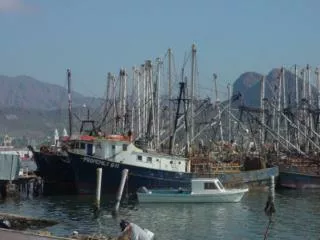
North Bimini • Area size: 30.69 km2 • Habitats: • Mangrove (western edge) • Seagrass beds • Bonefish flats • Reef • lagoon • Main threats • Major development • Foreign fishing • Historic site • Healing hole
Abaco • Area size: ≈ 95.16 km2 • Abaco Barrier Reef • Habitats • Coral reef • Seagrass beds • mangroves • Major threats • Casuarinas • Lionfish (2 species)
Exuma • Site 1: Size: 145.52 km2 • mangroves and creeks • Bonefish flats • Spiny lobster breeding grounds • Major threat • Lack of enforcement • Site 2: Size: 101.83 km2 • Nassau grouper spawning aggregation • Patch reefs • Major threats • Commercial fishing (LI) • Bleaching • Lionfish
South Eleuthera • Area size: 50.30 km2 • Habitats • Patch reefs • Mangroves • Blue holes • Seagrass meadows • Breeding grounds • Queen conch • Spiny lobster • Main threats • Depressed economy • enforcement • Lionfish
Berry Islands • Area size ≈ 136.31 km2 • Edge of tongue of the ocean • Habitats • Extensive Coral reef • Seagrass beds • conch nursery grounds • Main threats • Lionfish • Developments • Fishing
CURRENTLY….. • National Implementation Support Programme (NISP) Partnerships (DMR, BNT, TNC, BEST COM) • Capacity Plan • Sustainable Finance Plan • Master Plan • Assessment of current state of proposed areas & defining boundaries. • Continued stakeholder consultations • Management plan/zoning
Email contacts: lakeshiaanderson@bahamas.gov.bs & jbullard@bnt.bs