Download

1 / 27
270 likes | 279 Vues
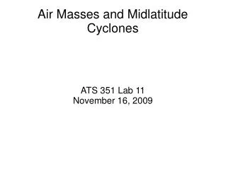
Cyclones: Horizontal Structure and Evolution. AOS 101 Section 301 20 April 2009. The Mid-Latitude Cyclone. Large area of low pressure, with winds that flow counter-clockwise around the pressure minimum. The Mid-Latitude Cyclone.

E N D
Cyclones: Horizontal Structure and Evolution AOS 101 Section 301 20 April 2009
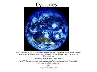
The Mid-Latitude Cyclone Large area of low pressure, with winds that flow counter-clockwise around the pressure minimum
The Mid-Latitude Cyclone Large area of low pressure, with winds that flow counter-clockwise around the pressure minimum L
The Mid-Latitude Cyclone Large area of low pressure, with winds that flow counter-clockwise around the pressure minimum Clouds and precipitation often organized around fronts – regions of strong temperature gradients
The Mid-Latitude Cyclone Large area of low pressure, with winds that flow counter-clockwise around the pressure minimum Clouds and precipitation often organized around fronts – regions of strong temperature gradients L
The Mid-Latitude Cyclone Large area of low pressure, with winds that flow counter-clockwise around the pressure minimum Clouds and precipitation often organized around fronts – regions of strong temperature gradients Systems which persist for 5-7 days on average, and are responsible for much of the weather that we see day-to-day
Distinctive Shape • What gives the mid-latitude cyclone its distinctive comma-head shape?
Distinctive Shape • Clouds appear in regions of rising air • The structure of a mid-latitude cyclone promotes rising air in specific areas which create the “comma” appearance
Because friction is important near the surface, the winds are directed slightly toward the center of the low pressure (L) Low level convergence leads to rising air, and clouds appear in the “comma head” region
Fronts are also regions that promote rising air, leading to clouds and precipitation in frontal regions
Fronts • Regions of strong temperature gradients • Cold air is advected south behind the cold front, and warm air is advected north behind the warm front • The movement of cold/warm air into new territory creates rising motion • These fronts provide the cyclone with its energy source, when they are gone, the cyclone dies
Cold Fronts Because cold air is denser than warm air, it pushes its way into the region inhabited by warm air (in front of the cold front)
Cold Fronts Because cold air is denser than warm air, it pushes its way into the region inhabited by warm air (in front of the cold front) The warm air rises up over the dome of cold air pushing in at a steep angle
Warm Fronts In the region of the warm front, warm air is slowly pushing cold northward
Warm Fronts In the region of the warm front, warm air is slowly pushing cold northward This creates a shallow ramp of cold air that warm air rises on top of as it pushes the cold air out of the way
Fronts • Because the geometry of these fronts are different, they produce different kinds of weather: • Cold Fronts = Sharp lines of intense precipitation and deep clouds • Warm Fronts = Wide regions of less-intense precipitation and shallower clouds
Occluded Fronts • Cold fronts can move more quickly than warm fronts • When a cold front catches up with a warm front, the warm air is squeezed out of the way, leading to an occluded front • This is the “last gasp” for the front, and occlusion occurs as the storm reaches peak intensity, then weakens and dies
Cyclone Lifecycle • Cyclones go through three distinctive phases in their 5-7 day lifespan:
Incipient Stage We start with a “stationary front”, which is just a region of strong temperature contrast between cold polar air and warm tropical air
Incipient Stage We start with a “stationary front”, which is just a region of strong temperature contrast between cold polar air and warm tropical air A small low-pressure disturbance starts to circulate air, creating warm fronts and cold fronts
Mature Stage • Cyclone strengthens to mature stage: • Sea level pressure drops • Pressure gradient and Winds increase • More clouds and precipitation • Better defined fronts • “Comma” appearance
Occluded Stage Frontal occlusion begins as the cold front catches up to the warm front Storm is at its strongest – lowest sea-level pressure, strongest winds, strong precipitation “Death knell” – cyclone center is detached from warm air, fronts and cyclone will start to weaken
Decaying Stage Cyclone center now completely separated from warm air Sea-level pressure rises Pressure-gradient and winds die down Precipitation and clouds cease This storm has used all of its available energy