Download
1 / 23
270 likes | 680 Vues
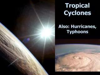
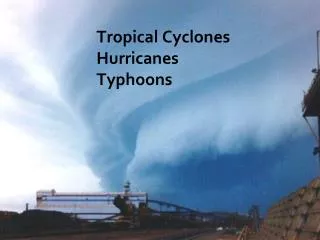
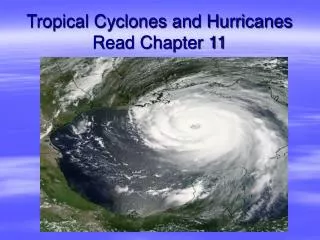
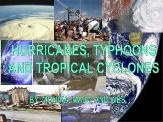
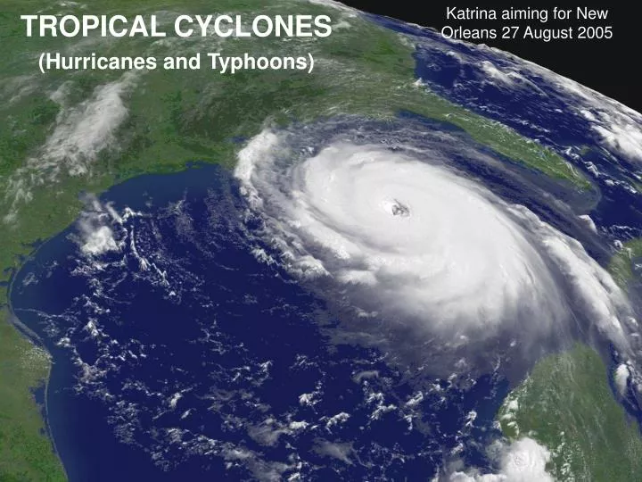
TROPICAL CYCLONES HURRICANES TYPHOONS. Katrina aiming for New Orleans 27 August 2005. TROPICAL CYCLONES (Hurricanes and Typhoons). Tropical Cyclones: Names and Nature

E N D
TROPICAL CYCLONES HURRICANES TYPHOONS Katrina aiming for New Orleans 27 August 2005 TROPICAL CYCLONES (Hurricanes and Typhoons)
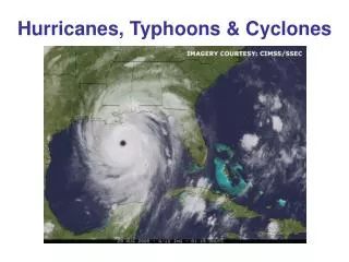
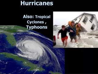
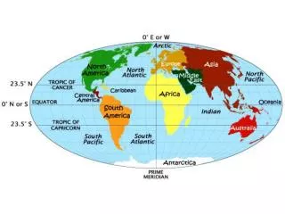
Tropical Cyclones: Names and Nature Tropical cyclones, the deadliest of all storms, rage over all the world’s tropical and subtropical oceans except for the South Atlantic. In each ocean basin they assume different names but are essentially the same. They are called hurricanes In the Atlantic and eastern Pacific Oceans, typhoons, in the western Pacific, baguios in the Philippines, and cyclones in the north Indian Ocean. Tropical cyclones are intense low pressure areas roughly 600 km (375 miles) in diameter that form over warm waters (T > 26.5C = 80F) and have wind speeds that reach or surpass 74 mph. To form, hurricanes need, Conditions for Formation of Tropical Cyclones 1. Warm ocean waters at least 78°F (26°C) to provide the heat. 2. Coriolis force to provide the rotation. 3. A seedling or cyclonic weather disturbance with extra cloud cover. 4. Almost uniform large scale wind with little vertical shear to allow heat to accumulate. 5. An exhaust system consisting of a divergent upper level disturbance. Hurricanes develop when regions of disturbed, cloudy weather pass over warm water. The disturbances include 1: fronts from higher latitudes, 2: poleward bulges of waves in the ITCZ, 3: squall lines from Tropical West Africa, and 4: reincarnations of Atlantic hurricanes that pass over Mexico or Central America. Hurricanes are spinning engines that need the Coriolis force to start the rotation. Only then can the ice skater effect increase the spin to a violent whirlwind as the air
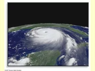
converges toward the center of the storm. Therefore, no hurricane ever forms within about 3° latitude of the equator and none ever crosses the equator as a hurricane. Hurricanes have warm cores (centers), but their seedlings may not. To develop a warm core, the large scale wind must be almost the same at all heights. Any significant vertical shear of the wind will tear it apart. Thus, the strong tropical easterly jet shuts off all Cyclones around India at the height of the summer monsoon in July and August, while persistent upper level westerly winds virtually rule out hurricanes over the South Atlantic. The thermal wind implies that hurricanes form where the large scale temperature field is horizontally uniform. Thus, hurricanes do not have fronts and differ profoundly from extratropical cyclones or winter lows, which have fronts, and develop where the largest horizontal temperature gradients occur – directly below the jet stream. Finally, hurricanes, like any engine, need an exhaust valve to flush out the excess heat and air at the top of the troposphere. This is provided by disturbances with divergence over the storm including outflow regions 1: of deceased hurricanes, 2: to the sides of jet stream troughs that have invaded the tropics from higher latitudes. Unfortunately, these disturbances are often too weak to identify. Structure of Tropical Cyclones Earth’s rotation organizes the hurricane’s clouds into a unmistakable pinwheel pattern with a relatively calm and clear central region called an eye. The eye ranges from 15 to as much as 100 km wide. It tends to be clear when the hurricane is intensifying – otherwise a canopy of high clouds may cover it. There are also frequently bands of low stratocumulus or cumulus clouds lined into giant spirals.
The eye is surrounded by the eye wall, which gives the appearance of a cosmic stadium, towering to over 10 miles, 15 km or 50,000 feet. The eye wall, also called the central dense overcast is a donut-shaped region of the most intense rain and fastest winds. Further out the clouds are lined into spiral bands, which contain gusty winds and heavy showers, possibly with thunderstorms. When the hurricanes come over land, some of these thunderstorms spawn tornadoes. The spiral bands and central dense overcast make the tropical cyclone resemble spiral galaxies, in which the stars of the galaxy’s spiral arms correspond to the thunderstorms of the hurricane’s spiral band, and the star clusters of the galaxy’s core correspond to the hurricane’s central dense overcast. Winds and Sea State Near the ground the air spirals inward and is accelerated by the ice skater effect (conservation of angular momentum) despite loss of energy to friction. Thus, the fastest winds are found at the inner edge of the eye wall. These winds shred the sea surface, filling the air with long trails of spray and spume, and in extreme cases making it hard to tell the boundary between sea and air. But even in large, category 5 storms, hurricane force winds seldom extend more than 100 miles (160 km) from the center. As the air converges toward the center some of it rises in the spiral bands to form heavy showers or thunderstorms. But most air approaches the inner edge of the eye wall, where it spins too fast to converge any further. It then turns sharply up and tilts out to leave a distinct eye in the center and form the eye wall. The rapidly rising air of the eye wall yields the storm’s most torrential rain and its thickest clouds, with temperatures sometimes dropping below -90°C (-130°F).
Death Hurricanes die when they leave tropical waters or when they draw in cold or dry air. Thus, they always die once they come over land in the sense that the winds weaken rapidly, but they may produce torrential rains and flooding for several days. When hurricanes draw in cold air they often transform into and are reborn as extratropical cyclones. This happened with the so-called Perfect Storm, that was made into a movie, and which generated ocean waves up to 100 feet high! Hurricane Season Warm waters make hurricanes storms of summer and early fall. In the Atlantic, peak hurricane season begins in late July and ends in October. The Pacific Ocean warms earlier and stays warm longer, so hurricane and typhoon season there begins in June and continues into November. The North Indian Ocean warms earliest of all and remains warm the longest, so Cyclone season begins in April and runs into November. Ironically, no hurricanes form in the Indian Ocean at the height of the summer monsoon during July and August. South of the equator, peak season runs from January to April. The South Atlantic Ocean is rarely warm enough to produce hurricanes although in the past few years two South Atlantic Hurricanes were recorded after a gap of more than a century.
Seedlings for Hurricanes Squall Line
2005/240 28 Aug, 1700 UTCHurricane Katrina approaching the Gulf Coast Satellite: Terra - Pixel size: 2km Next slide has Pixel size: 0.5 km Features include Open Eye Vortices in Eye Spiral Bands Central Dense Overcast Cumulus rows aligned with wind over land Thunderstorm overshooting tops in Spiral Bands
Wind Speed Around Katrina This is a typical wind profile around a moving hurricane. Speed is small in the eye decreasing toward the center. The fastest winds surround the center but are greatest on to the right of the storm. Wind speed is greater to the right of the storm’s motion because the wind is close to the sum of the storm’s motion and rotation. These add on the right hand side and subtract on the left hand side.
Radar Image of Katrina. The most intense rainfall (orange and red colors) appears in spiral bands and in the eye wall around the eye wall (black circle at bottom where there is no rain. This radar image is from Slidell, LA. When the eye wall hit Slidell, the radar unit was destroyed.
stratiform stratiform rainband eyewall Hurricane Radar Cross Section EYE EYE WALL
As air spirals in toward the center, it conserves angular momentum and speeds up much like an ice skater who spins faster when she stretches her arms over her head.
Hurricane Tracks Hurricanes follow well established tracks because they are herded gently by the larger scale winds around the large subtropical high pressure areas. At first they move from east to west in the tropics with a typical forward speed about 10-15 mph. They often slow down and move erratically when they approach the western sides of the oceans, where the large scale winds often become weak and variable. Some hurricanes continue moving toward the west until they smash into land, while others turn poleward and recurve toward the east when they pass beyond about 30° latitude and enter the region of the westerlies, where they tend to accelerate, and can reach forward speeds up to 60 mph. This happened to the Hurricane of 1938, which occurred before satellites and radar. The result was horrendous. The hurricane claimed over 600 lives when it smashed into the south shores of Long Island and New England. Destruction The main loss of lives and property occur along the shorelines because hurricanes are low pressure areas that suck the sea surface up, while its winds push the waters toward shore. Typically, the sea surface rises about 3 m or 10 feet in what is called the storm surge but can rise up to about10 meters in extreme cases, such as Hurricanes Camille (1969) and Katrina. But the winds and torrential, flooding rains also wreak havoc inland, while tornadoes add insult to injury. Loss of life is now much reduced in the United States and the Caribbean because of excellent forecasting (the population is evacuated), but occasional disasters such as in Bangladesh and Burma still occur because of poverty, ignorance, faulty communications, and terrible governments.
Storm Track for Hurricane Katrina 23-30 August 2005 6-hour Positions Birth
TROPICAL CYCLONE TRACKS FOR THE WORLD Tropical cyclones form over tropical waters at least 80°F but not near the the equator. They move around the large subtropical high pressure areas and can leave the tropics.
Rainfall from Hurricanes Hurricanes produce torrential rains. This can be both good and bad. Hurricane rains sometimes relieve droughts but can provide too much water in too short a time. During Hurricane Floyd, for example the Tar River in North Carolina rose up to 40 feet in places and put much of the state’s highway system under water. An enormous number of animals, many trapped in pens, drowned leaving a terrible stench of decay. In 1998, Hurricane Mitch brought 70” of rain in 5 days (NYC gets 42” per year) to Honduras in 5 days and Nicaragua, leading to mudslides and floods that claimed 10,000 lives and destroyed 75% of the infrastructure of Honduras.
HURRICANE STORM SURGES The storm surge is a potentially catastrophic rise of sea level (accompanied with towering waves) when a storm passes onshore. Storms raise sea level at least 2 ways. 1: The inverted barometer effect. Sea water is forced from the higher air pressure outside a storm to the storm center. For every inch air pressure is lowered, sea level rises 13 inches. 2: Winds blowing toward shore force sea water against the coast. The maximum rise occurs when the wind forces the water into a shallow, narrowing bay or channel. The combination of these two effects can raise sea level up to 10 m in extreme hurricanes. Drowning during storm surges has caused the major loss of human life from hurricanes. LAND OCEAN When a hurricane approaches land, the winds to its right in the North Hemisphere blow toward shore, so the maximum storm surge occurs to the right of the eye.
New Orleans, below Sea Level was a Disaster Waiting to Happen (and it will again). Katrina lifted Lake Ponchartrain over the levees, flooding the city
Hurricane Katrina’s Storm Surge – up to 27 feet Katrina Storm Track http://www.tacc.utexas.edu/research/users/features/dawson.php