Download
1 / 42
430 likes | 1.12k Vues
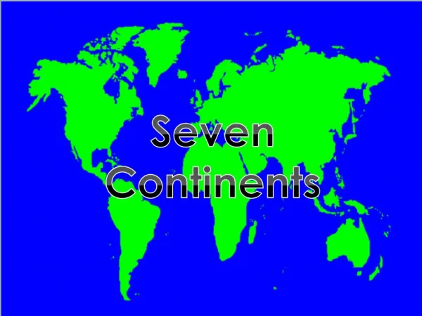
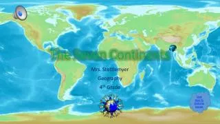
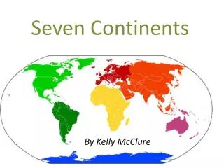
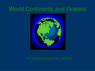
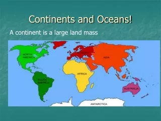
Continents and Oceans Our Earth is made up of seven continents and four oceans. The continents include North America, South America, Europe, Asia, Africa, Australia , and Antarctica . The oceans include the Arctic , the Atlantic , the Indian , and the Pacific.

E N D
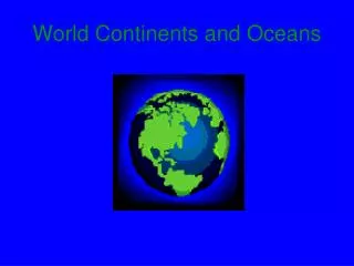
Continents and Oceans Our Earth is made up of seven continents and four oceans. The continents include North America, South America, Europe, Asia, Africa, Australia, and Antarctica. The oceans include the Arctic, the Atlantic, the Indian, and the Pacific.
Continents and Oceans Our Earth is made up of seven continents and four oceans. The continents include North America, South America, Europe, Asia, Africa, Australia, and Antarctica. The oceans include the Arctic, the Atlantic, the Indian, and the Pacific.
Continents and Oceans Our Earth is made up of seven continents and four oceans. The continents include North America, South America, Europe, Asia, Africa, Australia, and Antarctica. The oceans include the Arctic, the Atlantic, the Indian, and the Pacific.
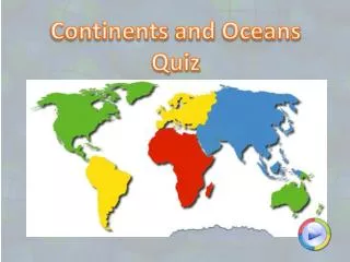
Continents and Oceans Our Earth is made up of seven continents and four oceans. The continents include North America, South America, Europe, Asia, Africa, Australia, and Antarctica. The oceans include the Arctic, the Atlantic, the Indian, and the Pacific. land masses of the earth
Continents and Oceans Our Earth is made up of seven continents and four oceans. The continents include North America, South America, Europe, Asia, Africa, Australia, and Antarctica. The oceans include the Arctic, the Atlantic, the Indian, and the Pacific. land masses of the earth
Continents and Oceans Our Earth is made up of seven continents and four oceans. The continents include North America, South America, Europe, Asia, Africa, Australia, and Antarctica. The oceans include the Arctic, the Atlantic, the Indian, and the Pacific. land masses of the earth
Europe Africa
Asia Europe Africa
Asia Europe Africa Australia
Asia Europe Africa Australia Antarctica
Asia Europe Africa South America Australia Antarctica
Asia North America Europe Africa South America Australia Antarctica
Color each continent a different color. You may use crayons, markers or colored pencils.
Hemispheres Our Earth is also divided into four hemispheres. A hemisphere is half of a globe. Two imaginary lines are used to create these hemispheres. These imaginary lines are the equator and the prime meridian. The equator is a line around the middle of the earth that divides the globe into the northern and southern hemispheres. The prime meridian is a line around the middle of the earth that divides the globe into the eastern and western hemispheres.
Hemispheres Our Earth is also divided into four hemispheres. A hemisphere is half of a globe. Two imaginary lines are used to create these hemispheres. These imaginary lines are the equator and the prime meridian. The equator is a line around the middle of the earth that divides the globe into the northern and southern hemispheres. The prime meridian is a line around the middle of the earth that divides the globe into the eastern and western hemispheres.
Hemispheres Our Earth is also divided into four hemispheres. A hemisphere is half of a globe. Two imaginary lines are used to create these hemispheres. These imaginary lines are the equator and the prime meridian. The equator is a line around the middle of the earth that divides the globe into the northern and southern hemispheres. The prime meridian is a line around the middle of the earth that divides the globe into the eastern and western hemispheres.
Hemispheres Our Earth is also divided into four hemispheres. A hemisphere is half of a globe. Two imaginary lines are used to create these hemispheres. These imaginary lines are the equator and the prime meridian. The equator is a line around the middle of the earth that divides the globe into the northern and southern hemispheres. The prime meridian is a line around the middle of the earth that divides the globe into the eastern and western hemispheres.
Hemispheres Our Earth is also divided into four hemispheres. A hemisphere is half of a globe. Two imaginary lines are used to create these hemispheres. These imaginary lines are the equator and the prime meridian. The equator is a line around the middle of the earth that divides the globe into the northern and southern hemispheres. The prime meridian is a line around the middle of the earth that divides the globe into the eastern and western hemispheres. broken into parts
Hemispheres Our Earth is also divided into four hemispheres. A hemisphere is half of a globe. Two imaginary lines are used to create these hemispheres. These imaginary lines are the equator and the prime meridian. The equator is a line around the middle of the earth that divides the globe into the northern and southern hemispheres. The prime meridian is a line around the middle of the earth that divides the globe into the eastern and western hemispheres. half the earth broken into parts
Hemispheres Our Earth is also divided into four hemispheres. A hemisphere is half of a globe. Two imaginary lines are used to create these hemispheres. These imaginary lines are the equator and the prime meridian. The equator is a line around the middle of the earth that divides the globe into the northern and southern hemispheres. The prime meridian is a line around the middle of the earth that divides the globe into the eastern and western hemispheres. half the earth broken into parts
Hemispheres Our Earth is also divided into four hemispheres. A hemisphere is half of a globe. Two imaginary lines are used to create these hemispheres. These imaginary lines are the equator and the prime meridian. The equator is a line around the middle of the earth that divides the globe into the northern and southern hemispheres. The prime meridian is a line around the middle of the earth that divides the globe into the eastern and western hemispheres. half the earth broken into parts can’t be seen
Hemispheres Our Earth is also divided into four hemispheres. A hemisphere is half of a globe. Two imaginary lines are used to create these hemispheres. These imaginary lines are the equator and the prime meridian. The equator is a line around the middle of the earth that divides the globe into the northern and southern hemispheres. The prime meridian is a line around the middle of the earth that divides the globe into the eastern and western hemispheres. half the earth broken into parts can’t be seen
Hemispheres Our Earth is also divided into four hemispheres. A hemisphere is half of a globe. Two imaginary lines are used to create these hemispheres. These imaginary lines are the equator and the prime meridian. The equator is a line around the middle of the earth that divides the globe into the northern and southern hemispheres. The prime meridian is a line around the middle of the earth that divides the globe into the eastern and western hemispheres. half the earth broken into parts can’t be seen
Hemispheres Our Earth is also divided into four hemispheres. A hemisphere is half of a globe. Two imaginary lines are used to create these hemispheres. These imaginary lines are the equator and the prime meridian. The equator is a line around the middle of the earth that divides the globe into the northern and southern hemispheres. The prime meridian is a line around the middle of the earth that divides the globe into the eastern and western hemispheres. half the earth broken into parts can’t be seen
Label the hemispheres on the next page.
What line divides these hemispheres? ______________________ What line divides these hemispheres? ______________________
Northern Hemisphere Southern Hemisphere What line divides these hemispheres? ______________________ equator Western Hemisphere Eastern Hemisphere What line divides these hemispheres? ______________________ prime meridian
Geographic Grids These two imaginary lines help us to create a grid system on the surface of our globe. This grid system helps us identify the exact location of any place on earth. A grid system has lines that are similar to the lines on a sheet of graph paper. Letters of the alphabet are placed on the left hand edge of the grid and numbers are placed on the bottom edge. When you put a number and a letter together you call it a coordinate. Coordinates tell us the exact locations of things on the surface of the earth. Weathermen use this grid system to tell us the location of hurricanes and tropical storms. Ship captains and airplane pilots use it to locate where they are and where they are going.
Geographic Grids These two imaginary lines help us to create a grid system on the surface of our globe. This grid system helps us identify the exact location of any place on earth. A grid system has lines that are similar to the lines on a sheet of graph paper. Letters of the alphabet are placed on the left hand edge of the grid and numbers are placed on the bottom edge. When you put a number and a letter together you call it a coordinate. Coordinates tell us the exact locations of things on the surface of the earth. Weathermen use this grid system to tell us the location of hurricanes and tropical storms. Ship captains and airplane pilots use it to locate where they are and where they are going.
Geographic Grids These two imaginary lines help us to create a grid system on the surface of our globe. This grid system helps us identify the exact location of any place on earth. A grid system has lines that are similar to the lines on a sheet of graph paper. Letters of the alphabet are placed on the left hand edge of the grid and numbers are placed on the bottom edge. When you put a number and a letter together you call it a coordinate. Coordinates tell us the exact locations of things on the surface of the earth. Weathermen use this grid system to tell us the location of hurricanes and tropical storms. Ship captains and airplane pilots use it to locate where they are and where they are going.
Geographic Grids These two imaginary lines help us to create a grid system on the surface of our globe. This grid system helps us identify the exact location of any place on earth. A grid system has lines that are similar to the lines on a sheet of graph paper. Letters of the alphabet are placed on the left hand edge of the grid and numbers are placed on the bottom edge. When you put a number and a letter together you call it a coordinate. Coordinates tell us the exact locations of things on the surface of the earth. Weathermen use this grid system to tell us the location of hurricanes and tropical storms. Ship captains and airplane pilots use it to locate where they are and where they are going.
Geographic Grids These two imaginary lines help us to create a grid system on the surface of our globe. This grid system helps us identify the exact location of any place on earth. A grid system has lines that are similar to the lines on a sheet of graph paper. Letters of the alphabet are placed on the left hand edge of the grid and numbers are placed on the bottom edge. When you put a number and a letter together you call it a coordinate. Coordinates tell us the exact locations of things on the surface of the earth. Weathermen use this grid system to tell us the location of hurricanes and tropical storms. Ship captains and airplane pilots use it to locate where they are and where they are going.
Geographic Grids These two imaginary lines help us to create a grid system on the surface of our globe. This grid system helps us identify the exact location of any place on earth. A grid system has lines that are similar to the lines on a sheet of graph paper. Letters of the alphabet are placed on the left hand edge of the grid and numbers are placed on the bottom edge. When you put a number and a letter together you call it a coordinate. Coordinates tell us the exact locations of things on the surface of the earth. Weathermen use this grid system to tell us the location of hurricanes and tropical storms. Ship captains and airplane pilots use it to locate where they are and where they are going.
Geographic Grids These two imaginary lines help us to create a grid system on the surface of our globe. This grid system helps us identify the exact location of any place on earth. A grid system has lines that are similar to the lines on a sheet of graph paper. Letters of the alphabet are placed on the left hand edge of the grid and numbers are placed on the bottom edge. When you put a number and a letter together you call it a coordinate. Coordinates tell us the exact locations of things on the surface of the earth. Weathermen use this grid system to tell us the location of hurricanes and tropical storms. Ship captains and airplane pilots use it to locate where they are and where they are going.
Geographic Grids These two imaginary lines help us to create a grid system on the surface of our globe. This grid system helps us identify the exact location of any place on earth. A grid system has lines that are similar to the lines on a sheet of graph paper. Letters of the alphabet are placed on the left hand edge of the grid and numbers are placed on the bottom edge. When you put a number and a letter together you call it a coordinate. Coordinates tell us the exact locations of things on the surface of the earth. Weathermen use this grid system to tell us the location of hurricanes and tropical storms. Ship captains and airplane pilots use it to locate where they are and where they are going.
Geographic Grids These two imaginary lines help us to create a grid system on the surface of our globe. This grid system helps us identify the exact location of any place on earth. A grid system has lines that are similar to the lines on a sheet of graph paper. Letters of the alphabet are placed on the left hand edge of the grid and numbers are placed on the bottom edge. When you put a number and a letter together you call it a coordinate. Coordinates tell us the exact locations of things on the surface of the earth. Weathermen use this grid system to tell us the location of hurricanes and tropical storms. Ship captains and airplane pilots use it to locate where they are and where they are going.
Geographic Grids These two imaginary lines help us to create a grid system on the surface of our globe. This grid system helps us identify the exact location of any place on earth. A grid system has lines that are similar to the lines on a sheet of graph paper. Letters of the alphabet are placed on the left hand edge of the grid and numbers are placed on the bottom edge. When you put a number and a letter together you call it a coordinate. Coordinates tell us the exact locations of things on the surface of the earth. Weathermen use this grid system to tell us the location of hurricanes and tropical storms. Ship captains and airplane pilots use it to locate where they are and where they are going.
Label the globe on the next page.
Color the lines of latitude red. Color the lines of longitude blue.
latitude longitude