Download
1 / 21
220 likes | 481 Vues
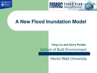
A New Flood Inundation Modelling. Gareth Pender School of Built Environment. Heriot Watt University. Contents. Introduction to rapid flood spreading modelling-prediction of flood depth and flood extent. A new conceptual model for maximum velocity prediction.

E N D
A New Flood Inundation Modelling Gareth Pender School of Built Environment Heriot Watt University
Contents • Introduction to rapid flood spreading modelling-prediction of flood depth and flood extent. • A new conceptual model for maximum velocity prediction. • IIIustration of application to an artificial digital elevation model. • IIIustration of application to case studies.
1.1 Existing RFSMs RFSMs HR Wallingford Julien Lhomme et al. Halcrow ISIS Fast. Heriot Watt University Martin Krupka and Yang Liu. (1) Krupka M., Wallis S., Pender S., Neélz S., 2007, Some practical aspects of flood inundation modelling, Transport phenomena in hydraulics, Publications of the Institute of Geophysics, Polish Academy of Sciences, E-7 (401), 129-135. (2) Lhomme J., Sayers P., Gouldby B., Samuels P., Wills M., Mulet-Marti J., 2008, Recent development and application of a rapid flood spreading model, River Flow 2008, September. (3) Liu Y, Pender G (2010) “A new rapid flood inundation model”, the first IAHR European Congress, Edinburgh, UK.
1.2: Requirements for an RFSM • Short time to run (Typically < 5s) • A good overall agreement of the final water depth and flood extent predictions between SWEM and RFSM. • A good overall agreement of the maximum velocity prediction over a flood cell between SWEM and RFSM. useful for application to catchment scale flood modelling and probabilistic flood risk analysis (e.g. Bayesian Analysis).
Minimum Cell Plan area (Amin) Minimum Depth (Dmin) • 1.3 Basic RFSM algorithm RFSM flood cells DTM grid cells Real Floodplain • Pre-calculation An array of flood storage cells is constructed from DEM • Inundation A specified volume of flood water is distributed across the storage cells. An example of pre-calculation process Volume (cubm) Water level (m) An example of constant extra head (source: Krupka et al. 2007)
1.4 Two different spreading algorithms Next active grid Current active grid (b) (a) One-directional RFSM Multi-directional RFSM
Area 2 Area 1 = Area2 • 1.5 Our improved RFSM • Rules to provide accurate prediction: • Water will spread from high location to lower locations (one directional or multiple directional spilling algorithms) with merging process. • Dynamic Driving head based on inflow hydrograph • Floodplain area with a high roughness uses a high driving head discharge t Fig. Inflow Hydrograph
1.6 Model parameters and evaluation functions (1) (2) (3)
1.7 Application example Inflow hydrograph Inflow 3D plot
1.8 Compare RFSMs with ISIS2D Flood extent using ISIS2D after 10 hours Flood extent using MD-RFSM Flood extent using OD-RFSM Water depth of cross section comparison using ISIS2D and RFSMs
1.9 ISIS2D simulation 10 m grid resolution ISIS2D model will take about 1 hour to run.
1.10 One directional RFSM spilling process RFSM will take about 1 second to run.
Volume = vol Inflow at time Area of a big flood cell outflow at time • 2.1 Maximum Velocity prediction using a new conceptual model
2.2 Performance Comparison of the conceptual model and ISIS2D Average Maximum velocity predictions for 17 regions using our proposed model Maximum velocity using ISIS2D Average Maximum velocity for 17 regions using ISIS2D The conceptual model parameter C was calibrated using one ISIS2D simulation with peak inflow value= 150cubm/s for inflow hydrograph.
2.4 Application to Thamesmead, London Thamesmead 2m resolution grid digital elevation data and inflow hydrograph.
2.5 Performance Comparison of the conceptual model and TUFLOW (a): Final water depth after 1hour using RFSM (b) : Final water depth after 1hour using TUFLOW (c): Region average maximum velocity prediction using the new conceptual model (d): Region average maximum velocity prediction using TUFLOW
2.7 Flood extent predictions Using ISIS2D and RFSM Fig.2. Flood extent and water depth at 45.25 hours using RFSM. ( 5m grid resolution model will take 2 seconds to run) Fig1. Flood extent and water depth after 45.25 hours using ISIS2D. (15m grid resolution model will take more than 1 hour to run)
Future work (1) Test more locations. (2) Fast Rapid flood spreading Modelling using Cellular Automata. Thank you!