Download
1 / 1
10 likes | 97 Vues
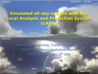
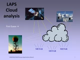
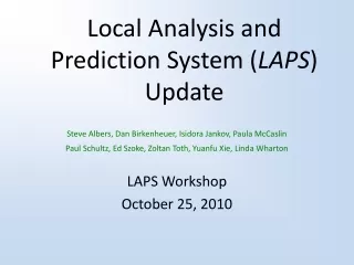
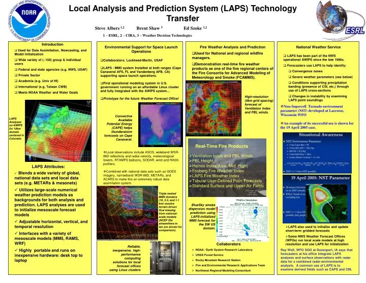
Local Analysis and Prediction System (LAPS) Technology Transfer. Steve Albers 1,2. Brent Shaw 3. Ed Szoke 1,2. 1 – ESRL, 2 – CIRA, 3 – Weather Decision Technologies. Introduction Used for Data Assimilation, Nowcasting , and Model Initialization

E N D
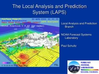
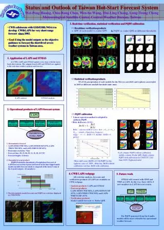
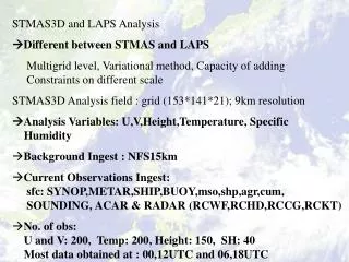
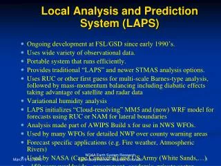
Local Analysis and Prediction System (LAPS) Technology Transfer Steve Albers 1,2 Brent Shaw 3 Ed Szoke 1,2 1 – ESRL, 2 – CIRA, 3 – Weather Decision Technologies • Introduction • Used for Data Assimilation, Nowcasting, and Model Initialization • Wide variety of (~150) group & individual users • Federal and state agencies (e.g. NWS, USAF) • Private Sector • Academia (e.g. Univ of HI) • International (e.g. Taiwan CWB) • Meets NOAA Weather and Water Goals • Environmental Support for Space Launch Operations • Collaborators: Lockheed-Martin, USAF • LAPS / MM5 system Installed at both ranges (Cape Canaveral AFS, FL and Vandenberg AFB, CA) supporting space launch operations. • First operational modeling system in U.S. government running on an affordable Linux cluster and fully integrated with the AWIPS system... • Prototype for the future Weather Forecast Office! • Fire Weather Analysis and Prediction • Used for National and regional wildfire managers. • Demonstration real-time fire weather products as one of the five regional centers of the Fire Consortia for Advanced Modeling of Meteorology and Smoke (FCAMMS). • National Weather Service • LAPS has been part of the NWS operational AWIPS since the late 1980s. • Forecasters use LAPS to help identify: • Convergence zones • Severe weather parameters (see below) • Conditions supporting precipitation banding (presence of CSI, etc.) through use of LAPS cross-sections • Changes in instability by examining LAPS point soundings High-resolution (4km grid spacing) forecast of Ventilation Index and PBL winds. • Non-Supercell Tornado environment parameter (NST) developed at Lacrosse, Wisconsin WFO • An example of its successful use is shown for the 19 April 2005 case. Convective Available Potential Energy (CAPE) helps thunderstorm forecasts on Cape Canaveral. LAPS Analyses on AWIPS for 10km domain centered in Colorado 1 • Real-Time Fire Products • Ventilation Index and PBL Winds • PBL Height • Haines Index (Low, Mid, High) • Fosberg Fire Weather Index • LAPS Fire Weather Index • Tabular User-Defined Point Forecasts • Standard Surface and Upper-Air Fields • Local observations include ASOS, wideband WSR-88D reflectivity and radial velocity, meteorological towers, RTAMPS balloons, SODAR, wind and RASS profilers. • Combined with national data sets such as GOES imagery, narrowband WSR-88D, METARs, and ACARS to make this an extremely robust data assimilation system. LAPS Attributes: • Blends a wide variety of global, national data sets and local data sets (e.g. METARs & mesonets) • Utilizes large-scale numerical weather prediction models as backgrounds for both analysis and prediction. LAPS analyses are used to initialize mesoscale forecast models • Adjustable horizontal, vertical, and temporal resolution • Interfaces with a variety of mesoscale models (MM5, RAMS, WRF) • Highly portable and runs on inexpensive hardware: desk top to laptop Triple nested MM5 domains (10, 3.3, and 1.1 km) resolve terrain-driven flow missing from national-scale models (NCEP Eta streamlines in tan are shown for comparison). BlueSky smoke dispersion model prediction using LAPS-initialized MM5 forecast for the SW US domain. • LAPS also used to initialize and update short-term gridded forecasts • Some NWS Weather Forecast Offices (WFOs) run local scale models at high resolution and use LAPS for initialization • Ray Wolf, WFO SOO at Davenport, IA says that forecasters at his office integrate LAPS analyses and surface observations with radar data for a combined radar-environmental analysis. A common use of LAPS is to examine derived fields such as CAPE and CIN. • Collaborators • NOAA / Earth System Research Laboratory • USDA Forest Service • Rocky Mountain Research Station • Fire and Environmental Research Applications Team • Northwest Regional Modeling Consortium Reliable, inexpensive, high-performance computing solutions for local forecast offices using Linux clusters