Download
1 / 19
190 likes | 354 Vues
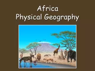
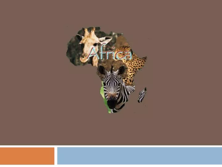
Africa’s Physical Geography. Plateau and Basins. Most of Africa is elevated 1,000 feet above sea level. A plateau covers most of the continent causing this rise. Basins are depressions , or dips, in the plateau. Rivers. Niger – Located in West Africa. It is 2,600 miles long.

E N D
Plateau and Basins • Most of Africa is elevated 1,000 feetabove sea level. A plateau covers most of the continent causing this rise. • Basins are depressions, or dips, in the plateau.
Rivers • Niger – Located in West Africa. It is 2,600 miles long. • Congo – Located in Central Africa. It is 2,900 miles long. • Nile – Located in North Africa. It is 4,160 miles long. It is the longest river in the world.
Aswan High Dam • Nile goes through flood and drought seasons. The Aswan High Dam was built to help the farmers with irregular water supply. It’s construction created a false lake. It has disrupted the successful Nile cycle.
Mountains • Ahaggar Mountains – North Africa • Tibesti Mountains – North Africa • Atlas Mountains – North Africa • Mt. Cameroon – over 13,000 ft. in Central Africa • Mt. Kenya – over 17,000 ft. in East Africa • Mt. Kilimanjaro – over 19,000 ft. in East Africa. It is the tallest mountain in Africa.
Deserts • Kalahari Desert – Southern Africa, approximately 100,000 square miles in size • Namib Desert – Southern Africa, slightly larger than the Kalahari. It is located to the West of the Kalahari. • Sahara Desert – North Africa. It is the largest desert in the world at 3,500,000 square miles and growing.
Forests • Africa has the largest tropical land area of any continent, because it sits on the equator. • The largest rainforest is in Central Africa. It is mostly in the Congo Basin. • The canopy is where most animals in a rainforest live. It is the top layer of branches, approximately 150 ft. high. • Slash-and-burn farming has nearly wiped out Madagascar’s rain forest. • Oak and pine forests grow near the Atlas Mountains
Rift Valleys • Long thin valleys formed by tectonic activity. East Africa is leaving the rest of Africa. Africa’s rift valleys are over 4,000 miles long. • Lake Tanganyika – is the longest freshwater lake in the world. It is a result of the rift valleys. • Lake Victoria – Africa’s largest lake. Also a result of the rift valleys. World’s 2nd largest freshwater lake. • Victoria Falls – It’s spray can be seen from 50 miles away. It is the largest waterfall in the world.
Plains • Serengeti – is a grassland. Some of the grasses grow taller than the average person. It is in East Africa. • Serengeti National Park – protects an area and allows for tourism. • Sahel – means “shore of the desert”. It is a narrow bit of grassland by the Sahara. It is mostly in West Africa. • Desertification – the expansion of the desert into moist areas near the desert
Resources • Mineral – World’s largest producer of chromium. Africa also has a lot of gold, platinum, cobalt, copper, phosphates, diamonds, and various other minerals. • World’s leader in Petroleum production. Nigeria has a lot of debt from mismanagement of their large oil supply. • World’s largest producer of cocoa beans. • Agriculture is the primary economic activity in Africa.