Download
1 / 23
230 likes | 345 Vues
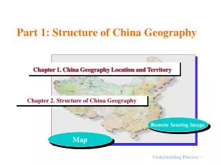
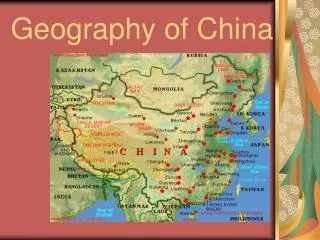
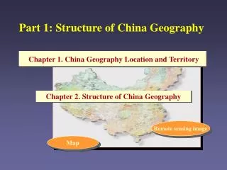
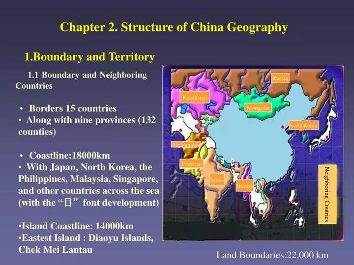
Chapter 2. Structure of China Geography. 1.Boundary and Territory. 1.1 Boundary and Neighboring Countries. Russia. Kazakstan. Borders 15 countries Along with nine provinces (132 counties) Coastline:18000km

E N D
Chapter 2. Structure of China Geography 1.Boundary and Territory 1.1 Boundary and Neighboring Countries Russia Kazakstan • Borders 15 countries • Along with nine provinces (132 counties) • Coastline:18000km • With Japan, North Korea, the Philippines, Malaysia, Singapore, and other countries across the sea (with the “目”font development) • Island Coastline: 14000km • Eastest Island : Diaoyu Islands, Chek Mei Lantau Mongolia North Korea Afghanistan Pakistan Neighboring Coutries India Burma Land Boundaries:22,000 km
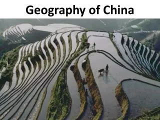
1.2 Territory Area: • Land Area:9,600,000km2,Land power, China is a mountainous country • Ocean Area:3,000,000km2(Four Large Seas) Dec 10th 1982:UNCLOS Nov 16th 1994:Entered into force, the establishment of new marine order. • Important Changes State territorial rights extended from 3 nautical mile to 12 nautical mile Designated 200-nautical mile as Exclusive Economic Zone Delimited 35.8% of the world's sea as coastal countries World seabed and its resources for the common heritage of mankind Territory Area:960+300=1260(ten thousand km2 )
The Composition and Division of the Sea under the Jurisdiction of P.R.China ——China's Sea as National Territory (Editor:Qian Yan-ping, Ocean Press,1998) ? • The maximum seas under the jurisdiction of China : inland sea , ports, territorial sea, • contiguous zone, exclusive economic zone and continental shelf Territorial Sea Baseline Continental Shelf Exclusive Economic Zone Contiguous Zone Ports Territorial Sea Inland Sea Mare Liberum World's oceans and seas are divided into regions under the international jurisdiction and national jurisdiction
The Composition and Division of the Sea under the Jurisdiction of P.R.China 1 —— Inland Sea of China Including : national port, the gulf, the strait and the other sea within the territorial sea baseline Inland Sea Ocean Land Territorial Sea Baseline Legal status equivalent of the country’s lake and river, owning the absolute sovereign right
The Composition and Division of the Sea under the Jurisdiction of P.R.China 2 —— Territorial Sea of China Divide Territorial Sea Using Straight Baselines Method Territorial Sea Line Territorial Sea Width Territorial Sea Baseline (The lowest ebb line) China owning sovereign rights of biological and non- biological resources of territorial seas ; All states enjoy free shipping home rights without victims through territorial seas. Normal Baselines Method Territorial Sea Line Law of the PRC on the Territorial Sea and the Contiguous Zone and international convention in 1992:Territorial seas including 12 nautical miles from the baselines of the territorial sea waters. Territorial Sea Territorial Sea Width Territorial Sea Baseline Inland Sea Straight Baselines Method Land
The Composition and Division of the Sea under the Jurisdiction of P.R.China 3 ——Contiguous Zone of China Law of the PRC on the Territorial Sea and the Contiguous Zone and international convention in 1992:Territorial seas including 12 nautical miles from the baselines of the territorial sea waters. Baseline width of the territorial sea beyond territorial seas: not exceeding 24 nautical miles Territorial Sea Baseline Territorial Sea Line Inland Sea contiguous zone Ocean Law : Owning the right to prevent and punish the violation of security, customs, financial, sanitation or immigration laws in its land territory, inland sea or territorial waters, and regulations.
The Composition and Division of the Sea under the Jurisdiction of P.R.China 4 ——Exclusive Economic Zoneof China Legal status : State of all its natural resources owning the rights of exploration, exploitation, conservation and utilization; other states enjoy their flight and navigation as well as the laying of submarine cables and pipelines, and other free rights. Inland Sea Territorial Sea Ocean The width of the territorial sea beyond the territorial sea baseline should not exceed 200 nautical miles Our Exclusive Economic Zone severe problems (interference with the sovereignty of neighboring countries on the South China Sea; width of Yellow Sea and East China Sea)
The Composition and Division of the Sea under the Jurisdiction of P.R.China 5 ——Mare Liberum Regions under the National Jurisdiction Regions under the international Jurisdiction Mare Liberum International Seabed Management of all sea area outside national sea area, the common heritage of humankind
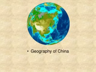
2. View China from Outer Space 2.1 Flying to View China (Video) Snow line (m)
2.2 View China Land from Satellite Remote Sensing Image of China Information Sources: Landsat1\2\3;MSS Height 750-900km Standard false color composite 584 multimaps merging • Scale series : 1:100 0,000 -1:6000,000 • Editor: Chen Shupeng • Science Press
Identification of Chinese Remote Sensing Image Resolution and its Geographical Significance: • Spatial Resolution:79M—Basic Geographical Unit Area of one map:34,000 square kilometers - macro • Spectrum Resolution:Multi-spectral (not concluding visible-light ) mixed pixel -Geographic integration • Spatial Resolution : period:18 days—dynamic monitoring quasi-synchronous :Hour in the Northern Hemisphere 9 to 10 time clock—third dimension • Standard and Quantitive Information in the World
Reading Chinese Remote Sensing Image • Geomorphologic Level • Hydrological Level • Land Use and Cover Level • Climate level
Theme Location Contrast between China and America Geographic Perspective “Who can Raise Chinese People” Homework
Theme Geographic Perspective “Who will feed China” 1. Two Important Publications in 1995 • Who will Feed China – Wake up Call for a Small Planet • Lester R.Brown(Director,World Surveying Institution of America) • China’s Agricultural Development Report • 95(White Paper on China's Agriculture) • Liu Jiang (China Agriculture Minister) Chinese leaders concerned about China's future and the world politicians, scientists, economists, and the eyes of the world 1/5 towards the country with a large population.
Analysis of Book Skin that Brown Chosen Agriculture? Rural? Farmer? Chinese? Lagging Farming Fashion Poor minority areas, traditional agriculture 38 61 Poor
2. Brown's Main Point of View (Pessimism) Future : Chinese people can not feed themselves (Chinese Food Panic) Who can not feed Chinese people (World Food Panic) 1)From the 1990s to 2030, China will follow industrialization path of Japan and Korea in 1950-1990,with worker-peasant contradictions, Significant decline in per capita arable land, food needs contradiction. 2) China will have 1.6 billion people in 2030.we must rely on food imports, which attracts worldwide grain price has been inflated. Weather China has the ability to buy foreign food and which country can provide China with food.
3. Survey Brown's View from the Perspective of Geography 1)The model of industrialization can’t be compared between small island and land power country. Limiting factors in grain output are essentially different, the former, land quantitative restrictions, the latter, land quality restrictions. 2)Chinese natural geographical diversity-industrialization process, food production geographical diversity, the impact of geographical differences is also large; And essentially different at small island state, can be complementary of regions, complementary of the worker-peasant.
3) Overestimate China's per-capita appropriation level 10,644 U.S. dollars China's per capita GDP in 2030, (amounting to lower than the current per capita GDP of Japan at 6% growth rate (1998 to 32,380 U.S. dollars in Japan; Shanghai, China for 3,000 U.S. dollars), not owning Japan's import capacity. 4) Chinese consumption levels may be corresponding with the industrialization level of the current Beijing, Shanghai, Guangzhou in 2030.
4. Chinese People can Feed Themselves 1)China has the ability to solve food needs problems. 2)The basis of Brown’s perspective is inadequate or even wrong 3)Chinese people can feed themselves 5. Who are feeding American People (Chen Baiming,1998) What materials are America relying on to maintain the standard of living and economic development capacity? 1) Strongly dependent on the resources of the world (per capita energy consumption four times of per capita in the world) 2) The high pollution emissions to the environment (U.S. CO2 emissions accounting for 23.7% of the world total, 5.15 times per capita for the world in 1995) 3) The living standard with highconsumption.
Homework:Location Contrast between China and America • Theme : Similarities and differences of geographical location between China and the United States and analysis features preliminarily • Methods : Reading maps and analysis, comparison with tables • Ability Training : The ability to obtaining information from the map • Requirements : Two people every group to discuss, hand up one homework
Related Website • http://www.china-ns.com/ • http://www.mlr.gov.cn/index.jsp • http://www.cng.com.cn • http://www.dlpd.com • http://www.digitalearth.net.cn/C-index1.htm • http://www.nrscc.gov.cn/