Download
1 / 20
200 likes | 205 Vues
This lesson aims to help 3rd grade students understand and compare the geography of Botswana and North Carolina. Through engaging activities and observation, students will learn about different physical features, regions, and cultural aspects of both places.

E N D
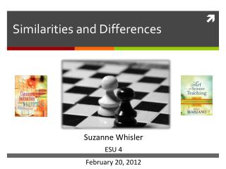
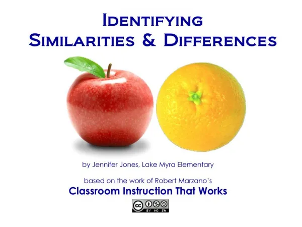
ACROSS OCEANS- IDENTIFYING SIMILARITIES AND DIFFERENCES FROM OUR LAND TO YOURS Matt Cuddington, M.A., CCC-SLP Jenny Jones, SLP Graduate Student Mamie Shutt, Special Education Teacher
OBJECTIVES • North Carolina 3rd grade Essential Standard: • 3.G.1 Understand the earth's patterns by using the five themes of geography: • Location* • Place* • Human environment interaction • Movement • Regions*
LESSON OBJECTIVE Social Studies • Geography of Botswana as compared to North Carolina, United States of America • 3.G.1.1- Find absolute and relative locations of places within the local community and region • 3.G.1.6- Compare various regions according to their characteristics
CURRICULUM/ CLASSROOM OBSERVATION • During our visit we have been able to observe the differences in regions as we traveled through the country from Gaborone to Francistown, Kasane, and Maun. • Participants have also observed the teaching of Botswana history throughout many of the classrooms we visited, such as differences in population density in different regions. • Physical features of the land play an important role and greatly impact population. This creates a direct link between standards.
COLLABORATION • Observation and participation in classrooms in 8 schools throughout Botswana • Speaking with DuduetsangMoroka, Speech Therapist and MaleshwanaMauco, Behavior Analyst • Setswana language and cultural studies with BontleMolefe and Miso Baipidi
CONTENT • Teacher will present a world map to orient students to Botswana and NC • Engage students by gathering background knowledge • Where is Africa? • Where is Botswana? • Where is America? • Where is North Carolina? • What is a geographical feature? • What is a mountain/hill? • What is a desert/piedmont? • What is a delta/coast?
REFERENCE MATERIALS • Maps: World, Botswana, North Carolina • Graphics: • NC: mountains, piedmont, and coast • Botswana: desert, hills, and delta
CONTENT • What do you know about the physical geographical features in either of these places? • Differences in trees • Vegetation • Soil type • Look for knowledge of specific features that will be discussed • Language and vocabulary • Mountain – thaba • Hill – thabana • Desert – sekaka • Bush - naga
ACTIVITIES • Learners will make “foldables” that list and describe the different features and regions • Teacher will provide pictures of the different regions/features and have learner locate and place where the corresponding pictures belong on map • *some students may only be able to identify features and not be able to differentiate regions Students could identify regions by coloring different parts of a map
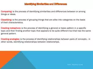
EVALUATION Differences Similarities • T Chart • Similarities and Differences Chart can be completed in various ways: • Writing • Sorting • Matching
EVALUATION Differences Similarities • Written Example • Can be modified based on each learner’s ability level • Hills • Low lands • Rivers
EVALUATION Differences Similarities • Sorting Example • Can be modified based on each learner’s ability level • Pictures or objects provided
UNIVERSAL DESIGN FOR LEARNING • Representation • Pre-teaching concepts • Graphic organizers (foldable) • Interactive maps • https://www.topozone.com/north-carolina/ • Coloring pages • http://www.supercoloring.com/coloring-pages/north-carolina-map • http://www.supercoloring.com/coloring-pages/botswana-map-outline • Tactile/sensory objects • Sand, leaves, tree branches, grass, water • Video clips • https://www.youtube.com/watch?v=fj63VPbNhbA&feature=youtu.be • https://www.youtube.com/watch?v=iiv6m62z7Ig
UNIVERSAL DESIGN FOR LEARNING • Action/Expression • Sorting pictures • Labeling maps • Verbally describing features • Dictate to scribe • Identifying corresponding textures to features • Engagement • Maps • Pictures • Videos • Textures • Centers • Partner work
EXTENSION • Speech/ Language Goals • Using visual and verbal cues, Maitumelo will verbally answer “what” and “where” questions in 8 out of 10 trials over 3 consecutive sessions. • Given verbal and visual prompts, Thabo will use geographical vocabulary terms (i.e. mountains, hills, rivers, piedmont, coast, desert, savannah, delta, etc.) when describing similarities and differences of various regions in 8 out of 10 trials over 3 targeted sessions.
CONTACT INFORMATION • Matt Cuddington, M.A., CCC-SLP • mccuddington12@gmail.com • Mamie Shutt, Special Education Teacher • bajaseaturtle@yahoo.com • Jenny Jones, WCU Graduate Student • jrjones13@catamount.wcu.edu