Download
1 / 16
180 likes | 372 Vues
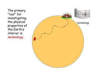
EARTHQUAKE SEISMOLOGY. COMPOSITION AND STRUCTURE OF THE EARTH. Crust Region above the Mohorovicic discontinuity = Moho The outermost rock layer, divided into : Continental Crust (averages about 35 km thick; 60 km in mountain ranges; diagram shows range of 20-70 km) Granitic composition

E N D
COMPOSITION AND STRUCTURE OF THE EARTH • Crust Region above the Mohorovicic discontinuity = Moho The outermost rock layer, divided into : • Continental Crust (averages about 35 km thick; 60 km in mountain ranges; diagram shows range of 20-70 km) Granitic composition • Oceanic Crust (5 - 12 km thick; diagram shows 7-10 km average)Basaltic composition. Oceanic crust has layered structure (ophiolite complex) consisting of the following: • Pillow basalts • Sheeted dikes ;interconnected basaltic dikes • Gabbro
COMPOSITION AND STRUCTURE OF THE EARTH • Mantle (2885 km thick): • Region between Moho and Core Mantle Boundary stretches from the below the crust to 2900 km below the surface. • The upper part is partially molten and the lower part is very dense. • Peridotite is the dominant rock of the upper part of the Earth’s mantle. • Lithosphere ; outermost 100 km of Earth . Consists of the crust plus the outermost part of the mantle. Divided into tectonic or lithospheric plates that cover surface of Earth • Substructure of mantle • Upper mantle (90-400 km) • Low velocity layer (60-250 km, decrease in velocity, partial melt asthenosphere • Transition zone (400-1050 km) • Lowe mantle (1050-2891 km) • D’’ layer (2700-2891 km, mixing of mantle and core materials, transition to core)
COMPOSITION AND STRUCTURE OF THE EARTH • Outer core (2270 km thick) • S-waves cannot pass through outer core, therefore we know the outer core is liquid (molten). • Composition: Molten Fe (85%) with some Ni, based on studies of composition of meteorites. Core may also contain lighter elements such as Si, S, C, or O. • Convection in liquid outer core plus spin of solid inner core generates Earth's magnetic field. Magnetic field is also evidence for a dominantly iron core.
COMPOSITION AND STRUCTURE OF THE EARTH • Inner core, solid,(1216 km radius). Solid Fe (85%) with some Ni based on studies of meteorites.
Plate Tectonics The Earth's lithosphere is broken up into major plates and minor ones. Tectonic plates can include both continental and oceanic areas. Major plates are African Plate, Antarctic Plate, Indian - Australian Plate, Eurasian Plate, American Plate, and Pacific Plate. Minor plates include the Arabian Plate, the Caribbean Plate, the Juan de Fuca Plate, the Cocos Plate, the Nazca Plate, the Philippine Sea Plate and the Scotia Plate.
Plate Boundaries • Tectonic plates interact in various ways as they move across the asthenosphere, producing volcanoes, earthquakes and mountain systems. • There are 3 primary types of Tectonic Plate boundaries: • Divergent boundaries • Covergent boundaries • Transform
Divergent • Plates move away from one another, creating a tensional environment. • Characterized by shallow-focus earthquakes and volcanism. • Release of pressure causes partial melting of mantle peridotite and produces basaltic magma. • Magma rises to surface and forms new oceanic crust. • Occur in oceanic crust (oceanic ridges) and in continental crust (rift valleys). • Continental rift valleys may eventually flood to form a new ocean basin. • Examples Divergent margin process: formation of the oceanic crust and lithosphere
Convergent • Plates move toward one another, creating a compressional environment. • Characterized by deformation, volcanism, metamorphism, mountain building, seismicity, and important mineral deposits. • Three possible kinds of convergent boundaries: • Oceanic-Oceanic Boundary • Oceanic-Continental Boundary • Continental-Continental Boundary
Oceanic-Oceanic Boundary • One plate is subducted, initiating andesitic ocean floor volcanism on the other. • Can eventually form an island arc volcanic island chain with an adjacent deep ocean trench. • Characterized by a progression from shallow to deep focus earthquakes from the trench toward the island arc (Benioff zone). • May also form a back-arc basin if subduction rate is faster than forward motion of overriding plate. presently concentrated in the Western Pacific ocean. Izu-Bonin-Mariana Arc
Oceanic-Continental Boundary • Oceanic plate is dense and subducts under the Lighter continental plate. • Produces deep ocean trench at the edge of the continent. • About half the oceanic sediment descends with the subducting plate; the other half is piled up against the continent. • Subducting plate and sediments partially melt, producing andesitic or granitic magma. • Produces volcanic mountain chains on continents called volcanic arcs and batholiths. • Part of the oceanic plate can be broken off and thrust up onto the continent during subduction (obduction). • Obduction can expose very deep rocks (oceanic crust, sea floor sediment, and mantle material) at the surface. • Characterized by shallow to intermediate focus earthquakes with rare deep focus earthquakes.
Continental-Continental Boundary • Continental crust cannot subduct, so continental rocks are piled up, folded, and fractured into very high complex mountain systems. • Characterized by shallow-focus earthquakes, rare intermediate-focus earthquakes. and practically no volcanism.
Transform • Plates move laterally past one another. • Largely shear stress with lithosphere being neither created nor destroyed. • Characterized by faults that parallel the direction of plate movement, shallow-focus earthquakes, intensely shattered rock, and no volcanic activity. • Shearing motion can produce both compressional stress and tensional stress where a fault bends. • Transform faults occur on land, • connect segments of the oceanic ridge, and provide the mechanism by which crust can be carried to subduction zones.