Download
1 / 37
370 likes | 375 Vues
Rank Requirements. Second Class. Demonstrate how a compass works and how to orient a map. Explain what map symbols mean. Using a compass and a map together, take a 5-mile hike (or 10 miles by bike) approved by your adult leader and your parent or guardian. First Class.

E N D
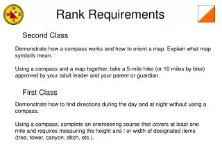
Rank Requirements Second Class Demonstrate how a compass works and how to orient a map. Explain what map symbols mean. Using a compass and a map together, take a 5-mile hike (or 10 miles by bike) approved by your adult leader and your parent or guardian. First Class Demonstrate how to find directions during the day and at night without using a compass.Using a compass, complete an orienteering course that covers at least one mile and requires measuring the height and / or width of designated items (tree, tower, canyon, ditch, etc.).
Orienteering Merit Badge Requirements • Show that you know first aid for the types of injuries that could occur while orienteering, including cuts, scratches, blisters, snakebite, insect stings, tick bites, heat and cold reactions (sunburn, heatstroke, heat exhaustion, hypothermia), and dehydration. Explain to your counselor why you should be able to identify poisonous plants and poisonous animals that are found in your area. • 2. Explain what orienteering is. • 3. Do the following: • a. Explain how a compass works. Describe the features of an orienteering compass. • b. In the field, show how to take a compass bearing and follow it.
Merit Badge Requirements • 4. Do the following: • a. Explain how a topographic map shows terrain features. Point out and name five terrain features on a map and in the field. • b. Point out and name 10 symbols on a topographic map. • c. Explain the meaning of declination. Tell why you must consider declination when using map and compass together. • d. Show a topographic map with magnetic north-south lines. • e. Show how to measure distances using an orienteering compass. • f. Show how to orient a map using a compass. • 5. Set up a 100-meter pace course. Determine your walking and running pace for 100 meters. Tell why it is important to pace-count. • 6. Do the following: • a. Identify 20 international control description symbols. Tell the meaning of each symbol. • b. Show a control description sheet and explain the information provided. • c. Explain the following terms and tell when you would use them: attack point, collecting feature, aiming off, contouring, reading ahead, handrail, relocation, rough versus fine orienteering.
Merit Badge Requirements • 7. Do the following: • a. Take part in three orienteering events. One of these must be a cross-country course.* • b. After each event, write a report with (1) a copy of the master map and control description sheet, (2) a copy of the route you took on the course, (3) a discussion of how you could improve your time between control points, and (4) a list of your major weaknesses on this course . Describe what you could do to improve. • 8. Do ONE of the following: • a. Set up a cross-country course of at least 2,000 meters long with at least five control markers. Prepare the master map and control description sheet. • b. Set up a score-orienteering course with 12 control points and a time limit of at least 60 minutes. Prepare the master map and control description sheet. • 9. Act as an official during an orienteering event. This may be during the running of the course you set up for requirement 8. • 10. Teach orienteering techniques to your patrol, troop or crew.
First Aid cuts, scratches, blisters, snakebite, insect stings, tick bites, heat and cold reactions (sunburn, heatstroke, heat exhaustion, hypothermia), and dehydration
First Aid Identify poisonous plants and poisonous animals that are found in your area. Poison Ivy Wash affected area immediately Calamine lotion can help relieve itching eastern Massasuga rattlesnake The massasauga can be characterized as a shy, sluggish snake. Its thick body is colored with a pattern of dark brown slightly rectangular patches set against a light gray-to-brown background
What is Orienteering ? Orienteering is a sport involving navigation with map and compass. It's easy to learn, but always challenging. The object is to run, walk, ski, or mountain bike to a series of points shown on the map, choosing routes —both on and off trail—that will help you find all the points and get back to the finish in the shortest amount of time. The points on the course are marked with orange and white flags and punches, so you can prove you've been there. Each “control” marker is located on a distinct feature, such as a stream junction or the top of a knoll.
Map Colors • Black. Indicates cultural (man-made) features such as buildings and roads, surveyed spot elevations, and all labels. • b. Red-Brown. The colors red and brown are combined to identify cultural features, all relief features, non-surveyed spot elevations, and elevation, such as contour lines on red-light readable maps. • c. Blue. Identifies hydrography or water features such as lakes, swamps, rivers, and drainage. • d. Green. Identifies vegetation with military significance, such as woods, orchards, and vineyards. • e. Brown. Identifies all relief features and elevation, such as contours on older edition maps, and cultivated land on red-light readable maps. • f. Red. Classifies cultural features, such as populated areas, main roads, and boundaries, on older maps. • g. Other. Occasionally other colors may be used to show special information. These are indicated in the marginal information as a rule.
Terrain Features Hill—a point or small area of high ground. When you are on a hilltop, the ground slopes down in all directions. Ridge—a line of high ground with height variations along its crest. The ridge is not simply a line of hills; all points of the ridge crest are higher than the ground on both sides of the ridge.
Terrain Features Valley—reasonably level ground bordered on the sides by higher ground. A valley may or may not contain a stream course. A valley generally has maneuver room within its confines. Contour lines indicating a valley are U—shaped and tend to parallel a stream before crossing it. The course of the contour line crossing the stream always points upstream. Saddle—a dip or low point along the crest of a ridge. A saddle is not necessarily the lower ground between two hilltops; it may be a break along an otherwise level ridge crest.
Terrain Features Depression—a low point or hole in the ground, surrounded on all sides by higher ground. Draw—similar to a valley, except that it normally is a less developed stream course in which there is generally no level ground and, therefore, little or no maneuver room. The ground slopes upward on each side and toward the head of the draw.
Terrain Features Spur—a usually short, continuously sloping line of higher ground, normally jutting out from the side of a ridge. A spur is often formed by two thoroughly parallel streams cutting draws down the side of a ridge Cliff—a vertical or near-vertical slope. A cliff may be shown on a map by contour lines being close together, touching, or by a ticked "carrying" contour line. The ticks always point toward lower ground.
Declination Angle The North Magnetic Pole is slowly drifting across the Canadian Arctic. It is moving approximately northwest at 40 km per year.