Download

1 / 36
360 likes | 596 Vues
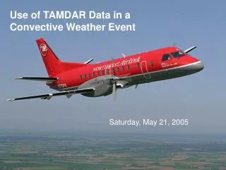
NWS Meteorologists Guide to TAMDAR Weather Data. The Great Lakes Fleet Experiment Fall 2004-Spring 2005. NWS Meteorologists Guide to TAMDAR. Roger Smith General Forecaster Baltimore/Washington WFO Sterling, Virginia.

E N D
NWS Meteorologists Guide to TAMDAR Weather Data The Great Lakes Fleet Experiment Fall 2004-Spring 2005
NWS Meteorologists Guide to TAMDAR • Roger Smith General Forecaster Baltimore/Washington WFO Sterling, Virginia
Brief History of NWS Acquisition of Upper Air Data via Aircraft Flights • NWS began regularly scheduled aircraft weather observations in 1919. Pilots were not paid unless they reached an altitude 13.5 k ft. Pilots received a bonus for every 1000 ft above 13.5 k ft. • Aircraft obs were discontinued in the early 1940's, when radiosondes were first employed by the NWS. • ACARS ( Aircraft Communications, Addressing and Reporting System) was first used to report wind and temperature data in support of the Global Weather Experiment in August of 1979. • TAMDAR deployed in Great Lakes Forecasting Experiment beginning in the fall of 2004.
ACARS (Aircraft Communications Addressing and Reporting System) • While aircraft weather data is often commonly referred to as ACARS, it is also known as MDCRS (Meteorological Data Collection and Reporting System) and AMDAR (Aircraft Meteorological Data Report) • American, Delta, Northwest and United Airlines and Federal Express and United Parcel Service supply ACARS data. • Airlines agreed to allow NWS, airline and university meteorologists to use ACARS (MDCRS) data in 1997. • Airline and NWS meteorologists have found ACARS/MDCRS data very useful in producing more accurate forecasts and warnings • The NWS and United Parcel Service are evaluating a new water vapor sensor at the present time.
TAMDAR Program Description Tropospheric Airborne Meteorological Data Report • As part of the Aviation Weather Safety Program initiative, NASA has contracted with AirDat LLC to design and build a low cost airborne instrument to measure temperature, moisture, pressure, wind, ice accretion and turbulence • The goal is to determine if additional upper air observations will contribute to improved aviation and public weather forecasts and warnings. • TAMDAR sensors were first installed on prop-jet aircraft that serve small and medium size airports.
TAMDAR Program Description • TAMDAR were installed on 64 Mesaba Airlines (Northwest Airlink) Saab 340 aircraft beginning in September 2004
TAMDAR Instrument NASA Twin Otter UND Cessna Citation II TAMDAR instruments Pictures of TAMDAR units installed on NASA and UND research aircraft
AirDat operates a sensor network for collecting upper air data in near real time. The aircraft-mounted sensor, called TAMDAR (Tropospheric Airborne Meteorological Data Reporting), transmits observations via satellite to AirDat's data center, where they are processed, archived and distributed. TAMDAR supplements existing data sources with improved temporal and spatial coverage and richer data sets for better weather reporting and forecasting. AirDat is now deploying TAMDAR sensors to provide upper air data for the continental United States.
TAMDAR Design Specifications • Operating Temperature: -70 C to +55 C Ambient • Pressure Altitude Range: -500 Ft. to 50,000+ Ft. • Airspeed Range: <= Mach .82
TAMDAR Overview • TAMDAR (Tropospheric Airborne Meteorological Data Report) is the result of several NASA sponsored aviation weather safety initiatives. The goal is to design, build, and fly an inexpensive instrument that would measure meteorological variables from commuter aircraft flying to small and medium size cities. It is anticipated that TAMDAR will result in more accurate weather forecasts and reduce aircraft accidents and delays. • NASA has partially funded the design and testing of the TAMDAR instrument. Airdat LLC has contributed towards the design and testing, as well as satellite communications capabilities, quality control, etc. Mesaba Airlines is providing access to, and modification of, their aircraft to install the TAMDAR sensor. National Weather Service (NWS) meteorologists used the data as part of the Great Lakes Fleet Experiment, and provide feedback on data quality, availability, and application to various weather phenomena.
TAMDAR Overview • TAMDAR data is retrieved from 64 Mesaba Airlines Saab 340 turboprop aircraft. • The Saab 340 was chosen because it flies shorter flights at lower altitudes than most regional jet aircraft. The fact that there are shorter duration flights means that there are more takeoffs and landings, and therefore, more soundings. • The fact that they fly at lower altitudes is also important, as data from the mid levels of the atmosphere is important for most meteorological processes. This also compliments the large commecial jets that provide a significant amount of ACARS/MDCRS data from the upper levels of the atmosphere. • Even though TAMDAR will initially be used on the Saab 340, it can be installed on most any commercial aircraft, with FAA certification.
TAMDAR Overview • Data are generally available every 10 mb from the surface through the first 100 mb, and every 50 mb thereafter. • Test flights indicate that TAMDAR temperatures are accurate within 1 deg C, humidity within 5%, wind direction within 5 degrees, and wind speed within 4 knots.
Data Availability • Mesaba flies the Saab 340 aircraft to approximately 80 cities • Since each of the 64 aircraft makes approximately seven flight segments per day, there are nearly 1000 soundings per day. • Data coverage is greatest in the Great Lakes region, but still considerable in parts of the Northeast, Southeast and northern Plains
Data Availability • Some destinations have nearly 100 soundings per day (MSP, DTW, MEM), while others have only a few (BGM, FNT) • You can find TAMDAR flight schedules on the GLFE web page www.crh.noaa.gov/tamdar
TAMDAR Program Description TAMDAR Flights are In Green Notice that data is also available beyond the Great Lakes region
Why do we need TAMDAR? • Numerical model skill improved greatly during the past twenty years due to improved model terrain, physics, grid sizes, as well as increased computational speed. • Future improvements will likely be slower, unless more upper air data is acquired.
Why do we need TAMDAR In order to fill in some of the gaps in the weather balloon network, the NWS uses other useful sources of upper air data, such as Wind Estimates from Doppler Radar Wind Profilers GOES and POES Satellites Commercial aircraft
Why do we need TAMDAR? • The NWS Upper air network is nearly the same as it was in the 1940s. A lot of weather occurs between radiosonde sites!
Why do we need TAMDAR? Current NWS radiosonde network east of the Rocky Mountain States
Why do we need TAMDAR? • ACARS data from commercial jet aircraft are very helpful, but there are relatively few soundings from small cities
Why do we need TAMDAR? TAMDAR Soundings will fill many of the gaps in the current upper air network!
Great Lakes Fleet Experiment • A NASA/AirDat funded six-nine month evaluation called the ”Great Lakes Fleet Experiment” began November 1, 2004. The NWS was a major participant. • The goal was to determine whether TAMDAR units are a reliable, cost effective means of gathering upper air data - and whether these data can improve warnings and forecasts
Great Lakes Fleet Experiment • NWS Meteorologists were asked to use the data and comment on it’s quality, timeliness and utility. • TAMDAR has potential to significantly improve warnings and forecasts
Great Lakes Fleet Experiment NWS meteorologists can retrieve TAMDAR data from the FSL aircraft data web page at http://acweb.fsl.noaa.gov This interactive web page can produce wind plots and soundings
NWS Forecaster Role • TAMDAR should be useful in many forecast applications • Upper air analysis and verification of model forecasts • Precipitation type forecasts • Severe storm environments • Fog formation (UPS method) • Turbulence forecasts • LLWS
Upper Air Analysis TAMDAR winds, temperature and dewpoints can be compared to model initial analyses and forecasts
Precipitation Type Forecasts Real time data from the lower troposphere is crucial when forecasting the precipitation type of winter storms. TAMDAR could provide this information at many locations
Severe Storm Environments • Research has shown that knowledge of the near-storm environment is essential to effective severe thunderstorm and tornado warnings. • Wind profilers, WSR-88D VWP, and 18UTC special radiosonde releases are helpful in determining the potential for severe thunderstorm development, but there are still many spatial and temporal gaps in coverage. • TAMDAR soundings will be useful in determining stable layers, lapse rates, winds aloft and moisture availability. • Stability parameters such as CAPE and CIN can also be calculated.
Low Ceiling and Visibility Forecasts • Knowledge of the temperature, moisture and wind fields in the boundary layer is vital when forecasting low ceilings and visibilities. Little real time data is available at most airports, so model soundings and MOS guidance are often used when producing aviation forecasts. • TAMDAR equipped aircraft will fly to and from nearly 80 airports in the central and eastern United States, and can provide the necessary data to produce more accurate forecasts of low ceilings and visibilities that adversely affect all airports.
Low-level Wind Shear • The presence of low-level wind shear should be easy to determine at airports with TAMDAR data. • Wind speed and direction at 10mb vertical increments in the boundary layer, along with an airborne turbulence sensor, will provide the necessary information to make more accurate forecasts of LLWS.
Temperature Water Vapor Mixing Ratio Vector Wind Magnitude Key: Blue-w/o TAMDAR Red-with TAMDAR Solid-analysis Dotted-6 hour forecast Dashed with triangles-12 hour forecast
Fig. C6 Without TAMDAR Snowbands 18Z, Feb. 02, 2005 Radar reflectivity RTFDDA Analyses WSR-88D With TAMDAR
Great Lakes Fleet Experiment • TAMDAR data can also be sent to AWIPS via FSL’s MADIS data server. Instructions can be found on the GLFE web page http://www.crh.noaa.gov/tamdar
NWS Forecaster Resources • A web site http://www.crh.noaa.gov/tamdar has been established that will provide meteorologists with information on TAMDAR and the GLFE • It contains the latest flight schedules so that you can determine when TAMDAR soundings are available in your area, a Forum where you can ask or answer questions, and people to contact for more information.
References • Comprehensive article on Aircraft Weather Data • http://www.crh.noaa.gov/tamdar/papers/aircraft.pdf • TAMDAR instrument details and flight tests • http://www.crh.noaa.gov/tamdar/papers/TAMDARsensor.pdf • NWP applications of TAMDAR • http://www.crh.noaa.gov/tamdar/papers/RUC.pdf • Impacts of aircraft data on FSL, NCEP and ECMWF models • http://www.wmo.int/files/www/GOS/Alpbach2004/3B_3PetersenRalph.pdf • Previous forecaster evaluations of aircraft weather data • http://acweb.fsl.noaa.gov/docs/mamrosh-2000/p.pdf