Download

1 / 25
250 likes | 366 Vues
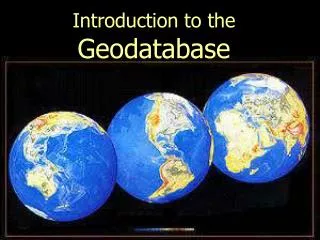
Building Geodatabase of the Brazos basin. For the application of WRAP and SWAT By Seongha Hwang April 17, 2002. Contents. Introduction What is Geodatabase? How to create? Relationship class Application Result Next step Question. Introduction.

E N D
Building Geodatabase of the Brazos basin For the application of WRAP and SWAT By Seongha Hwang April 17, 2002
Contents • Introduction • What is Geodatabase? • How to create? • Relationship class • Application • Result • Next step • Question
Introduction • This study deals with building Geodatabase of the Brazos river basin for the application of WRAP and SWAT model. • Basic Concept and Creating a new personal Geodatabase.
What is Geodatabase? • Geodatabase model - A data model included in ArcGIS for representing geographic information
Categories of Geodatabase • Personal Geodatabase - many readers and a single editor • Multiuser Geodatabase - can be read and edited by multi users
How to create? • Creating a new geodatabase from scratch • Migrating existing data into the geodatabase • With CASE tools
Creating a new geodatabase from scratch • No data or part of data • Designing and managing items with ArcCatalog
Migrating existing data into the Geodatabase • Shapefiles, Coverages, INFO tables, and dBASE tables ArcCatalog Convert to Geodatabase
Building Geodatabase with CASE tools • CASE : Computer-Aided Software Engineering - Tools and techniques that automate the process of developing software systems and database design
Relationshipsbetween objects • A relationship class explicitly defines the relationships between objects in a geodatabase
Datasetsfor the Brazos basin • WRAP • SWAT
Datasets for WRAP • DEM (30X30) • Control Points(3316) • Stream network(NHD) • FDR • Curve Numbers • Precipitation(mean annual)
Datasets for SWAT • STATSGO • National soil table • National Land Cover Dataset • Land use table • Weather Stations • Weather data
Creating Brazos Geodatabase • ArcCatalog in ArcGis - Creating a New personal Geodatabase
Importing existing data • In Data folder - Export the data into Geodatabase • In Geodatabase - Import the data from their folder
Convert and Store • Using import or export tools, conversion of data into Geodatabase is performed automatically, then data are stored in the Geodatabase.
Next Step • Establishing complete geodatabase • Giving relationships between objects
Question ?Questionnent ?¿hay alguna pregunta?없음말고…^o^ /