Download
1 / 28
300 likes | 536 Vues
Remote Sensing SPOT and Other Moderate Resolution Satellite Systems. SPOT. Le Systeme Pour l'Observation de la Terre (Earth Observation System). SPOT 1, 2, 4. http://www.crisp.nus.edu.sg/~research/tutorial/spacebrn.htm. 1. SPOT 1,2,3. A French satellite system

E N D
Remote SensingSPOT and Other Moderate Resolution Satellite Systems
SPOT Le Systeme Pour l'Observation de la Terre (Earth Observation System) SPOT 1, 2, 4 http://www.crisp.nus.edu.sg/~research/tutorial/spacebrn.htm
1. SPOT 1,2,3 • A French satellite system - SPOT-1 was launched in Feb 21, 1986 - SPOT-2 in 1990 - SPOT-3 in 1993 • The first commercial system designed to provide high quality service and data for operational users worldwide
2. Orbits • Altitude 832km • Inclination 98.70 • 10:30am passes descending point • 26 days for vertical observation, 1-4 days for oblique observations
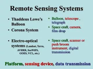
3. SPOT Sensor Systems • Components - two identical High Resolution Visible (HRV) imaging systems – pushbroom - a telemetry transmitter, and magnetic tape recorders
3. The Pushbroom Technique • “Pushbroom" scans based on charge coupled devices (CCD) which allows imaging the entire data line along track • A linear array of CCDs each corresponding to a pixel • Pushbroom allows longer lifetime, reduced geometric errors, and longer dwell time
3. Pushbroom .. • A 6,000-detector subarray for the panband • Three 3,000-detector subarrays for the three multispectral bands respectively • The pointable mirror is controlled by the ground station to acquire oblique images A: Linear Array of DetectorsB: Focal Plane of ImageC: LenseD: Ground Resolution Cell http://hosting.soonet.ca/eliris/remotesensing/bl130lec11.html
4. SPOT Resolutions • Panchromatic mode • Multispectral mode
4. Resolutions - Pan • Panchromatic mode - spectral resolution: 0.51-0.73microm - radiometric resolution: 256 level of brightness - spatial resolution: 10x10m - temporal resolution: 2.5-26 days
4. Resolutions - XS • Multispectral configuration - spectral resolution: band1: 0.50-0.59mm (green) band2: 0.61-0.68mm (red) band3: 0.79-0.89mm (near infrared) - radiometric resolution: 256 levels - spatial resolution: 20x20m - temporal resolution: 2.5-26 days
5. The Nadir Viewing • The nadir viewing • The off-nadir viewing
5. The Nadir Viewing .. • The two 60km swath overlap 3km • The total swath is 117km
5. The Off-Nadir Viewing.. • Can view in a maximum 27o in 45 steps of 0.6o each • Can view an area of a maximum 950km, with each scene 60-80km http://hosting.soonet.ca/eliris/remotesensing/bl130lec11.html
5. The Off-Nadir Viewing .. • The same area can be viewed from different angles to acquire stereo coverage • The twin sensors can operate in different viewing angles http://www.crisp.nus.edu.sg/~research/tutorial/spot.htm#vegetn
SPOT 1, 2, 3 • SPOT 1 was withdrawn in 1990 • SPOT 2 is deorbited in 2009 • SPOT 3 stopped in 1997
6. SPOT 4, 5, and 6 SPOT 4 SPOT 5 SPOT 6 http://www.crisp.nus.edu.sg/~research/tutorial/spot5.htm
6. SPOT 4 • Launched on Mar 23, 1998 • High Resolution Visible and Infrared (HRVIR) • An additional mid-infrared 1.58-1.75mm for vegetation, mineral, and soil moisture monitoring • Replace the pan band with a red band that produces both 10m black/white and 20m XS data • A wide IFOV Vegetation Monitoring Instrument with 1km resolution, 2250km swath, B, R, NIR, MIR bands
6. SPOT 5 • Launched on May 3, 2002 • Replace HRVIR with two high resolution geometric instruments (HRG) • A 5m pan band, 10m G, R, NIR bands, and a 20m MIR band • High resolution stereoscopic (HRS) instrument, prepares 10m global wide DEM
6. SPOT 6 • Launched on September 9, 2012 • Altitude 694 Km • A 1.5m pan band, 8mB, G, R, NIR bands • High resolution stereoscopic (HRS) instrument, prepares 10m global wide DEM
7. SPOT Data • Direct transmission occurs within 2,600km to the ground stations, otherwise tape recorders are used • SPOT Image Co. • http://www.astrium-geo.com/en/147-spot-6-7 http://www.astrium-geo.com/na/
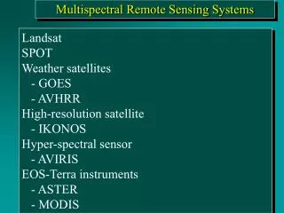
Moderate Resolution Land Satellites • IRS (the Indian Remote Sensing) • RESURS-01 (Russia) • ADEOS (ADvanced Earth Observing Satellite, Japan) • JERS-1 (Japan)
1. IRS (The Indian Remote Sensing) • Developed, launched, and operated by the Republic of India • IRS-1A (1988) and IRS-1B (1991) - XS bands similar to TM bands 1-4 - spatial resolutions 72.5 m and 36.5m - 140+ km swath • IRS-1C (1995) and IRS-1D (1997) - XS bands 23m resolution, a MIR band 70m resolution - a pan band 5.8m resolution - Wide Field Sensor 188m resolution, 774km swath
2. RESURS-01 1-4 (Russia) • The series was launched by Russia in 1985, 1988, 1994, 1998 • RESURS-01 3, 4 - 29-45m, 140-185m resolution for the green, red, and 2 NIR bands - 520-740m resolution for the thermal band - 600-710km swath - 4-day temporal resolution at the equator, daily at high latitudes
3. ADEOS (ADvanced Earth Observing Satellite, Japan) • Launched by Japan in 1996 • The Advanced Visible and Near Infrared Radiometer - B, G, R, NIR bands, 16m resolution - a pan band 8m resolution - 80km swath • Ocean Color and Temperature Sensor - 8 bands in visible and NIR, 4 bands in thermal region - 700m resolution, 3 day temporal resolution
4. JERS-1 (Japan) • Developed by Japan, 1992-1998 • Optical Scanner - uses pushbroom scanning in 7 visible, NIR, and MIR bands - stereoscopic observation - 18x24m resolution - 75km swath
5. Other satellites • launched since 2000 by many countries China-Brazil, korea, European space agency, Algeria, Turkey, Nigeria, UK, India, Thailand, Russia, China
Readings • Chapter 6