Download

1 / 52
520 likes | 796 Vues
River Raisin Watershed & Hydrologic Analysis. Dave Fongers Hydrologic Studies Unit, LWMD, MDEQ 517-373-0210 fongersd@michigan.gov. www.michigan.gov/deqnps. Overview. Streambank Erosion (NPS Grants) Hydrology Channel-forming flow, stream stability Examples.

E N D
River Raisin Watershed & Hydrologic Analysis Dave Fongers Hydrologic Studies Unit, LWMD, MDEQ 517-373-0210 fongersd@michigan.gov www.michigan.gov/deqnps
Overview • Streambank Erosion (NPS Grants) • Hydrology • Channel-forming flow, stream stability • Examples
Goal of Hydrologic Analysisfor NPS Grants to Control Erosion Assess watershed and stream stability so that proposed solutions will: • address the cause (improve flow regime) • not move the problem to another location • be permanent No band-aid solutions.
General causes of excessive streambank erosion: • Sparse vegetative cover due to too much animal or human traffic. • Concentrated runoff adjacent to the streambank (i.e. gullies, seepage). • An infrequent event, such as an ice jam or low probability flood, damaging a specific streambank. • Unusually large wave action. • A change in the stream form impacting adjacent portions of the stream (i.e. dredging, channelization). • A significant change in the hydrologic response of the watershed.
All streams are dynamic systems. Some erosion is natural. Natural Erosion
Obstructions This erosion may be caused by flow diverting around debris or ice piling against the former bridge supports. Nearby streambanks are stable. Removal of the former bridge supports should eliminate the cause of the erosion at this site.
Cause Cause Cause Cause Cause Cause Cause Sometimes the cause of the erosion is obvious.
Channel changes This erosion started 80 years ago when a fourteen-mile reach of natural stream was diverted to this three-mile long, straight channel. A limited hydrologic study was conducted for this CMI project.
Flow Changes This unstable stream has extensive erosion all along the banks. The erosion is worse in some areas due to heavy foot traffic. A hydrologic study, incorporating modeling, was conducted to help select the appropriate rehabilitation BMPs.
Watershed An area contributing runoff and sediment.
Watershed An area contributing runoff and sediment.
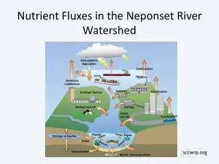
Factors That Affect Flow • Ease of runoff movement (time of concentration) • Watershed size (delineation) • Soils • Land use • Precipitation • Antecedent moisture • Snow melt • Frozen ground • Spatial extent of storm Human activity can alter these.
Channelization, addition of drains, storm sewers, pavement, graded lawns, and bare soils convey water more rapidly. Ease of Runoff Movement
Watershed Size 1,067 square miles
1978 Land Use Changing land use is the most likely cause of flow changes.
Approximately Neutral More Runoff
The altered flow regime affects: • habitat (water velocity, temperature, sediment, other pollutants)
The altered flow regime affects: • habitat (water velocity, temperature, sediment, other pollutants) • flooding (frequency and elevation)
The altered flow regime affects: • habitat (water velocity, temperature, sediment, other pollutants) • flooding (frequency and elevation) • channel morphology
Increase Flow or Slope Increase Sediment, Erosion
Stability Hydrology: a given set of hydrologic conditions (antecedent soil moisture, rainfall, snowmelt, etc.) always cause the runoff from the watershed to respond in a consistent manner in terms of both total volume and peak discharge. Practically, this means the land uses, soils, and drainage patterns within the watershed are not changing. Stream or Channel Morphology: the stream's sinuosity, profile, and cross-sectional dimensions are constant. This does not mean no erosion. It does mean no net change in channel shape, which can only occur if the flow regime, especially the channel-forming (1- to 2-year) flow, is not changing. Past hydrologic changes can cause a stream to be unstable for 60 years or more.
Channel-Forming Flow: a theoretical discharge that would result in a channel morphology close to the existing channel. Extreme flood flows generally have little effect on channel morphology because they are so rare. More frequently occurring flows, those with a 1- to 2-year recurrence interval, are generally the dominant channel-forming flows in stable, natural streams (Schueler, 1987 and Rosgen, 1996). Hydrologic changes that increase these flows can cause the stream to become unstable.
Extensive erosion indicates stream instability. Erosion on both sides of straight channels
Extensive erosion indicates stream instability. Erosion on the inside of bends
This active down-cut indicates stream instability. Stability cannot be determined from one photo, however.
This active down-cut indicates stream instability. Stability cannot be determined from one photo, however.
Goal of Hydrologic Analysisfor NPS Grants to Control Erosion Assess watershed and stream stability so that proposed solutions will: • address the cause (improve flow regime) • not move the problem to another location • be permanent No band-aid solutions.
NPS Grants • No hydrological/morphological changes maintain and protect existing flow regime • Limited changes restore and protect previous flow regime • Significant past/ongoing changes, morphology unstable but adapting balance between improving flow regime and rehabilitating morphology • Ongoing significant changes with morphology unstable and restricted ability to adapt maintain existing flow regime in future developments, balance between improving flow regimes from developed sites and rehabilitating morphology
Pollard Drain/River Raisin Watershed Hydrology Stable? Stream Morphology Stable? Probably/? Yes/? The drain is stable; the river is not. This project has specific benefits to both areas. Much of the drainage area defined in the proposal is only drained through subsurface drainage. Please include any unique characteristics of the watershed.