Download
1 / 23
230 likes | 363 Vues
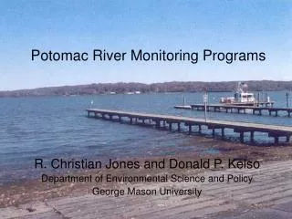
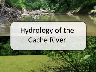
Cache River Monitoring 11-6000. Jennifer L. Bouldin , PhD Ecotoxicology Research Facility Arkansas State University. Cache River. Delta – bottomland hardwood forests Agricultural land 2 main channels of watershed Cache & Bayou DeView. Cache River. 95% of watershed in NE AR

E N D
Cache River Monitoring11-6000 Jennifer L. Bouldin, PhD Ecotoxicology Research Facility Arkansas State University
Cache River • Delta – bottomland hardwood forests • Agricultural land • 2 main channels of watershed • Cache & Bayou DeView
Cache River • 95% of watershed in NE AR • Impairment turbidity, total dissolved solids, and lead. • Agriculture activities the major source • Upper Cache highly channelized • Lower Cache not channelized • Except for last 7 miles • Forms Big Woods connected to White River bottomland hardwood forests arkansaswater.org
RamsarConvention on Wetlands • Intergovernmental treaty • Wetlands of International Importance • Commitment to maintain • Ecological character • Sustainable use of all wetlands in their territories
Wetland of International Importance • 1989 • Ramsar site 442
Sampling sites 1 • Site 1 – upstream of target subwatersheds • Sites 2-6 – Bayou De View subwatersheds • Site 7 – Cache River main channel 3 2 4 5 6 7
Measured Parameters • pH • Dissolved Oxygen • Total Suspended Solids (TSS) • Turbidity • Dissolved Nitrate, Nitrite, Orthophosphate • Total Nitrogen, Total Phosphorus
3.83 1.94 1.65 2.12 1.53 1.81 Site 1 2.16
1.62 2.22 1.72 Site 2
3.71 1.88 2.23 Site 3 3 3
1.64 2.26 1.74 Site 4 4 4 896 505
Site 5 5
1.96 Site 6 6 6
Site 7 7
Preliminary results • Nutrient spikes following applications and rainfall events • Sediment and nutrients tend to decrease at downstream sites • Cache and Bayou De View channels • Benefit from wetlands and natural meanders • Established wetlands should reduce nutrient and sediment loading • Data from drought year (2012) and wet year (2013) difficult to interpret
Questions? Thanks to ANRC, Carlos Rosado-Berrios, students and technicians at Ecotox