Download
1 / 49
490 likes | 496 Vues
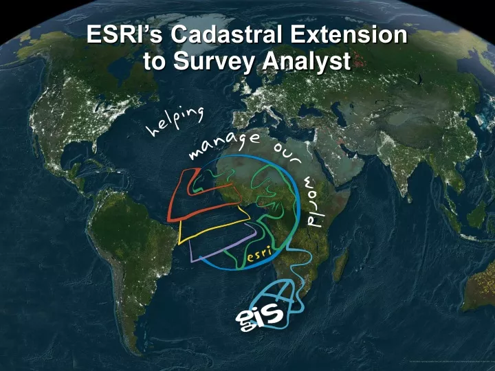
ESRI’s Cadastral Extension to Survey Analyst. Introduction. This presentation will describe development work currently underway for the new Cadastral Extension to Survey Analyst. ALICE Project. Topics of Discussion. Introduction and Overview System Design and Concepts

E N D
ESRI’s Cadastral Extensionto Survey Analyst CLSA, Reno, NV, March 11, 2006
Introduction • This presentation will describe development work currently underway for the new Cadastral Extension to Survey Analyst. • ALICE Project CLSA, Reno, NV, March 11, 2006
Topics of Discussion Introduction and Overview System Design and Concepts Links with NSRS and CRTN CLSA, Reno, NV, March 11, 2006
Introduction and Overview CLSA, Reno, NV, March 11, 2006
GOAL To build a simple extension to ArcGIS to improve and maintain the positional accuracy of boundary geometry and associated GIS layers. CLSA, Reno, NV, March 11, 2006
Motivation • Multipurpose GIS is often “pinned” on the cadastral layer • Cadastral base map governs other associated GIS layers • Accurate and consistent spatial data significantly extends GIS usefulness CLSA, Reno, NV, March 11, 2006
Well, it looks good … … but it’s of little value for surveyors! CLSA, Reno, NV, March 11, 2006
One Important Driver GPS • GPS enabled systems ARE ubiquitous • GIS currently provides comprehensive underlying mapping information • But to make GIS more useful and GPS more valuable, this information must be accurate • GIS needs to improve here! CLSA, Reno, NV, March 11, 2006
Cadastral Extension Requirements Survey Analyst Cadastral Extension: • Is extendable (data models & tools) • Follows survey methods for managing geometry • Incrementally improves positional accuracy of existing GIS datasets • Maintains spatial relationships between the Cadastral base map and associated GIS layers CLSA, Reno, NV, March 11, 2006
Components Cadastral fabric geometry + geodetic control coordinates + weighted least-squares adjustment + accumulated displacement vectors =ACCURATE FEATURE LAYERS CLSA, Reno, NV, March 11, 2006
Cadastral fabric • The fabric is a continuous surface of connected parcels • It is also a dimensioned boundary network • Follows explicit geometric constraints such as common parcel corners • Parcels are also constrained by their relation to other parcels • Constraints are inherent in the model and enforced during data entry CLSA, Reno, NV, March 11, 2006
Survey measurements • Once upon a time measuring bearing and distance was easier than fixing a position • So land surveys are described by parcel dimensions • Precision of these measurements is generally known • So, measures and connections were known, but true coordinates were not CLSA, Reno, NV, March 11, 2006
Existing LIS • Most LIS databases derived from scanning or heads-up digitizing of plat maps • Accuracy poor even after “rubber-sheeting” to control • Most importantly, original record measures are stored but not used • Instead, they are often distorted after a “rubber-sheeting” adjustment CLSA, Reno, NV, March 11, 2006
From Measures to Coordinates • We need accurate coordinates for the fabricand associated GIS layers • Accurate fabric coordinates are derived from: • geodetic control • survey measurements • Like control, fabric points have: • A physical location (monument) • Reliability information (level of confidence) CLSA, Reno, NV, March 11, 2006
Advantages • A dimensioned cadastral fabric can be made very accurate using limited control • A least-squares adjustment uses all of the survey information, including historic, to distribute error • In Cadastral Extension, coordinates are a derived quantity, stored as a transient attribute of a point rather than a definition of the point CLSA, Reno, NV, March 11, 2006
More advantages • Coordinates as attributes means historical coordinates can be retained, just like historical survey measurements • Datum re-adjustmentsand epoch updates are facilitated when measurements are retained and used in a least-squares adjustment CLSA, Reno, NV, March 11, 2006
Fabric as Control for GIS • Often, associated GIS layers are created and maintained in context with the cadastre • An accurate cadastre then can serve as control for the rest of the GIS • If we capture the shifts in coordinates of the parcel corners • we can use these to adjust the associated layers and maintain spatial relationships • The result is more accurate coordinates all around CLSA, Reno, NV, March 11, 2006
Who wants this? • Measurement Cadastres • Survey measurements have definitive role • Specifically designed for this • Coordinated Cadastres • Use fabric and geodetic control to move from measures to coordinates • Customize to work with coordinates as the source CLSA, Reno, NV, March 11, 2006
System Design and Concepts CLSA, Reno, NV, March 11, 2006
Simple data model CLSA, Reno, NV, March 11, 2006
Fundamental design concept • Differentiate Source information from Derived information • Differentiate Survey Rules information from GIS Rules CLSA, Reno, NV, March 11, 2006
Fabric as a network • Parcels are the basic ‘unit of work’ • Create and edit parcels • Join parcels to the fabric • Control points fix and geo-referencethe fabric • Connected (and historic) parcels provide redundancyof measurements • Fabric network is constrained to control points and adjusted by least-squares CLSA, Reno, NV, March 11, 2006
4 4 4 2 7 1 6 2 3 6 2000 1985 1994 Historical parcels • Parcels updated with new record information are never deleted from the fabric, they are simply marked as Historic • 4 different types of historic information maintained: • State of the Cadastre on a particular date • State of the Fabric on a particular date • Lineage of a Parcel • History of adjustments to the fabric CLSA, Reno, NV, March 11, 2006
Parcel creation and editing • Parcel is ‘unit of work’ • Parcels are created by entering a loop traverse of the parcel boundary • Parcel closure is reported on-the-fly • At this stage corner coordinates are in an arbitrary local coordinate system First Level QA check CLSA, Reno, NV, March 11, 2006
Parcel “Joining” • Joining is an interactive ‘point and click’ operation • Match shared points • Automatic 2D translation-rotation-scale performed • From local project coordinate space • To projected coordinate space (SPCS) • Additional Q/C check provided by the transformation residuals resulting from Joining • Parcel Joining enforces the cadastral specific geometric constraints between parcels CLSA, Reno, NV, March 11, 2006
Parcel Joining - 1 CLSA, Reno, NV, March 11, 2006
Parcel Joining - 2 CLSA, Reno, NV, March 11, 2006
Parcel Joining - 3 CLSA, Reno, NV, March 11, 2006
Parcel Joining CLSA, Reno, NV, March 11, 2006
Build fabric using Joining • Joining is the easiest and fastest way to build the fabric • Joining ensures best fit to the existing fabric • No slivers or overlaps possible • Can transfer basis-of-bearing • Provides approximate coordinates needed by the adjustment CLSA, Reno, NV, March 11, 2006
Least-squares adjustment • Fabric + Control + LSA = Good Coordinates • LSA does more than improve coordinates • Shows where control is needed • Helps isolate errors in the data (e.g. incorrectly entered measurements) • Post-adjustment analysis reports • LSA only estimates coordinates, never changes the original measurement values CLSA, Reno, NV, March 11, 2006
Adjustment history maintained • After LSA the software creates a set ofadjustment vectors • Each point’s coordinate residual generates a vector • This in turn generates a residual vector field • Vector sets are stored as a history of coordinate shifts based on each sequential LSA • GIS layers may be adjusted using the vector field • You decide when to adjust a GIS layer to the fabric • This is possible because the fabric maintains its adjustment “history” via the vector field CLSA, Reno, NV, March 11, 2006
Accumulated Adjustment Vectors CLSA, Reno, NV, March 11, 2006
Example of Feature Adjustment Utility line features incorrectly located with respect to the fabric… Using LSA vector field, utility line features are adjusted to the fabric. CLSA, Reno, NV, March 11, 2006
What’s the RESULT of all this? • A cadastral fabric that is: • Accurate to the same mathematical integrity as the original survey measurements • Complete by preserving all observed data • Coordinated in the NSRS • A GIS database of original survey measurements • Ability to correctly geo-reference GIS feature layers to the fabric • Ability to keep apace with NSRS re-adjustments and epoch updates using LSA CLSA, Reno, NV, March 11, 2006
Why this approach is better • Original data are preserved • Data model adheres to cadastral specific geometric constraints • Provides incremental accuracy improvements: • Of the fabric • Of associated GIS feature layers • Highly user customizable with a simple model • Deep integration with ArcGIS CLSA, Reno, NV, March 11, 2006
Links with NSRS and CSRS CLSA, Reno, NV, March 11, 2006
GIS in support of CORS? Mission: The mission of Stark GIS is to develop the most accurate mapping system possible, enabling all current and future mapping to be referenced to a common framework. Stark GIS also is charged with disseminating the data created and encouraging Stark County's townships, cities, and villages to develop and utilize their own GIS. CLSA, Reno, NV, March 11, 2006
Height modernization and GIS • Zilkoski, D. & D. D'Onofrio. GEODETIC PHASE OF NOS' SAN FRANCISCO BAY DEMONSTRATION PROJECT states: • “Explicit Objectives A modernized height system primarily based on the CORS will ensure a common foundation for all spatially related geographic data, including land and marine GIS data, and provide reliable height information for FEMA's Flood Plain Mapping program and for local surveyors, engineers, and planners. It will also support GIS requirements for regional and national transportation GIS’s, and provide data critical to monitor watershed planning and protection.” CLSA, Reno, NV, March 11, 2006
GIS and height modernization • THE CONTRIBUTION OF GEODETIC DATA TO THE NATIONAL SPATIAL DATA INFRASTRUCTURE • Rear Admiral J. Austin Yeager, NOAA, Director, Coast and Geodetic Survey; Captain Lewis A. Lapine, NOAA Chief, National Geodetic Survey, C&GS; and John F. Spencer, Jr., Chief, National Geodetic Information Branch, NGSstates: • “In the 1993 National Research Council (NRC) report, Toward a Coordinated Spatial Data Infrastructure for the Nation (1), it was exemplified that geodetic control is required to systematically register all spatial information to allow their integration into Geographic Information Systems (GIS). Such GIS systems have application in wetlands delineation, mineral assessment, renewable resource management, public health, urban and regional planning, disaster response and recovery, and national defense, among others.” CLSA, Reno, NV, March 11, 2006
Unrealized vision GIS was not ready Until Now! CLSA, Reno, NV, March 11, 2006
Accurate fabric aids height modernization goals Pennsylvania Height Modernization Forum Report July 16, 2004 Sponsored by the National Geodetic Survey and the Pennsylvania Department of Transportation Co-sponsored by the United States Geological Survey and Herbert, Rowland & Grubic, Inc. A positionally accurate cadastral fabric can truly modernize FEMA FIRM maps by adjusting the flood plain boundary to the fabric, bringing about significant improvements in the insurance assessment process. CLSA, Reno, NV, March 11, 2006
GIS – Making coordinates useful “But the mere application of geodesy alone doesn’t create order out of chaos. Geodesy shapes our lives today through a combination of three innovative tools: • the Global Positioning System (GPS), which supplies the coordinates; • NOAA’s National Spatial Reference System (NSRS), which gives the GPS coordinates integrity; and • Geographic Information Systems (GIS), which make the coordinates useful. As our society and economy become increasingly dependent on complex technologies, the need for precise positioning and consistent, reliable data intensifies. This imaginative trio of GPS, NSRS, and GIS is providing the order needed for ensuring public safety, enhancing economic prosperity, and protecting environmental quality throughout the nation.” CLSA, Reno, NV, March 11, 2006
A unique union • Survey Analyst for Cadastres with Low Distortion Projections (LDP) • LDP is a mapping projection that minimizes the difference between distances depicted in a GIS when compared to the real-world distances “at ground elevation” • “Standard” mapping projections are “at sea level” (ellipsoid) • Distortion increases with elevation • NGS is considering supporting “registered” LDP as an addition to their Geodetic Tool Kit CLSA, Reno, NV, March 11, 2006
Why use LDP? • The value of a GIS increases directly as a function of its accurate portrayal of items of interest • Local govt. GIS managers are realizing the benefits of incorporating survey measurements (COGO) • Leads to better decision support from the GIS • There is virtually no “cost” to using LDP in GIS • “On-the-fly” re-projection is routine in ArcGIS • Standard Projections are not good enough for local GIS • UTM distortion is 1:2,500 (2.1 ft per mile) • SPC distortion is 1:10,000 (0.5 ft per mile) • But in both cases distortion at ground usually much greater CLSA, Reno, NV, March 11, 2006
Why will NGS support LDP? • Local GIS will increasingly use LDP for their data • The fundamental purpose of the NSRS is to support mapping • SPCS is not adequate for many applications • Use of well-defined “registered” projections can encourage use of the NSRS rather than local control • OPUS option for positions in LDP coordinates • Data sheets could include LDP coordinates • The LDP tool encourages state and local government to utilize the NSRS as their GIS basis • Eventually LDP will replace current SCPS in state regulations CLSA, Reno, NV, March 11, 2006
A CRTN Application with Survey Analyst COMM RTD Rover RTD Pro Bubba to Boss … Survey Analyst PDA RTD Rover Integrating Data Hey Bubba’s, thanks for the coordinates. I just ran the LSA and I need you to pick up points… Web Services PDA Bubba to Boss … CLSA, Reno, NV, March 11, 2006
Technology crouches at our door… Most of the nation’s infrastructure — our transportation, utility, energy, and communications systems — depends on the teamwork provided by GPS, GIS, and the National Spatial Reference System. … but we must master it! CLSA, Reno, NV, March 11, 2006
Contact Information ESRI 380 New York St., Redlands, CA Kevin M. Kelly, Geodetic Engineer Kevin_kelly@esri.com; 909-793-2853 x1162 Tim Hodson, Product Engineer thodson@esri.com; 909-793-2853 x2077 CLSA, Reno, NV, March 11, 2006