Download

1 / 37
450 likes | 875 Vues
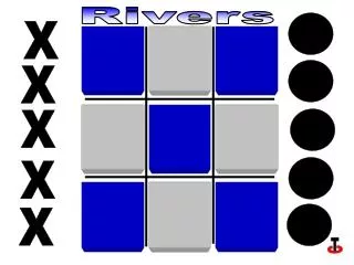
Rivers. Location Profiles Processes Landforms. Main UK Rivers. Thames. 10. Spey. 1. Clyde. 4. 2. Shannon. 1. 7. Tees. 3. 5. Ouse. 9. 5. 4. Tay. 2. Severn. 8. 7. Trent. 6. 6. Forth. 9. 3. 8. 10. 2. 5. River Profile. Source. Mouth + Delta.

E N D
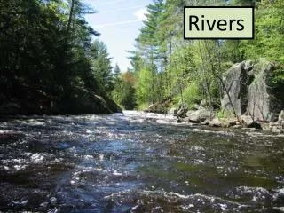
Rivers Location Profiles Processes Landforms
Main UK Rivers Thames 10 Spey 1 Clyde 4 2 Shannon 1 7 Tees 3 5 Ouse 9 5 4 Tay 2 Severn 8 7 Trent 6 6 Forth 9 3 8 10
2 5
River Profile Source Mouth + Delta Classic River Profile Upper Course Middle Course Lower Course Steep ground Moderate ground Gentle ground Fast flow Moderate flow Gentle flow Erosion Transportation Deposition V-shaped valley Waterfall Small meander Small floodplain Large meander Large floodplain Oxbow lake
River Processes - Transportation Now Watch The Flash Presentation On River Transportation
Process Description Saltation Force of water drags or rolls rocks along river bed. Traction Dissolved material is carried along in the water. Suspension Pebbles are picked up and bounced along the river bed by flowing water. Solution Very light clays are held up in the water as it flows. River Processes - Transportation
River Processes - Erosion Abrasion/Corrasion Hydraulic Action Corrosion Attrition Force of water hitting off river banks causes them to wear down. Stones carried by river hit into river bed and bank, eroding & scraping them. Stones collide into each other knocking edges off – get smaller and rounder. Rocks dissolve in water e.g. limestone
Landforms Of The Upper Course V-shaped Valleys Waterfalls
V-shaped Valley River Gradient River Speed Erosion
1 As the river flows it erodes downwards initially, due to the great energy it has. This happens mainly because of the process of corrasion (explain in detail for in exam!)
2 The river therefore forms a deep and steep sided channel. Over time freeze thaw (again explain) weathering acts upon the riverbank. This loosens the rock and soil.
3 As the rock & soil from the river bank breaks up, it is transported to the river by to gravity and the wash effect of rain on the soil.
4 The eroded material that falls into the river is then transported downstream by the river and is deposited on its bed or on a river beach.
2 1 3 4 1 2 3 4 River erodes downwards due to fast flowing water carrying stones. A deep/steep sided channel forms & weathering loosens soil on the banks Rock & soil from river bank breaks up, falls into river due to gravity & rain Eroded material transported downstream and deposited on river bed.
Waterfall River Gradient River Speed Erosion
Waterfall Now Watch The Two Flash Presentations On Waterfall Development
Waterfall Now Watch The Second Flash Presentation On Waterfall/Gorge Development
A = Hard Rock Swirling Rock Soft Rock Unsupported Rock Plunge Pool Undercutting A D C B Waterfall- Diagram C = F = D = B = E = E F
Waterfall gorge ~ soft ~ abrasion ~ collapses ~ cliff ~ deeper ~ plunge ~ hard A waterfall is formed when a river flows over a layer of ______ rock, which is lying over a layer of soft rock. The _____ rock erodes more quickly. The hard rock sticks out forming a _____ in the river, which is a waterfall. The soft rock at the bottom of the waterfall/cliff is then eroded further to form a ____________ pool. This pool becomes bigger and ____________ as water swirls broken rock around. The hard rock is left unsupported and so eventually ______________. Over a long period of time the waterfall retreats backwards forming a narrow and steep sided valley called a _______. You will gain marks for describing either how the erosion occurs e.g. Hydraulic Action & __________. hard soft cliff plunge deeper collapses gorge abrasion
Meander Oxbow Lake Floodplain Landforms Of The Middle & Lower Course
Meanders Inner Bend Outer Bend Slow Flow Fast Flow Low Energy High Energy Small Rocks Large Rocks Deposition Erosion Shallow Water Deep Water River Beach River Cliff
Bank will collapse Small river cliff ( river beach ) Deposition of Sand and shingle Deepest part of the river Meander - River bend Fastest current slowest current Outer bank Is undercut
Meanders - Sequence Exercise Use your cross section diagram and the words in the same order as below to write 2 paragraphs explaining how meanders form. Paragraph 1 Outer bend ~ fast flow ~ high energy ~ large rocks ~ erosion ~ deep water ~ river cliff. Paragraph 2 Inner bend ~ slow flow ~ low energy ~ small rocks ~ deposition ~ shallow water ~ river beach
Formation of a Meander Alluvium river cliffs greatest speed deposition erosion loss of energy meanders The course of a river usually has many bends in it. These are called___________. The _____________of water is on the outside of the bend where _________takes place and the channel is worn away to make___________The water flows more slowly round the inside of the bend. This causes __________________ and _________________ when the river overflows its banks it deposits material called ______________ on the valley floor. meanders greatest speed erosion river cliffs loss of energy deposition alluvium
Deposition Erosion Meander Floodplain Alluvium Shallow Water Deep Water
Blue - River Green Valley Floor Brown Valley Sides
2 5
Outer Bend An oxbow lake starts to form when large meanders develop close together (A). As their outer bends erode more, there is only a small piece of land remaining between them, called a neck (B). Large Meanders Neck Oxbow Lakes
Straighter Channel Eventually the river erodes through the neck of the meander and makes a new straighter river channel (C). The river now flows down this channel and deposits material blocking up the old channel. Deposition Old Channel
This leaves an oxbow lake in the old river channel and without a supply of water the lake can dry up (D). The lake may reform when there is heavy rain or flooding. Oxbow Lake
Flat Land Floodplain
Floodplain Flat Land Meander Sketch
A A F F Floodplain E B C D A = B = C = D = E = F = Bluff Line Layers Of Alluvium River Bed Level Rises With Increased Deposition Small Particles Deposited Away From River Larger Particles Deposited Close To River Levee
Floodplain A floodplain is a flat area of land either side of a river, which floods regularly. The widest examples are found in the middle and lower course. The river valley gets wider as meanders continue to grow, eroding back the sides of the valley. The flat valley that forms is called a floodplain and develops as alluvium (mud/silt) sediment is deposited after a flood. The smallest particles are found at the edge of the floodplain and the largest particles nearest to the river. The largest particles by the river bank form a mini ridge called a levee, which runs parallel with the river.