Download
1 / 81
810 likes | 978 Vues
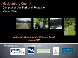
Presented by: In association with:. Mecklenburg County Comprehensive Park and Recreation Master Plan. Nationally Recognized….Uniquely Local March 2008. ETC Institute Leisure Vision. Themes.

E N D
Presented by: In association with: Mecklenburg CountyComprehensive Park and Recreation Master Plan Nationally Recognized….Uniquely Local March 2008 ETC Institute Leisure Vision
Themes • Connecting people to opportunities and places within Mecklenburg County Parks and Recreation Services • Three Key Themes: • Conservation and Stewardship • Parks and Greenways • Recreation Programs and Facilities
Purpose of the Study: Goals and Objectives Seek community input to guide Department direction Update Nature Preserves Plan Update Greenways Plan Identify GAPS in parks and recreation facilities across the County and in Towns Identify remaining pieces of land that could be acquired for park and nature preserves Establish what to do with “land banked” properties
Purpose of the Study: Goals and Objectives (cont.) Development of a Program Plan for the Department to implement Establish park, facility and amenity standards and needs across the County Establish a Capital Improvement Plan for existing assets, new parks, recreation facilities, and land Coordinate the needs of Towns in the County with the MCPR Master Plan as one plan
Methodology in Development of the Master Plan Focus groups, stakeholder interviews, household survey Analysis of existing master planning documents Greenprinting process to identify available land and gaps based on a weighted criteria built on community values for natural areas, neighborhood parks, community parks, and regional parks
Mecklenburg County Citizen Survey • Questions on full range of usage, customer satisfaction, needs, unmet needs, and priorities questions • Goal of 1,000 completed surveys. • Actually completed 1033 surveys. Results have 95% level of confidence with margin of error of +/-3%
Finding #2: Participation in Programs is Lower with Good Satisfaction
Finding #3: Mecklenburg County is Prime Provider of Services
Finding #6: Residents Have a Need for a Wide Range of Parks and Recreation Facilities
Finding #8: Walking and Biking Trails and Outdoor Swimming Pools Are Most Important Facilities
Finding #9: Respondents Have a Need for a Wide Range of Programs
Finding #13: 50% of Respondents Do Not Feel There Are Sufficient Parks and Green Space Areas Within Walking Distance of Their Residence, With 11% Not Sure
Finding #14: Using Greenways for Environmental Protection and Major Connected Network of Trails Are Very Important
Finding #16: Purchase Land to Preserve Open/Green Space, Use Floodplain Greenways to Develop Trails/Facilities, and Develop New & Connect Existing Walking/Biking Trails Are Most Important Actions
Q17. Actions Respondents Would Be Most Willing to Fund With Their County Tax Dollars by percentage of respondents who selected it as one of their top four choices 44% Purchase land to preserve open/green space 34% Use floodplain greenways to develop trails/facil 34% Develop new & connect existing walk/biking trails 28% Fix-up/repair older park buildings/recreation ctrs 25% Upgrade existing neighborhood/community parks 22% Develop new nature trails/nature centers 18% Develop new indoor recreation centers 17% Develop special events park for festivals/concerts 17% Purchase land to protect the environment 13% Purchase land to develop athletic fields/rec facil 12% Develop multi-purpose indoor athletic/activity ctr 10% Upgrade existing youth/adult athletic fields 9% Develop new off-leash dog parks 6% Develop new fieldhouse at Grandy Cole Center site 6% Develop new outdoor spray pools 5% Develop a new 50 meter competitive pool 4% Develop skate parks 1% Develop soap box derby 4% Other 0% 20% 40% 60% 1st Choice 2nd Choice 3rd Choice 4th Choice Source: Leisure Vision/ETC Institute (January 2008) Finding #16: Purchase Land to Preserve Open/Green Space, Use Floodplain Greenways to Develop Trails/Facilities, and Develop New & Connect Existing Walking/Biking Trails Are Most Important Actions
Finding #17: Over 75% of Respondents Would Vote in Favor or Might Vote in Favor of a Bond Referendum to Fund the Acquisition, Improvement and Development of the Parks, Trails and Facilities Most Important to Their Households
Summary of Overall Findings Usage of parks is high with good satisfaction Participation in programs is lower with good satisfaction Mecklenburg County Parks is the prime provider of services
Summary of Overall Findings Enjoyment of the outdoors and close to our home/residence are prime reasons for usage Market reach of web site is high with opportunities to improve overall marketing There is a wide range of needs and unmet needs for outdoor and indoor parks, trails, recreation facilities and programs
Summary of Overall Findings Walking and biking trails are the most important facilities, followed by small neighborhood parks, and large community and regional parks Special events/festivals and adult fitness and wellness programs are most important programs
Summary of Overall Findings Market opportunities exist to grow programs of high importance at Mecklenburg County facilities 50% of household respondents do not feel there are sufficient parks and green space areas within walking distances of their residence, with 11% not sure
Summary of Overall Findings 88% or more of households feel it is important to use Mecklenburg County Greenways for environmental protection and a major connected network of walking, biking and nature trails
Summary of Overall Findings Purchase land to preserve open/green space, use floodplain greenways to develop trails/facilities, and develop new and connect existing walking and biking trails are most important actions respondents would support with tax dollars
Natural Areas – Land Acquisition Priorities Greenprinting: 2-stage process • Resource Analysis • Top-down conservation assessment • Parcel Prioritization • Bottom-up acquisition analysis
Greenprinting Step 1: Resource Analysis – Areas Critical for Habitat Protection 5% Forested Habitat 5% Early Successional Habitat 5% Wetland Habitat 5% Riparian Habitat 5% Natural Heritage Sites 25% Buffer zones adjacent to identified unique/rare habitats and NHSs 10% Wildlife Corridors 10% Endangered, Rare, and Species of Concern 5% Critical Watersheds 25% Large Unbroken Natural Areas *Relative weights indicate strategic importance for acquisition
Greenprinting Step 2: Parcel Prioritization – Natural Areas Acquisition Priorities Requirements: • Must be greater than 5 acres • Must contain a critical natural resource Scoring Criteria: • Total area of natural or pervious cover • Cultural resource present: farmland or historic site • Adjacent to an existing Nature Preserve • Targeted for acquisition (MIL Corridor property or 2007 Natural Areas Needs Assessment property) • Significant for water quality protection • Adjacent to existing park or greenway • Adjacent to other natural areas (CLC lands) • No Nature Preserve within a 3 mile radius
Tier 1 and Tier 2 - Priority Lands for Natural Area Protection Tier 1 60 properties 3,578 acres Tier 2 28 additional properties 2,591 additional acres
Tier 1, Tier 2 and Tier 3 - Priority Lands for Natural Area Protection Tier 1 60 properties 3,578 acres Tier 2 28 additional properties 2,591 additional acres Tier 3 85 additional properties 6,991 additional acres
Land Banked Properties - Nature Preserves Stevens Creek Nature Preserve Berryhill Nature Preserve Oehler Nature Preserve Gateway Nature Preserve & Community Park Davis Farm Nature Preserve (N. side of Hucks Road) Sherman Branch – to be determined / remain land-banked
Land Banked Properties - Neighborhood, Community & Regional Parks • Neighborhood Parks • Teddington Drive • Crossridge Road • Eagles Landing property • Lincoln Heights property • Mayerling Drive • Prosperity Church property • Reid Park property • Community Parks • Capps property • Ezzel Farm property • Belt Road property • Pineville property • Reddman property • Gateway property • Hucks Road property • Regional Parks • Back Creek Church Road property • Eastfield property • Sherman Branch – to be determined / remain land-banked
Nature Center Methodology 7-1. Master Planning: Is the recreation center identified in the 2008 Parks Master Plan? [Y=2, N=0] 7-2. Property Ownership: Does the county, or partnering entity, currently own all parcels necessary for recreation center development? [Y=6, N=0] 7-3. Service Gap: Are there any developed recreation centers within a 2.5 mile radius? [Y=0, N=3] 7-4. Expansion: Does the project expand the current scope of programming at the recreation center? [Y=1, N=0] 7-5. Partnership Opportunity: Has a school, senior center, church, and / or library partnership opportunity been identified? [Y=5, N=0] Have outside funding sources been identified? [Y=3, N=0] Is the recreation center adjacent to a school, senior center, church, and / or library facility? [Y=1, N=0] 7-6. Linkages: Is the recreation center adjacent to a planned and / or developed greenway? [Y=1, N=0] Is the recreation center adjacent to a planned and / or developed park? [Y=1, N=0] 7-7. Mass Transit: Is the recreation center within a 0.5 mile radius of a public transportation station / depot? [Y=1, N=0]
Greenway Action Plan Primary Creek Corridors Minor Modifications – Town additions, citizen input, partnership opportunities 5 Year Development Plan Focus trail development on County land Apply ranking criteria to prioritize trail development Improvements to Existing Facilities Overland Connections – coordination with CDOT 10 Year Development Plan 5 Year Acquisition Plan Previous 10 year CNA Ranking Criteria
Primary Greenway Corridors Back Creek Back Creek Tributary Barton Creek Briar Creek Caldwell Station Creek Campbell Creek Cane Creek Clarke Creek, South Prong Clark’s Creek Clark’s Creek Tributary Clem’s Branch Coffey Creek Dixon Branch Doby Creek Edward’s Branch Flat Branch Four Mile Creek Gum Branch Irvins Creek Irwin Creek Kings Branch Little Hope Creek Little Sugar Creek Long Creek Mallard Creek Mallard Creek Tributary McAlpine Creek McDowell Creek McIntyre Creek McKees Creek McMullen Creek Paw Creek Polk Ditch Ramah Creek Reedy Creek Reedy Creek Tributary Rocky River Rocky River, North Prong Rocky River, South Prong Rocky River, West Branch Six Mile Creek Steele Creek Stewart Creek Stewart Creek – Lakewood Tributary Sugar Creek Toby Creek Torrence Creek Torrence Creek Tributaries Walker Branch
Trail Development – Ranking Criteria No Significant Barrier to Construction Developed Miles Per Park District <10% of planned miles, 10 points, >50% 0 points Project Partnerships 10 points per mile – public or private partnerships. No $ necessarily tied to development Funding Partnerships 1 point per $10,000 Located in Surrounding Town Listed in Other Adopted Plans or Studies Linkages -- Connectivity School, park or greenway facility, planned regional trail, destination, college/library, mixed-use development, transit, office or commercial area, neighborhood access Land Acquisition Multiplier Greenways Trail Development Methodology
5 Year Results Trail Development 42.8 miles of trail ($46.8M), 12.8 of which is currently funded 68 miles of trail by 2013! Distributed across the County Focus on Partnerships Trail development in parks and nature preserves Improvements to existing – 22 projects, $5.2M Overland Connections – further collaboration with CDOT Planning Process Update Stakeholder process on the front end Town plans are the county plans Recommendations – Ordinance review, Development Efficiencies
10 Year Results 5 Year Acquisition Plan Trail Development Complete Little Sugar Creek Greenway Complete Mallard Creek Greenway Regional Connections CDOT Connections 61.9 miles – total of 129 miles!
Park Facilities Gaps and Needs Analysis 2-stage process: • Capacity Service Area Analysis • Existing assets - map service areas based on facility capacity • Gap Analysis and Parcel Prioritization • Identify opportunities for new facilities in service gaps: • Size • Access via frontage on a major or minor thoroughfare • Partnership via adjacency to a school, library • Linkages to greenways • Linkages to developed parks • Residential population within new service area • Public transit accessibility
Park Facilities Methodology 6-1. Master Planning: Is the project identified in the 2008 Parks Master Plan? [Y=2, N=0] Does the project have its own approved Master Plan? [Y=2, N=0] 6-2. Service Gap: Are there any parks within the project’s intended service radius? [Y=0, N=4] 6-3. Residential Population: What is the residential population within the intended project’s service radius of the project (normalized to 0.5 mile radius)? [Add 1 point for each 10,000 persons] 6-4. Expansion: Does the project expand the current scope of programming at the facility (i.e. additional phase of development)? [Y=1, N=0] 6-5. Partnership Opportunity: Is project adjacent to a school and / or library? [Y=1, N=0] Has a public and / or private partnership been identified? [Y=1, N=0] Has an outside funding source been identified? [Y=2, N=0] 6-6. Linkages: Is project adjacent to a planned and / or developed greenway? [Y=1, N=0] Is the project adjacent to a planned and / or developed nature center? [Y=1, N=0] Is project adjacent to a planned and / or developed recreation center? [Y=1, N=0] 6-7. Mass Transit: Is the project within a 0.5 mile radius of a public transportation station / depot? [Y=1, N=0]
Neighborhood Parks - Service Area Analysis Neighborhood parks are 2 to 20 acres Neighborhood parks service radius is density based upon 3 acres per 1000 people