Download
1 / 18
180 likes | 185 Vues
Learn how the US IOOS Coastal and Ocean Modeling Testbed accelerates the transition of scientific advances to improve operational ocean products and services. Discuss the current projects, drivers for involvement, and ways to improve collaboration.

E N D
US IOOS Coastal and Ocean Modeling Testbed:How it can work for you! Becky Baltes COMT Project Manager February 25, 2015
Outline • COMT Background/Infrastructure • Current Projects • Drivers for COMT (READ: Where CSDL/CO-OPS can get involved) • Questions for you • Discussion on path forward 2
Background • Mission: To use targeted research and development to accelerate the transition of scientific and technical advances from the coastal and ocean modeling research community to improve identified operational ocean products and services (i.e. via research to operations and also operations to research). • Vision: A National Coastal and Ocean Modeling Testbed to enhance the accuracy, reliability, and scope of the federal suite of operational ocean modeling products, while ensuring its diverse user community is better equipped to solve challenging coastal problems and recognize the COMT to be where the best coastal science is operationalized. • COMT: • At IOOS • At NOAA • Compared to other NOAA Testbeds and Proving Grounds • Across Agencies 3
Organizational Chart EOB TSG? TMG
Projects GoMx- Hypoxia Cyber Infrastructure Fennel et al. JGR SURA issue (2013) SciWMS image below for Ruoying He's model rendered directly from a DAP server. WCOFS Wave Inundation CB- Hypoxia 6
Drivers • Ecological Forecasting Roadmap • Storm Surge Roadmap • OFS Development Cycle • Federal Operational Requirements • Administrative • ToR • Implementation Plan (Not written) 7
COMT Lessons Learned • Need for federal catcher’s mitt and identified funding and user requirement • End state for coastal ocean models and products may not follow existing pathways • Always need more coordination up front to improve coordination • Interagency coordination may come from individual projects 8
Questions/Topics for you • How can COMT better fit into NOS modeling advancements/Requirements? (Does timing matter?) • What is a better way to collect requirements from you? • Current role of Tech Steering Group (Incl. Pat and Ed) and how to shift it to better enable collaboration within NOS • How COMT fits into EFR and how it doesn’t 9
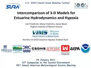
Transitioning an Estuarine Hypoxia Model to Operations in the Chesapeake Bay Virginia Institute of Marine Science, College of William & Mary Marjorie Friedrichs (PI) Carl Friedrichs (co-PI) Aaron Bever (consultant) Ike Irby (graduate student) Jian Shen (unfunded collaborator) Woods Hole Oceanographic Inst. Malcolm Scully (co-PI) Center for Environmental Science, University of Maryland Raleigh Hood (co-PI) Hao Wang (graduate student) Wen Long (unfunded collaborator) NOAA/CSDL Lyon Lanerolle (co-PI) Frank Aikman (unfunded collaborator) Objective Assess the readiness/maturity of a suite of existing estuarine dissolved oxygen models for producing predictions of hypoxia within the Chesapeake Bay, in an effort to accelerate the transition of hypoxia model formulations from academic research to Federal operational and regulatory centers.
Seasonal and Short-term Forecast System and Nutrient Load Scenarios for Hypoxia Prediction in the Northern Gulf of Mexico Katja Fennel (PI) Dalhousie Robert HetlandTexas A&M Jiangtao Xu NOAA Coast Survey Development Lab Dong S. KoNaval Research Laboratory DubravkoJusticLouisiana State University Partners Frank Aikman (CSDL), John Lehrter (EPA), Mike Murrell (EPA) Fennel et al. JGR SURA issue (2013) Objective Implement and demonstrate a real-time hypoxia forecasting system applicable to the hypoxia-prone Northern Gulf of Mexico.
The US West Coast Component of the COMT Alexander L. Kurapov (PI) Oregon State University Christopher A. Edwards University of California at Santa Cruz Yi Chao Remote Sensing Solutions, Inc Objectives • Compare 3 existing models as a step toward a coordinated super-regional modeling capability for the U.S. West Coast. • All the models are based on ROMS but differ in resolution. • The data assimilation components are different for each system. Pros and cons of each system will be analyzed. • Assess accuracy in forecasting surface and subsurface fields. • Compare performance of 3 different bio-chemical models (NPZDO, NEMURO, COSINE) within a single ROMS domain.
Puerto Rico/U.S. Virgin Islands Surge and Wave Inundation Model Testbed André van der Westhuysen, PI/Modeler IMSG at NOAA/NWS/NCEP/EMC Numerical Modeling Team: Joannes Westerink, Team co-PI University of Notre Dame Jane Smith, Team co-PI* USACE-ERDC Juan Gonzalez, Modeler University of Notre Dame Aurelio Mercado+Student, Modeler University of Puerto Rico Christina Forbes, Modeler NOAA/NWS/NCEP/NHC Operational Assessment Team: Jamie Rhome, Team co-PI* NOAA/NWS/NCEP/NHC Jesse Feyen, Team co-PI* NOAA/NOS/OCS/CSDL Data Management Team: Julio Morell, Team co-PI* CariCOOS/University of Puerto Rico *In-kind Objectives • Extend the present wave/surge operational forecasting capability from mild-sloped coastal areas such as the US East and Gulf of Mexico coasts to steep-sloped areas such as around Caribbean and Pacific islands • Transition this capability to NOAA’s National Hurricane Center and local WFOs.
Cyberinfrastructure for a Coastal & Ocean Modeling Testbed Eoin Howlett (PI) Applied Science Associates (ASA) David Foster ASA David Stuebe ASA Brian McKenna ASA Charlton Galvarino Collaborator, Consultant SciWMS image below for Ruoying He's model rendered directly from a DAP server. Objectives The goal of this project is to improve the function and performance of SciWMS so it can be used to visualize all compliant model results and observational data stored on the COMT archive server and to develop a SciWMS based web client to perform the visualization
Current Organizational Chart IOOS Program Office IOOS PM (Becky Baltes) Non-Federal Manager (SURA) SURA PM (C.Reid Nichols) SURA PI (Rick Luettich) TSG Shelf Hypoxia Inundation (PR/USVI) Cyber Infrastructure Estuarine Hypoxia West Coast
COMT Ongoing Goals • Advance common infrastructure for access, analysis and visualization of all ocean model data produced by the Federal Backbone and the IOOS Regions • Improve R2O and O2R by building stronger relationships between academia and operational centers through collaboration • Advance skill metrics and assess models in different regions and dynamic regimes • Transition models, tools, toolkits and other capabilities to federal operational facilities • Allow for both continuity of effort and new projects