Download
1 / 27
300 likes | 546 Vues
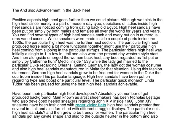
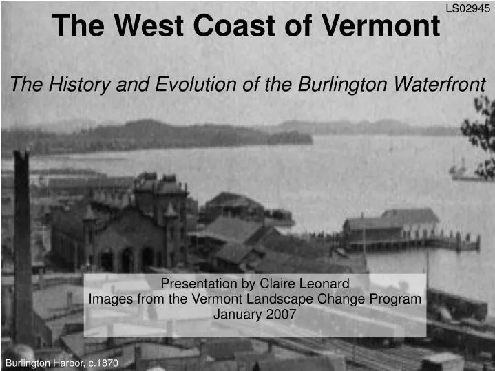
LS02945. The West Coast of Vermont The History and Evolution of the Burlington Waterfront. Presentation by Claire Leonard Images from the Vermont Landscape Change Program January 2007. Burlington Harbor, c.1870. Image from 1910. LS11508.

E N D
LS02945 The West Coast of VermontThe History and Evolution of the Burlington Waterfront Presentation by Claire Leonard Images from the Vermont Landscape Change Program January 2007 Burlington Harbor, c.1870
Image from 1910. LS11508 The waterfront of Burlington, Vermont, has been utterly transformed by humans several times in the last two centuries. The profile of the waterfront has altered to reflect changes in economics, transportation, technology, and land use philosophy.
LS01382 When Burlington was first settled, the shoreline of Burlington Bay consisted of a sandy, marshy crescent. An 1811 drawing of Burlington Bay shows rocks and sand.
1823: The Champlain Canal opened, allowing easy maritime trade to New York and the rest of the US for the first time. Trade and industry along the lake exploded. Burlington quickly became the biggest port in Vermont. Lumber, stone, and other products were shipped on barges and canal schooners. 1843: Another canal opened to the north, making trade with Canada easier. Juniper Island and Lake Champlain, c.1900. The view hasn't changed much since the 19th century. LS10000
LS00097 A drawing shows Burlington Harbor in 1841, just after the first breakwater was constructed. At least twelve wharves were built out into the lake. Most of the boat traffic was sailing ships, but several steamboats were operating on the lake by this time.
1849: A rail line came to the Burlington waterfront. Railroad companies, using sawdust from the lumber operations, filled in much of the lake shore, creating new land for lumberyards and rail yards. As the Vermont forests were depleted, the port shipped mostly lumber imported from Canada. LS02921 An 1865 stereoview shows industrial buildings and a railyard on filled land.
Beers Map from UVM Historic Preservation Program An 1869 map of Burlington shows the land and piers created by the railroad. In some places, they extended the shoreline by 500 feet. Lake Street, on the left side of the map, used to run right along the lake shore, but is now inland. To protect all the new development, the breakwater was extended in 1867.
A detail of the map shows the rail lines and engine house. Storage areas for lumber are visible along the top left. Two planing mills and a foundry can be seen on the lower right. Beers Map from UVM Historic Preservation Program
LS02980 A c.1870 stereoview shows the lumberyards and train depots. Burlington was the third busiest port in the US at this time. In 1873, 170 million feet of board lumber passed through Burlington.
LS00357 1860-1890 were the port's busiest years. This 1877 drawing shows the extent of the industrialization of the Burlington Waterfront. Note the Pine Street Barge Canal to the lower right, the piles of stacked lumber, and the steam and sailing ships. Over time, maritime trade became less economical compared to the railroad, and shipping became less important. The lumber industry in Vermont began to decline in the 1880s.
LS00081 This 1888 image taken from Battery Park shows a fire on the waterfront. Note how there are more buildings and less lumber storage. Also note the yacht club on the far right. Another 1888 image, taken from the other direction. The fire damage on the left is presumably from the same fire. LS00072
LS02022 This image from 1900 shows a much less busy harbor, and much less lumber.
LS00080 By the 1930s, the waterfront was dilapidated and underused. This photo was taken in 1930 from Battery Park, and shows bare grass and a single industrial building where the piles of lumber had been half a century before. Rail traffic at this time was reduced, because road transport had improved dramatically.
LS00079 This 1935 image shows wrecked boats and a weedy landscape. The yacht club is the only building that seems to be in reasonably good condition.
For much of the 20th century, the waterfront served as a storage area for coal and petroleum products that were imported by barge or rail. The Pine Street Barge Canal (upper right) became polluted in the early 20th century by a gasworks operation. This 1951 image shows the waterfront with petroleum storage tanks and little other development. Plumes of sediment and remnants of earlier structures are also evident. LS12108 (detail)
The Moran Plant, seen at the lower right, was a coal-fueled electric plant that operated from 1954 until 1986. This image is from 1975, and shows the extent of the rail yards and storage areas. LS12025
LS06418 Be glad this never happened! This model, from the 1970s, shows a proposed elevated highway that would have run along the waterfront. By the 1980s, the city began to look for ways to improve and redevelop the waterfront. Several proposed commercial projects-- including a plan for 18 story condos-- fell through. In 1989, the Supreme Court ruled that all the land the railroad companies had created by fill was a public trust, allowing limited options for development.
The “Burlington Waterfront Revitalization Plan” was developed in 1990. The plan had many goals, including: • The intention to make the waterfront an area that all the citizens of Burlington could enjoy freely year-round. • An effort to use existing buildings (like the Moran Plant) to create community resources, such as the ECHO Center, and to preserve elements of the area's industrial past. • Plans to make the area attractive and accessible for many different forms of recreation, including biking, skating, boating, and fishing. Burlington in 1980. LS00357
Recreation: The revitalization project was focused on developing the area for recreational use. Amidst the industrial history of the waterfront, people have used the area for recreation as well. This 1909 picture shows the Burlington Yacht Club. Three similarly designed buildings have existed at that location since 1887. The first two burned down, but the Burlington Community Boathouse exists there now. LS11291
Even in its post-industrial ruin, people managed to use the waterfront for recreation. This 1960 picture shows a man fishing, with ruined dock pilings in the distance. LS12084
More recreation: Perkins Pier in 1965. As today, it was used as a marina, though the park was not yet present. LS12057
LS11319 Transportation: The Burlington Waterfront also has a long history of transportation and tourism. Lake Champlain has had a tourist industry since the 1840s. This 1886 photograph shows a large passenger steamer docked in Burlington.
LS02864 The Champlain Transportation Company has been running ferries across the lake since the 1840s. Obviously, they've had some troubles along the way. This is the King Street Ferry dock in 1936, after a spring flood washed a number of boats onto the road, probably from the adjacent Perkins Pier marina.
LS02855 The confluence of transportation, recreation, and tourism. A ferry, the “City of Burlington”, sits at dock in front of the yacht club in 1937. In the background is the steamer “Ticonderoga”.
The same scene in 2004. The red-roofed Burlington Community Boathouse sits behind a small marina where pleasure craft are moored. Where this photo was taken, petroleum tanks stood in the 1970s. Though some elements of its industrial past remain, much of the Burlington waterfront today is an attractive public park. LS02855_001
Battery Park has historically overlooked a barely-developed lakeshore, a busy port for wooden sailing ships, a vast lumberyard and railyard, a post-industrial wasteland, and finally, Waterfront Park. The Burlington waterfront continues to evolve today, with continued revitalization and careful development. Many acres north of this park are being kept undeveloped, left for the future. LS00593_001
Bassett, T.D. Seymour. “An Inland Port: Burlington, Vermont, in 1840”. The New England Quarterly, Vol. 44, No. 4. (Dec., 1971), pp. 635-649. JSTOR. Accessed 1/8/07. <http://links.jstor.org/sici?sici=0028-4866%28197112%2944%3A4%3C635%3AAIPBVI%3E2.0.CO%3B2-0 > City of Burlington. “Burlington Waterfront Revitalization Plan”. Community and Economic Development Office, 1998. Accessed 1/9/07. <http://www.cedoburlington.org/waterfront/plan/watrevsection1.htm> City of Burlington. “The Moran Plant: History and Past Ideas”. Community and Economic Development Office, 2007. Accessed 1/9/07. <http://www.cedoburlington.org/moran_plant/history_and_past_ideas.htm> Lake Champlain Basin Program. “Wayside Exhibits: Burlington Area Exhibits”. Lake Champlain Basin Program, 2004. Accessed on 1/9/2007. First seen along Burlington Bikepath. <http://www.lcbp.org/wayside/sites/burlingtonsites.htm> Lake Champlain Maritime Museum. “History of Lake Champlain” Lake Champlain Maritime Museum. Accessed 1/7/07. <http://www.lcmm.org/shipwrecks_history/history/history.htm> Rakos, Lynn (?). “Burlington Breakwater: City of Burlington, Vermont”. US Army Corps of Engineers, New York District, 2006. Accessed 1/9/2007 <http://www.nan.usace.army.mil/project/vermont/burweb/> University of Vermont. “Historic Preservation Program Research: Student Projects”. Historic Preservation Program, 2006. Accessed 1/8/2007. <http://www.uvm.edu/histpres/HPJ/index.html> Sources