Download
1 / 21
220 likes | 426 Vues
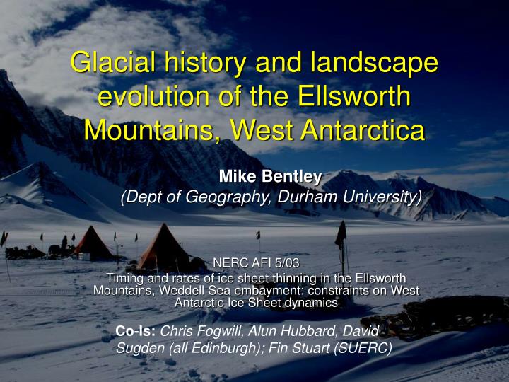
Glacial history and landscape evolution of the Ellsworth Mountains, West Antarctica. Mike Bentley (Dept of Geography, Durham University). NERC AFI 5/03 Timing and rates of ice sheet thinning in the Ellsworth Mountains, Weddell Sea embayment: constraints on West Antarctic Ice Sheet dynamics.

E N D
Glacial history and landscape evolution of the Ellsworth Mountains, West Antarctica Mike Bentley (Dept of Geography, Durham University) NERC AFI 5/03 Timing and rates of ice sheet thinning in the Ellsworth Mountains, Weddell Sea embayment: constraints on West Antarctic Ice Sheet dynamics Co-Is: Chris Fogwill, Alun Hubbard, David Sugden (all Edinburgh); Fin Stuart (SUERC)
LGM configuration of WAIS • Ice volumes • can’t yet quantify Antarctic ice volume • Needed for models • WSE is biggest unknown • When did ice start thinning and at what rate ? • Meltwater pulse 1A • ~20m sea level rise in <600 years • Weddell sea identified as candidate for source of MWP-1A but no geological evidence • Other Qs relating to deglaciation history e.g. influences on Weddell Sea oceanography Address Qs using: geomorphology, and cosmogenic surface exposure dating
Retreat history of Weddell Sea ice • Did the WAIS thin relatively early to a close-to-present configuration, or has it been thinning progressively from sometime after the LGM until the present day ? Glacial-interglacial transition OR Height of ice ? ? Time Time now now
Ross Sea region Stone et al., 2003. Science
Previous work in Ellsworths Denton et al., 1992, GSA Memoir Todd et al., WAIS 2004
Mt Epperly, Sentinel Range Denton et al trimline is of unknown age but has been widely assumed to come from LGM
MAR-2-CJF, MAR-3-CJF, MAR-4-CJF, MAR-5-CJF MAR-01-MJB, MAR-02-MJB MAR-03-MJB MAR-04-MJB MAR-05-MJB MAR-06-MJB MAR-6-CJF, MAR-7-CJF, MAR-8-CJF, MAR-9-CJF, MAR-10-CJF, MAR-11-CJF MAR-22-MJB, MAR-23-MJB, MAR-24-MJB, MAR-25-MJB MAR-12-CJF, MAR-13-CJF, MAR-14-CJF, MAR-15-CJF, MAR-16-CJF, MAR-17-CJF Marble Hills (central)
> 2 Ma Long Gables, Sentinel Range.
190 ka ~24 ka ? Marble Hills, Heritage Range
~24 ka ? Marble Hills, Heritage Range.
Patriot Hills Blue-ice moraines and ice dynamics Independence Hills
Summary of Glacial History and landscape evolution • Pre-existing fluvial landscape. Summits, drainage valley pattern • Alpine Glaciation. Formed dominant topography of horns, aretes etc but didn’t completely destroy fluvial. [Very old – likely pre-Quaternary ?] (> 2Ma) • Major WAIS expansion prominent Denton et al (1992) erosional trimline [could be ‘old’ ] (>140-400ka) • Possible cold-based glaciation(?) to a level below (3). • WAIS expansion to intermediate level. [Probably LGM in age] (< 24ka ?) • WAIS thinning. Intermediate moraines • Minor WAIS expansion ? Shown by fluted (overridden) moraines at several sites in Heritage Range. Few tens of metres thickening. • WAIS thinning, possibly ongoing. Preliminary cosmogenic surface exposure dates in bold
Conclusions • During the LGM the WAIS in the Weddell Sea embayment was much thinner (possibly half as much ice) than previously realised, we mapped this lower trimline over a 350 km transect • Main ‘Denton et al’ trimline is much older than thought -lots of weathering/geomorphological data -preliminary exposure age above trimline > 2 Ma -exposure ages below trimline suggest ice expansion > 140 ka • 200+ samples from 11 sites (350 km transect) to test thinning hypotheses -each site consists of an altitudinal profile of samples -awaiting data on lower thinning history but moraine limit may be ~24 ka • Long history of landscape evolution -using mapping, image analysis and cosmo analysis
Next steps • Laboratory: cosmogenic 10Be, 26Al, 21Ne analyses – Chris Fogwill • Modelling: linking thinning history to grounding line movements - Alun Hubbard