Download
1 / 18
180 likes | 316 Vues
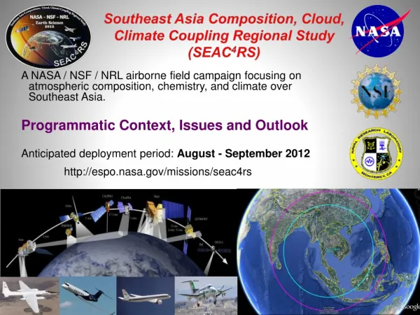
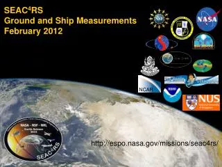
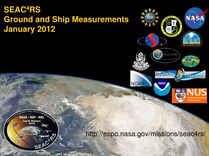
SEAC 4 RS Ground and Ship Measurements January 2012. NCAR. http://espo.nasa.gov/missions/seac4rs/. Surface Network Overview. Because of metrological complexity & political sensitivities in SE Asia, data from a ground network is required to adequately cover the region.

E N D
SEAC4RSGround and Ship MeasurementsJanuary 2012 NCAR http://espo.nasa.gov/missions/seac4rs/
Surface Network Overview • Because of metrological complexity & political sensitivities in SE Asia, data from a ground network is required to adequately cover the region. • All SEAC4RS ground components of sun photometer, lidar, ozone and in situ measurements have field history in the region with established partners. • There are few total “unknowns” but we expect the deployment to be fairly “fluid.” in nature. • Also, there is still room to accommodate needs of the science team, including the deployment of additional instrumentation-particularly at supersites and at sea.
Ground Network Components and preliminary POCs • AERONET/MAN: Brent Holben (brent.n.holben@nasa.gov ) • 20 Long term+7 Temporary • 3 ferry lines to be manned with microtops for MAN • MPLNET: Judd Welton (ellsworth.j.welton@nasa.gov ) • 4 Long term +5 Temporary sites. • NEIS in Thailand • SHADOZ: AnneThompson (anne@atmos.psu.edu) • 3 Long term+ 4/6 temporary* • VASCO Jeffrey Reid and HafJonsson (hjonsson@nps.navy.mil ). • Singapore Super Site: Jeffrey Reid (jeffrey.reid@nrlmry.navy.mil) • Source sampling: Yokelson (Bob.Yokelson@mso.umt.edu ) • Other likely data collections: • PujiLesteri (IIT-Bandung), Bandung- Filter chemistry • MasturaMahamud (UKM)-Filter Chemistry • BMG • GAW sites on Maylay Peninsula, Sabah, and Sumatra • Japanese sun photometer network? • Extensive Malaysian raobs
Nepal Llhasa Kampur EPA-NCU Hong Kong Hanoi SEAC4RS Ground Network AERONET+ MPLNet HQ Bac Lieu Penang AERONET AERONET Intensive Kuching Radiation Enhanced Site Singapore Supersite Pre-ex MPLNET Lidar MAN Intensive ALS Lidar Jambi VASCO Lidar Partner Raobs Jakarta SHADOZ Other meas. (GAW, SKYNET)
+ COAMPS/FLAMBE surface smoke concentration-August 2007 SEAC4RS SE Asia Ground Network AERONET AERONET Intensive. Radiation Enhanced Perm. Lidar MPLnet Intensive lidar SHADOZ Other aerosol measurements MAN VASCO Raobs
Airspace • Previous studies often focused on VPs over ground sites. • But both the political situation and clouds dictate that such profiles will be rare. • Even the range circles are a “best estimate. • Ground network is being developed to provide scale and “perspective” on airborne measurements. • But, we may get lucky….
MPLNET Overview http://mplnet.gsfc.nasa.gov All sites co-located with AERONET ✗ International agreement not final * Hong Kong group operates their own ALS lidar. They are not part of MPLNET due to current ban on bi-lateral NASA-China interactions. • MPLNET has exclusively used MPL instruments in past. Newer lidars from Leosphere (ALS model) are now accepted in MPLNET. • MPL: 527 or 532 nm, elastic backscatter lidar. Fully autonomous, 24/7 data. • ALS: 355 nm elastic backscatter lidar with depolarization capability. Autonomous, and 24/7 data where possible. • Standard network Level 1 data: 0000-2400 UTC, 0-30 km, 1 minute temporal and 75 m vertical resolutions. • MPL does good job of detecting thin cirrus in this region, we are still evaluating ALS performance but looks promising • NRT Data: available on website, 1 hour for some sites (still evaluating), next day for others
SHADOZ:Where & Who? 45 sondes per station, ~Daily release Enter Euphemism Here 1 2 3 4 5 6 Currently in Network
Cruise Specifics Sept. 1-28, 2008 to catch Borneo outflow On board lead: Haf Jonsson CIRPAS Meteorology: Raobs, mean met, fluxes Chemistry: Filters, DRUM Samper, CO2, Blake cans? Cloud: Radar (95 Ghz, dopper, zenith), Ceilometer Lidar: Leosphere ALS Particles: PCASP, SMPS, CN, CCN, APS, FSSP Optics: 3-l Neph & PSAP. Ocean: Water samples, CDOM, physo Other: cameras, dust trak. Room for more gear…..
Maritime Aerosol Network as a Component of AERONET • MAN represents an important strategic sampling initiative and ship-borne data acquisition complements island-based AERONET measurements MAN coverage-Oct 06 to Jan 2012 In the last several years data acquisition was extended to the areas that previously had very little or no coverage at all Smirnov, A., B.N.Holben, D.M.Giles, et al., Maritime Aerosol Network as a component of AERONET – first results and comparison with global aerosol models and satellite retrievals, Atm.Meas.Tech., 4, 583–597, doi:10.5194/amt-4-583-2011, 2011.
Singapore Supersite Roof and lab site on National University of Singapore campus. Easy to add equipment • Lidar: MPL Lidar, maybe Wisc HSRL • Radiation: AERONET, Solar, IR, direct/diffuse solar • Aerosol: SMPS, 3l neph & PSAP, TEOM • Filters: Elemental (DRUM), ICPMS, Organics, OC/BC gravimetery • Gas: O3, SO2, CO, NOx • Other: All sky camera, time-lapse video, local weather
Other site enhancements and measurements in the region. Enhancements • Solar flux radiometers will be added to several AERONET sites from GSFC and NRL. • 2 others will have “direct diffuse” solar radiometers. Other measurements (Need to negotiate data access) • 4 sites in Thailand have extensive radiation measurements as part of the Silpakorn University network. • There are three global GAW sites in our domino, plus 9 “regional.” They have widely varying data collection protocols and efficiencies. • Japanese SKYNET and a NEIS lidar in Phemai are also in the region, as is a lidar in Hong Kong. • We may be able to get other filter measurements in the region.
Yokelson Group Battery Powered Mobile FTIR Gases: HCN, CO, CH4, CO2, NH3, NOx, HCl, NMHC, OVOC PM2.5: EC/OC, metals (filters can be added)
Major Sources That Are Virtually Unstudied in Asia Brick Kilns Trash Burning Crop Residue Fires Cooking Fires
Room for more. • Generally we can get into key sites. • If other team members want to provide more instruments, we can help get them in and maintained. • There is also an opportunity for students for site staffing. • We are light on gas measurements. More Blake cans?
Summary • We have the most extensive ground largely in place network in the history of SE Asia. • Flight and weather restrictions imply the ground network is largely for regional context. The AERONET sites in particular will be around for a while. • SHADOZ will add three sites. • We have funding for a September cruise in Philippines water. • Singapore is a comprehensive supersite and easy to work with. • Other source measurements may be made by Yokelson’s group. • There are lots of other measurements being made in the region, but access is not always straightforward.