Download
1 / 20
200 likes | 354 Vues
3D Models of the Southern Great Basin and Ground Motion in Las Vegas. Arthur Rodgers Seismology Group Atmospheric, Earth and Energy Division Lawrence Livermore National Laboratory. Outline. Projects over the last five years Las Vegas Ground Motion Supported by DOE/NNSA Test-Site Readiness

E N D
3D Models of the Southern Great Basin and Ground Motion in Las Vegas Arthur Rodgers Seismology Group Atmospheric, Earth and Energy Division Lawrence Livermore National Laboratory Southern Great Basin & Las Vegas
Outline • Projects over the last five years • Las Vegas Ground Motion • Supported by DOE/NNSA Test-Site Readiness • Participation of: • UNR (Louie, Anderson) • UNLV (Luke, Snelson, Taylor) • Non-Proliferation Experiment Modeling • Supported by DOE/NNSA BAA, led by Steve Myers (LLNL) • Understand S-wave generation from explosions • Participation of UNR (Smith, Preston) • Future/Possible projects • EarthVision geologic models • WPP anelastic wave propagation code Southern Great Basin & Las Vegas
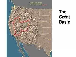
Study Area - Southern NV Seismic Stations in Las Vegas Valley Southern NV, NTS & Las Vegas Stations (triangles) Explosions (stars) & Earthquakes (circles) Basin depth from Langenheim et al. (2001) Southern Great Basin & Las Vegas
We have legacy ground motion recordings in Las Vegas from NTS explosions Pahute Mesa Yucca Flat 13 NTS explosions (1968-1989) 33 Sites in Las Vegas NTS ~ 110 km ~ 180 km Las Vegas Valley Data was painstakingly converted from analog FM tapes to digital form Southern Great Basin & Las Vegas
Amplification where basin deepest, spatial coverage of data is limited. Barnwell ground motions 0.2-1 Hz Basin depth from Langenheim et al. (2001) Southern Great Basin & Las Vegas
SSR amplifications are large BLUME-NTS Average SSR (solid) w/ error HVR (dotted) Southern Great Basin & Las Vegas
Site response shows strong variation within Las Vegas Valley Highest Frequencies • Amplifications strongest 0.4-2.0 Hz • Amplifications strongest in the central basin • Amplifications approach 10! Lowest Frequencies Southern Great Basin & Las Vegas
We want(ed) to predict ground motions of future events • Empirical data is limited • Spatial coverage • Covers downtown well • But not recently developed areas • Coverage poor in the north where amplification is high • Frequency content (band-width) • Legacy NTS ground motion data valid 0.2-5.0 Hz • 3D modeling can address these limitations • Spatial coverage limited by model coverage • Low-frequencies can be easily modeled Southern Great Basin & Las Vegas
3D Model of Southern Nevada and Las Vegas We built a 3D model of Las Vegas and southern NV, including NTS & Yucca Mountain. Basin structure (except Las Vegas) are taken from a regional compilation by the USGS. Yucca Mtn Little Skull Mtn Las Vegas Southern Great Basin & Las Vegas
3D modeling using Model Assembler model and Shawn Larsen’s E3D code Using early version of MA model (presented at AGU, 2002) Note shaking in basins … Southern Great Basin & Las Vegas
3D Simulation of Explosion Using John Louie’s Model Assembler Barnwell Las Vegas Valley Southern Great Basin & Las Vegas
LLNL (Jeff Wagoner) has developed EarthVision geologic models • NPE Project • Detailed model of NPE shot-point • Great Basin regional model • Other projects could benefit from existing EarthVision models • LLNL WPP code reads etree models in parallel • EarthVision-to-Etree tool makes models more accessible Southern Great Basin & Las Vegas
Geologic structure in Las Vegas from well-log interpretations Work of Wanda Taylor (UNLV) and Jeff Wagoner (LLNL). Need relationships between lithology and vP, vS and . Southern Great Basin & Las Vegas
NPE - Improved Phenomenology of Underground Nuclear Explosions Modeling with E3D improves understanding of seismic waves generated by underground explosions in the presence of complex topography and geology. Non-Proliferation Experiment Sept. 22, 1993 provides excellent data set. Detailed model of NTS based on geology and high-resolution geophysical data. Southern Great Basin & Las Vegas
Regional Great Basin model Covers regional observations of NPE. Target h=60 m. Southern Great Basin & Las Vegas
NTS shot-point model Southern Great Basin & Las Vegas
EarthVision to Etree Capability Lithologic index P-wave velocity Southern Great Basin & Las Vegas
USGS Model Represented As An Octant Tree Or “Etree” 2D example Allows variable and hierarchical resolution. For seismic velocity models fine resolution near surface, coarser with at depth. Southern Great Basin & Las Vegas
WPP - anelastic wave propagation code • Elastic and anelastic finite difference code • 2nd order, node centered formulation • Written in C++/C • Runs on Linux workstations/clusters & Mac OSX • Born parallel (uses mpich) • But can run on single processor • Available for download • http://www.llnl.gov/CASC/serpentine/software.html • ~50 page user’s guide & example input files Southern Great Basin & Las Vegas
WPP Current Features (version 1.1) • 3D P- and S-wave velocity and density models • Block, vfile (binary raster) and etree models • Purely elastic (no attenuation) • Handles acoustic case, where =0 • Absorbing (Clayton and Enquist) boundary conditions • Free surface boundary conditions • Models arbitrary number of sources • Point moment tensor & force, many source-time (moment) functions • Output • Writes time-series of motion as SAC files and 2D and 3D images • Mesh refinement • Coming soon • Free surface topography and embedded boundaries Southern Great Basin & Las Vegas