Download
1 / 24
240 likes | 405 Vues
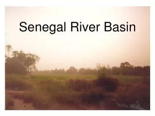
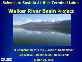
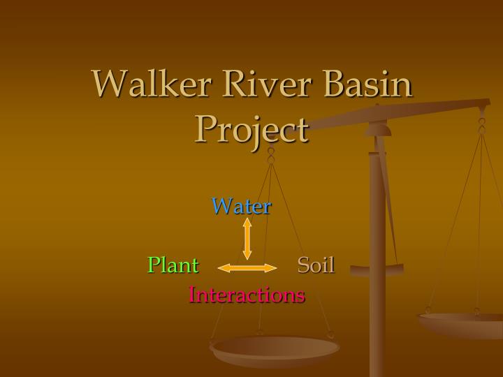
Walker River Basin Project. Water Plant Soil Interactions. Alternative Agriculture What are the agricultural practices and cost/benefits associated with alternative low water use crops? What are the best species and methods for native habitat restoration?.

E N D
Walker River Basin Project Water PlantSoil Interactions
Alternative Agriculture What are the agricultural practices and cost/benefits associated with alternative low water use crops? What are the best species and methods for native habitat restoration? Plant, Soil & Water Interactions (PSW) How do different agricultural and restoration practices affect PSW interactions? Do changes in site-specific interactions affect other ecosystems adjacent the Walker River? Integrated Components
Monitor Soil erosion Salinity / salt profile Soil nutrient input & output Soil organic matter Soil moisture Soil temperature Invasive species along Walker River Groundwater nutrient input & output Native plant varieties along Walker River Evapotranspiration and crop production functions Objectives How do we answer these questions???
Objectives • ULTIMATE GOAL!!! • Combine data collected into a model • Ask model which land is best suited for alternative agricultural or restoration practices. Best Land for Change
Agricultural Treatments • Alternative Low Water Use Crops • 15 vegetation types (alternative grains and potential bio-fuels) • 4 water treatments (50%, 75%, & 100%) • Native Revegetation/Restoration • 10 vegetation types (native grasses and shrubs) • 2 water treatments (0% & 25%)
Site Locations • Flood Irrigation Site • Wildlife Management Sites • Well Site
Site Locations • 5C Cottonwood – Vacant Lot • Ranch Sites • Valley Vista – Alfalfa Field
Site Locations • Walker River Riparian Habitat: • One site located in Wildlife Management Area
Where we are today. • Cool and warm season crops and native plants have been seeded • Have begun irrigation and weed control management
Monitoring • Soil Erosion: Dust Collectors • Installed Spring 2008 • Collect from 4 heights • 4”, 15”, 25”, & 41”
Monitoring • Soil Salinity & Nutrients • Soil Sampling • Agricultural Sites • Collected ~1300 soil samples • Riparian Site • 42 soil samples • Sample Depths • 0-6”, 6-12”, 12-24”, 24-36”, 36-48”, & 48-60” • Running soil water extracts through Ion Chromatograph to analyze for common nutrients • N, P, K, S, Ca, Mg, Na • Rings installed for monitoring nutrient movement in gas form • Initial CO2 readings taken
Monitoring • Soil Organic Matter • Surface soils tested for percent loss on combustion of organic matter • Soil Moisture • Samples taken pre- and post-irrigation to monitor water movement through soil • Sample 4 depths: 0-6”, 6-12”, 12-24”, & 24-36” • Invasive Species and Plant Varieties: • Vegetation surveys are ongoing
Monitoring • Soil Temperature: Fiber optic cable • Installed Dec. 2007 • Valley View Ranch & Wildlife Management Well Sites
Monitoring • Groundwater Nutrients: • Installed 7 shallow groundwater wells which are sampled regularly • Installed 6 bore holes to measure denitrification
Baseline data are being processed! • Valley View Ranch Site • Texture: Loamy Sand • Infiltration Capacity: 7.0 ± 2.4 in/hr • Bulk Density: 1.40 ± 0.12 g/cm3 • Sodium Adsorption Ratio (SAR): 1.24 ± 0.38 • May be phosphorus (P) limited as detectable P is variable • Soil wets down 2-3 feet, and significant increase in soil moisture is still seen 24 hours after irrigation.
Baseline Data • 5C Ranch Site • Texture: Sand • Infiltration Capacity: 4.0 ± 1.9 in/hr • Bulk Density: 1.34 ± 0.17 g/cm3 • SAR: 2.21 ± 7.91 • Does not retain soil moisture – have found no significant difference in moisture content of non-irrigated and irrigated plots within 24 hours of irrigation.
Baseline Data • Wildlife Management Well Site • Texture: Silty Clay Loam • Infiltration Capacity: 3.2 ± 1.5 in/hr • Bulk Density: 1.07 ± 0.07 g/cm3 • SAR: Pending… • Soil wets down 2-3 feet, and significant increase in soil moisture is still seen 1 week after irrigation.
Baseline Data • Wildlife Management Flood Site • Texture: Silty Clay Loam • Infiltration Capacity: 3.4 ± 1.4 in/hr • Bulk Density: 1.18 ± 0.05 g/cm3 • SAR: 29.35 ± 22.37 …Sodic Soil! • May be P limited as there is no detectable P • Soil wets down only within first 6 inches, but significant increase in soil moisture is still seen 1 week after irrigation.
Still to Come! • More nutrient description and moisture profile analysis as sites change with vegetation growth • Water table monitoring in wildlife management sites • Results from ongoing studies • Dust collection • Nutrient gas input/output • Groundwater nutrients • Soil temperature relative to soil moisture • Soil organic matter • Vegetative surveys