Download
1 / 40
430 likes | 691 Vues
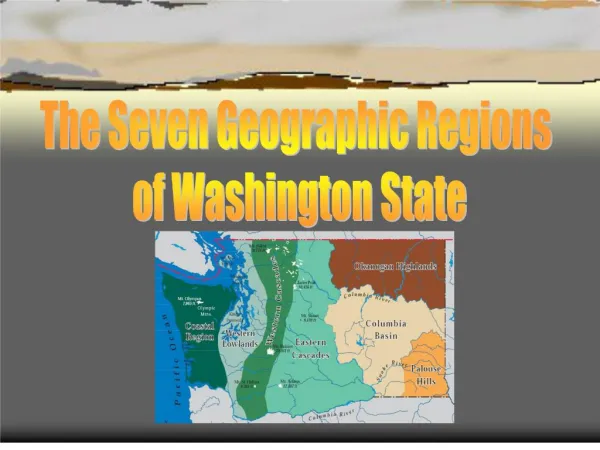
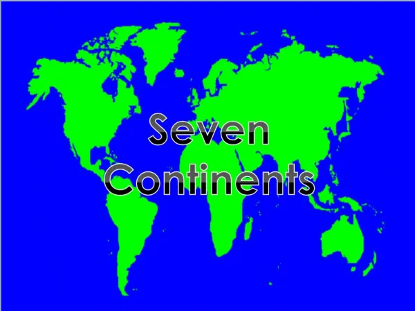
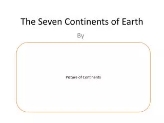
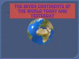
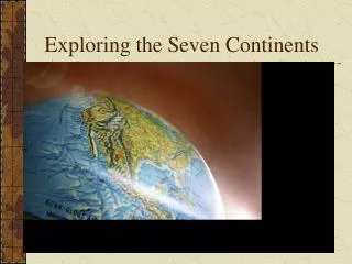
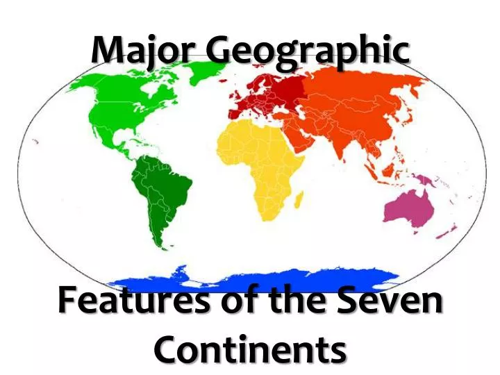
Major Geographic Features of the Seven Continents. Social Studies for Sixth Grade

E N D
Social Studies for Sixth Grade This lesson will be about major geographical features on all seven of the continents. The students will know about and be able to identify the seven continents and various major geographic features the continents are known for. In the following slide the students can click on any of the seven continents and it will display a map of the continent and the geographic locations they will need to be able to identify. They can then click on those locations for further information about the region. There will be a short quiz at the end of the presentation.
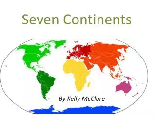
CLICK ON ONE OF THE EARTHS SEVEN CONTINENTS… Europe North America Asia Africa South America Oceania Antarctica CLICK HERE TO TAKE A SHORT QUIZ WHEN YOU ARE FINISHED
Locate and click on the links for the following locations: • Alaska Range • Rocky Mountains • Appalachian Mountains • Great Lakes • Mississippi/Missouri River • Rio Grande River • St. Lawrence River CLICK HERE TO RETURN TO THE SEVEN CONTINENTS
Alaska Range Mountains that are located in south-central Alaska. The highest peak in North America is located here, Mt. McKinley at 20,320 feet. CLICK HERE TO RETURN TO NORTH AMERICA
The Rocky Mountains The mountains are 3,000 miles in length and extend all the way from the U.S. state of New Mexico all the way up through the western part of the United States clear into the northernmost part of Canada’s British Columbia. CLICK HERE TO RETURN TO NORTH AMERICA
Appalachian Mountains About 1,500 miles in length expanding from the center of the U.S. state of Alabama through the eastern part of the U.S. all the way into the Canadian provinces of Newfoundland, New Brunswick, and Quebec. CLICK HERE TO RETURN TO NORTH AMERICA
The Great Lakes The largest lake group in the world contains five fresh water lakes. Lake Huron, Ontario, Michigan, Erie, and Superior cover an are of 95,000 square miles. CLICK HERE TO RETURN TO NORTH AMERICA
CLICK HERE TO RETURN TO NORTH AMERICA Mississippi/ Missouri Rivers The Mississippi is the major river in North America and is 2,339 miles in length. The river runs from northwestern Minnesota all the way to the Gulf of Mexico, just below New Orleans. The Missouri is the longest river in the United States with a length of 2,500 miles. The river runs from southern Montana in the Rocky Mountains to the state of Missouri where it meets the Mississippi River.
Rio Grande River The river runs from southern Colorado southeast to the Gulf of Mexico and forms the natural border between Texas and Mexico. CLICK HERE TO RETURN TO NORTH AMERICA
St. Lawrence River One of the most important shipping routes in the world, the St. Lawrence connects the Atlantic Ocean and the Great Lakes. It contains man-made canals to allow the deep-water ships passage. CLICK HERE TO RETURN TO NORTH AMERICA
Locate and click on the links for the following locations: • Andes Mountains • Amazon Basin • CLICK HERE TO RETURN TO MAP OF THE SEVEN CONTINENTS
The Andes Mountains The Andes Mountains are 4,500 miles in length, spanning the entire western coast of South America. Some of the earths largest volcanoes are located in the Andes. CLICK HERE TO RETURN TO SOUTH AMERICA
Amazon Basin This region is covered by the largest tropical rain forest in the world and covers 1/3 of South America. The Amazon River and its more than 1,000 tributaries run throughout the area. CLICK HERE TO RETURN TO SOUTH AMERICA
LOCATE AND CLICK ON THE LINKS OF THE FOLLOWING LOCATIONS: • Ural Mountains • Alps • Balkan Mountains CLICK HERE TO RETURN TO THE MAP OF THE SEVEN CONTINENTS
Ural Mountains The Ural Mountains form the natural border between Europe and Asia. CLICK HERE TO RETURN TO EUROPE
Alps The Alps are known for glaciers, lakes, valleys, and the best skiing conditions in the world. The Alps are source of many major rivers of the region including the Danube River. CLICK HERE TO RETURN TO EUROPE
Balkan Mountains The Balkan Mountains are most famous for Mt. Olympus, the highest peak in all of Greece. It was the mythical home for the Greek God Zeus in ancient times. CLICK HERE TO RETURN TO EUROPE
The planet’s largest continent covers 30% of the Earth’s surface and has 3 political divisions; The Middle East, Southeast Asia, and North Asia CLICK HERE TO RETURN TO SEVEN CONTINENTS
Locate the Euphrates, Tigris, and Indus Rivers. CLICK HERE TO RETURN TO ASIA
Mt. Everest, the world’s tallest mountain, is located in the Himalayan Mounains in Southeast Asia. Mt. Everest is 29,035 feet tall. CLICK HERE TO RETURN TO ASIA
North Asia is where the world’s largest country, Russia, and the world’s most populated country, China, are located. CLICK HERE TO RETURN TO ASIA
Locate and click on the links for the following locations: • Sahara Desert • Kalahari Desert • Congo River Basin • Nile River CLICK HERE TO RETURN TO THE SEVEN CONTINENTS
The Sahara Desert The Sahara covers almost 1/3 of Africa and is the largest desert in the world being approximately 3.5 million square miles in size. CLICK HERE TO RETURN TO AFRICA
The Kalahari Desert The desert is located at the southern tip of Africa. CLICK HERE TO RETURN TO AFRICA
Congo River Basin The Congo River Basin is about 1.4 square miles in size and almost 20% of the world’s rain forest is located there. The Congo River, pictured below, is the second longest river in Africa. CLICK HERE TO RETURN TO AFRICA
The Nile River The longest river in the world at about 4,160 miles in length and consists of dams, rapids, streams, swamps, tributaries, and waterfalls. CLICK HERE TO RETURN TO AFRICA
Locate and click on the links for the following locations: • Australia • Micronesia • Melanesia • Polynesia CLICK HERE TO RETURN TO THE SEVEN CONTINENTS
Australia The continent of Oceania used to be called Australia but the name was changed to refer to Australia, New Zealand, Papua New Guinea, and thousands of islands. It is the largest country in Oceania and known for its Great Barrier Reef, pictured here. CLICK HERE TO RETURN TO OCEANIA
Micronesia Also known as the small islands. (remember: micro means small) CLICK HERE TO RETURN TO OCEANIA
Melanesia Pictured here is the independent country of Vanuatu located in Melanesia. CLICK HERE TO RETURN TO OCEANIA
Polynesia Also known as many islands. (remember: “Poly” means many) Pictured here is Bora Bora part of the French Polynesia. CLICK HERE TO RETURN TO OCEANIA
Antarctica The continent is almost 98% solid ice and is the coldest, windiest spot on the planet. Officially the population is none but tourists visit the region and governmental research stations exist there. • Be able to locate the South Pole and the Antarctic Circle. • The Antarctic Circle marks the northern limit of the area where one day or more each year the sun does not set or rise. • The South Pole is the most southern point on the Earth’s surface and where Earth rotates on its axis. CLICK HERE TO RETURN TO THE SEVEN CONTINENTS
CLICK ON YOUR ANSWERS FOR THE FOLLOWING QUESTIONS • The Rocky and Appalachian Mountains are found on which continent. • a. Europe • b. Africa • c. North America • d. South America • The Ural Mountains form the Natural border between which two continents. • North America and South America • Europe and Asia • Europe and Africa • Africa and Asia The southern most point of the Earth is located in which continent. a. Africa b. Oceania c. Antarctica d. South America Mt. Everest, the world’s tallest mountain is located in which continent. a. North America b. Europe c. South America d. Asia Click here when you are finishedanswering the questions
GREAT JOB!!!!! You Were Correct! CLICK HERE TO ANSWER THE NEXT QUESTION
The correct answer is North America. CLICK HERE TO ANSWER THE NEXT QUESTION
The correct answer is Europe and Asia CLICK HERE TO ANSWER THE NEXT QUESTION
The correct answer is Antarctica. CLICK HERE TO ANSWER THE NEXT QUESTION
The correct answer is Asia CLICK HERE
Works Cited www.worldatlas.com http://image.guardian.co.uk/sys-images/Arts/Arts_/Pictures/2007/08/06/mountmckinley460.jpg http://www.marietta.edu/~biol/biomes/images/alpine/mtopview.jpg http://www.wildearthguardians.org/Portals/0/images/photo_Rocky_Mountains_900x300.jpg http://www.coastwatch.msu.edu/images/GreatLakes1.jpg http://www.uplandtales.org/wp-content/uploads/2009/02/river.jpg http://anquetil.colorado.edu/~arlowry/RGR/riogrande.jpg http://www.fhwa.dot.gov/hfl/images/ralls_46.jpg http://volcanoes.usgs.gov/Imgs/Jpg/Ruiz/30410135_061_large.jpg http://www.coolmelbourne.org/images/amazon-river-brazil-rainforest.jpg http://www.historyforkids.org/scienceforkids/geology/platetectonics/pictures/urals.jpg http://citypictures.org/r-europe-148-france-218-alps-france-2493.htm http://www.toursonline.org/wp-content/uploads/2008/03/mount_olympus_3.jpg http://www.asiatravel.com.np/uploads/gallery/Nepal/MountEverest.jpg http://www.mccullagh.org/db9/1ds-4/sahara-desert-sand-dune.jpg http://www.humanitysteam.org/files/547436.jpg http://www.internationalrivers.org/files/images/CongoNasa.jpg http://lucialai.org/wp-content/uploads/2009/09/egypt_river_nile.jpg http://www.airah.org.au/AM/Images/Conferene_files/GBReef.jpg http://www.newisraelblog.org/wp-content/uploads/2010/03/Micronesia.jpg http://www.dorlingkindersley-uk.co.uk/static/html/features/where_to_go/images/06june/02_vanatu.jpg http://www.dorlingkindersley-uk.co.uk/static/html/features/where_to_go/images/06june/02_vanatu.jpg