Download
1 / 17
170 likes | 292 Vues
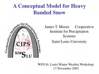
A light snow event: Feb 2-4, 2003. 2/3/03 – 6Z (midnight) Small storm passes to the SE, cold front to the NW. +. NWS Forecasts, 4am (9Z) Feb 4. BLACK HAWK-BREMER-GRUNDY-MARSHALL-STORY-TAMA- INCLUDING THE CITIES OF... AMES ...MARSHALLTOWN... WATERLOO/CEDAR FALLS 352 AM CST MON FEB 3 2003

E N D
2/3/03 – 6Z (midnight)Small storm passes to the SE, cold front to the NW +
NWS Forecasts, 4am (9Z) Feb 4 BLACK HAWK-BREMER-GRUNDY-MARSHALL-STORY-TAMA- INCLUDING THE CITIES OF...AMES...MARSHALLTOWN... WATERLOO/CEDAR FALLS 352 AM CST MON FEB 3 2003 ...WINTER WEATHER ADVISORY FOR THIS AFTERNOON AND THIS EVENING... .TODAY...CLOUDY WITH A CHANCE OF FREEZING DRIZZLE OR DRIZZLE THIS MORNING...THEN WIDESPREAD SNOW THIS AFTERNOON. ACCUMULATION 1 TO 2 INCHES. TURNING COLDER. BRISK. TEMPERATURES FALLING INTO THE UPPER 20S. NORTH WINDS 15 TO 25 MPH...GUSTING TO 30 MPH FROM LATE MORNING ON. CHANCE OF PRECIPITATION 80 PERCENT. .TONIGHT...WIDESPREAD SNOW EARLY...THEN PARTLY CLOUDY. ACCUMULATION 1 TO 3 INCHES.BRISK WITH BLOWING AND DRIFTING SNOW. LOW IN THE MID TEENS. NORTHWEST WINDS 15 TO 25 MPH...GUSTING TO 30 MPH. CHANCE OF SNOW 80 PERCENT. .TUESDAY...PARTLY SUNNY. HIGH NEAR 20. NORTHWEST WINDS 10 TO 20 MPH. DALLAS-MADISON-POLK-WARREN- INCLUDING THE CITIES OF...DES MOINES...INDIANOLA 352 AM CST MON FEB 3 2003 ...WINTER WEATHER ADVISORY FOR THIS AFTERNOON AND THIS EVENING... .TODAY...CLOUDY WITH A CHANCE OF FREEZING DRIZZLE OR DRIZZLE THIS MORNING...THEN WIDESPREAD SNOW THIS AFTERNOON. ACCUMULATION 1 TO 2 INCHES. TURNING COLDER. WINDY. TEMPERATURES FALLING INTO THE UPPER 20S. NORTH WINDS 15 TO 25 MPH...GUSTING TO 35 MPH FROM LATE MORNING ON. CHANCE OF PRECIPITATION 80 PERCENT. .TONIGHT...WIDESPREAD SNOW EARLY...THEN MOSTLY CLOUDY WITH SCATTERED FLURRIES FROM LATE EVENING ON. TOTAL ACCUMULATION...1 TO 3 INCHES. BRISK WITH BLOWING AND DRIFTING SNOW. LOW IN THE MID TEENS. NORTHWEST WINDS 15 TO 25 MPH...GUSTING TO 30 MPH. CHANCE OF SNOW 80 PERCENT. .TUESDAY...PARTLY SUNNY. HIGH IN THE LOWER 20S. NORTHWEST WINDS 10 TO 20 MPH.
RWFS – predicted storm totals Snowfall (inches) QPF (inches)
PRETREAT w/110 brine– 17Z (11am) Forecast at Ames (reprocessed)
PRETREAT w/110 brine – 17Z (11am) Forecast at Des Moines (rep.)
The event – 2/3/03, 12-15Z + AMW: 1oC, OVC DSM: 2oC, OVC + AMW: 1oC, OVC DSM: 1oC, OVC
The event – 2/3/03, 18-21Z + AMW: 1oC, OVC DSM: 1oC, OVC + AMW: -2oC, +SN DSM: -1oC, SN
The event – 2/4/03, 0-3Z + AMW: -5oC, BLSN DSM: -5oC, BLSN + AMW: -9oC, “UP” DSM: -8oC, BLSN
Temperature forecast: Ames 6am mid 6pm noon 6pm noon
Treatment comparison: Ames noon 6am 6pm noon mid 6am
Temperature forecast: Des Moines 6am mid 6pm noon 6pm noon
Treatment comparison: Des Moines noon 6am 6pm noon mid 6am
Light Event Summary • RWFS forecast • Temperature: Fine during event, rapid cooling after SN • Precipitation: location, timing, amount, type • All reasonable • Treatment • Reasonable given forecast • Matched reality well, except for… • Late plowing & salting due to roads icing over & BLSN • Lessons • Use a “whole storm” perspective for rec. treatments • Method to handle or alert for blowing snow treatments • Wind speed, direction – local knowledge is key for treatment