Download
1 / 21
220 likes | 329 Vues
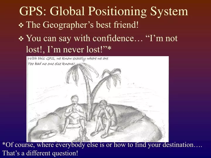
GPS: Global Positioning System. The Geographer’s best friend! You can say with confidence… “I’m not lost!, I’m never lost!”*. *Of course, where everybody else is or how to find your destination…. That’s a different question!.

E N D
GPS: Global Positioning System • The Geographer’s best friend! • You can say with confidence… “I’m not lost!, I’m never lost!”* *Of course, where everybody else is or how to find your destination…. That’s a different question!
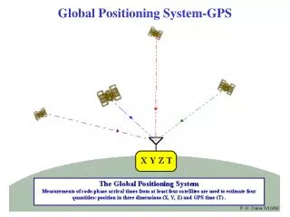
For all the ‘high tech’ involved the concept for the system is actually quite simple…. • A network of 24 Satellites in geosynchronous orbit • Each Satellite has an extremely accurate atomic clock and a radio transmitter with a unique frequency • The GPS receiver also has a highly accurate clock and the ability to receive radio signals from multiple satellites at the same time.
Each Satellite constantly broadcasts the time and every 30 min or so it also broadcasts an ephemeris which is the projected location of all satellites in the constellation. The satellite broadcasts the time, the receiver compares the time from the satellite to its internal clock… even at the speed of EMR propagation there is a slight delay… this delay provides a distance to each satellite.
GPS Mapping… accuracy Information in these notes is taken from: GPS Receiver Accuracy by C.J. Hoare, GlobeStar Positioning Services Inc. http://www.gpsnuts.com/myGPS/GPS/Technical/gps_receiver_accuracy_by_c.htm
The GPS receiver determines its position by being able to calculate its distance from several simultaneously observed satellites. • The distance is calculated by measuring the time shift in the transmitted time as reported by the satellite with the code at receive time
In order to function the GPS receiver has to: • know where each satellite was when the measurement code signal was dispatched (from the broadcast ephemeris) • be able to match its own clock to GPS time to know the time difference between the instant the signal started and the instant it was received.
Sources of error: • satellites are not quite where they say they are • transmitted signals are delayed • timing corrections are faulty • receiver has excessive measurement noise • available satellites are in a poor configuration
minimum error in practical terms +- 15 meters (45 feet) FAA performance test of the GPS and Glonass (Russian) systems: • fixed locations, the antennas were not moving past obstacles or under trees, so they represent ‘ideal’ figures • average accuracy from their monitor stations varied from 5 to 6 meters. • The maximum horizontal errors measured at the nine stations ranged from 16.8 to 22.1 meters.
GPS satellites are monitored by ground stations (US Space Command, Falcon AFB) • orbital parameters are calculated by comparing their pseudoranges to known tracking station locations. • a prediction of each satellite's future orbit parameters is produced and predicted location is information fed to each satellite. • However, even a nanosecond multiplied by the speed of light is about 0.3 meters
Both the ionosphere and troposphere affect the speed at which the signals travel. • Atmospheric errors are minimized for satellites near zenith and greatest for satellites near the horizon • many receivers allow the user to set elevation cut-off. • Maximum error occurs near dawn and dusk when the ionospheric changes are greatest.
Individual receivers vary in the amount of ‘noise’ they produce … noise produces error in the internal clock.Again… a nanosecond (A nanosecond (ns or nsec) is one billionth (10-9) of a second ) = .3 meters of error
The configuration of the satellite constellation can result in either a strong or a weak position solution. This is called DOP, Dilution of Precision • HDOP for horizontal, • VDOP for vertical, • PDOP for position • generally discard positions produced with a PDOP higher than 7
There is no "carry-over" from one fix to the next, so there may be norelationship between them • maps produced with a single GPS receiver can have large distortions - unless the area mapped is very large in comparison to the probable errors.
Multipathing: signals are split into two or more paths by reflection or refraction • Signals can reflect off a metal building, a tree, or almost anything (chain link fences are supposed to be very effective at splitting the incoming GPS signal) • Multiple signals produce wide variations in positional fixes.
Selective Availability (SA) • The intentional scrambling of time codes to insure that no instantaneous GPS reading would be more accurate than 100 meters. • According to several sources, the 100 meter threshold was defined by the resistance of the blast doors of an ICBM silo….. • SA was turned off during the Gulf War (1991) • SA was turned off permanently by executive order in 1999
Getting more accurate readings: • Differential Correction of GPS (DGPS) • Wide Area Augmentation System (WAAS)
Differential Correction • GPS readings are collected at a base station, with known coordinates. The variation between the ‘known’ coordinates and the instantaneous readings are used to correct the data on the roving unit. • Can be post processed or real time… RTK (real time kinematic correction)
Averaging: by taking an average of points the overall accuracy can be improved dramatically. • The USFS has determined that 50-60 instantaneous reading when averaged will produce accuracy of 3-5 meters.
Carrier Phase GPS • Units of this type use the waveform itself and measurements are carried out on the high frequency carrier wave and can achieve accuracy within millimeters.