Download
1 / 22
220 likes | 363 Vues
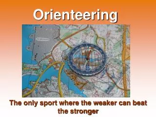
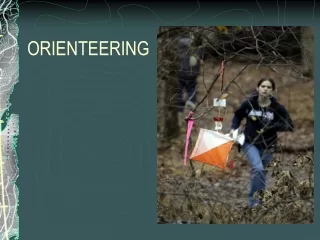
Tracking in orienteering. Trends in sport. to be media-friendly , to change the rules to make the sport simpler, more visible for the audience , to be attractive and interesting , not only sport, but a business, too. Are there tracking in other sports?. Paris-Dakar (where are the cars?)

E N D
Trackingin orienteering O-Map Seminar, Curitiba, Brazil, October-November 2006 Instructors: László Zentai (HUN), Flemming Hjorth Jensen (DEN)
O-Map Seminar, Curitiba, Brazil, October-November 2006 Instructors: László Zentai (HUN), Flemming Hjorth Jensen (DEN)
Trends in sport to be media-friendly, to change the rules to make the sport simpler, more visible for the audience, to be attractive and interesting, not only sport, but a business, too. O-Map Seminar, Curitiba, Brazil, October-November 2006 Instructors: László Zentai (HUN), Flemming Hjorth Jensen (DEN)
Are there tracking in other sports? Paris-Dakar (where are the cars?) Vendée Globe (A sailing race around the world, for singlehanders, without any stopover – where are the sailboats?) O-Map Seminar, Curitiba, Brazil, October-November 2006 Instructors: László Zentai (HUN), Flemming Hjorth Jensen (DEN)
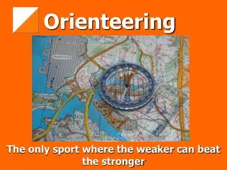
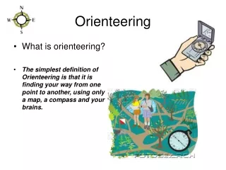
Specialities of orienteering sport Orienteering has never been popular in most countries (except Scandinavia) and it is not present in television. Orienteering events mostly take place in forest areas. One of the key elements of orienteering sport is a route choice: the shortest way in time between two control points depends on different factors. The competition map and course is secret before the event. If we give an on-line broadcast we had to have extra effort to avoid unwanted information handover to the competitors. Orienteering maps are very special products; they are interesting and legible only for the “experts” (competitors, fans). O-Map Seminar, Curitiba, Brazil, October-November 2006 Instructors: László Zentai (HUN), Flemming Hjorth Jensen (DEN)
Tracing the route Techniques to track a route in real time are available. In a vehicle, tracing software can help to adjust the position to the road network. On an orienteering event the competitors can run everywhere, so we cannot use any software for adjusting the position. But we have additional problems to solve: How can we get GPS signals on steep slopes in the forest, where the receiver cannot see enough satellites? How can we send back the competitor’s position if there is no reliable GSM coverage in the area? O-Map Seminar, Curitiba, Brazil, October-November 2006 Instructors: László Zentai (HUN), Flemming Hjorth Jensen (DEN)
World Orienteering Championships 2001(Tampere, Finland) – a case study Finland promised to have a competitor tracking system in the WOC 2001 events, when Tampere applied to become the WOC 2001 organizer. The promise given to the International Orienteering Federation in 1996 stated that: The tracking system will be satellite based. Competitor equipment will weight less than 250 g. Accuracy of the system will be better or equal to 10 meters (comparable to the orienteering map). Tracking data will be available real-time in TV broadcasting. O-Map Seminar, Curitiba, Brazil, October-November 2006 Instructors: László Zentai (HUN), Flemming Hjorth Jensen (DEN)
The goal of the tracking project was for the first time in orienteering sport to have GPS based tracking of competitors in live TV broadcasting Benefon is a Finnish mobile phone manufacturer, who has special products where the GPS receivers are integrated into a mobile phone. The responsibility of Benefon was to develop and provide the required amount of suitable devices with all the required special accessories for the event (vest, mobile device). Novo Group is a Finnish IT company. Their responsibility as the system integrator was to develop and operate the tracking system. Sonera is a Finnish telecom operator. They were responsible for providing required network coverage and capacity for transferring the location data from orienteers to the network. O-Map Seminar, Curitiba, Brazil, October-November 2006 Instructors: László Zentai (HUN), Flemming Hjorth Jensen (DEN)
The basic operation O-Map Seminar, Curitiba, Brazil, October-November 2006 Instructors: László Zentai (HUN), Flemming Hjorth Jensen (DEN)
Plan of the basic operation 1.The Benefon Track GSM received signal from GPS satellites and determined the position of the competitor every second. 2.The position was sent in every 20 seconds as an SMS via special network. 3.A server connected to the short message centre received the position and stored it in a special database. 4.According to the instructions from the TV director, predefined parts of the map with selected competitor(s) were to be retrieved and their route drawn with special software as a still image including the competitor names. 5.The image was transferred into the system to be seen by the TV director and being available for live broadcasting 15 seconds behind the real situation (nearly real-time) on average. O-Map Seminar, Curitiba, Brazil, October-November 2006 Instructors: László Zentai (HUN), Flemming Hjorth Jensen (DEN)
What was realized during the event? The amount of captured tracking routes was less than expected by the experts. The main reason for this was the GPS geometry during the competition. The still image generation for TV picture in the software became slower when the amount of data increased in the systems database due to a software design error. The used technology led to a system that was not as much a real-time system as the TV director had wished. The tracking system did not show any dramatic mistakes of competitors in TV. The main reason for this was not a bad working system, but rather that there were very few mistakes and different route choices made by the top runners. It was a successful project. O-Map Seminar, Curitiba, Brazil, October-November 2006 Instructors: László Zentai (HUN), Flemming Hjorth Jensen (DEN)
Experiences The collaborating partners must have a real incentive to participate and they have to be experienced. TV is a very demanding channel and requires a large amount of preparations. GPS is tricky. Dealing with GPS requires expert knowledge of its behaviour. The theory is relatively simple, but practically it is hard to manage and estimate. Understanding project timing. WOC competitions are organized mostly by volunteers, and not by full-time employers. O-Map Seminar, Curitiba, Brazil, October-November 2006 Instructors: László Zentai (HUN), Flemming Hjorth Jensen (DEN)
Photos O-Map Seminar, Curitiba, Brazil, October-November 2006 Instructors: László Zentai (HUN), Flemming Hjorth Jensen (DEN)
Utilization of the experiences of WOC2001 The following World Championships were: Even the sport is popular and well developed in these countries it was not planned to use a tracking system: everybody thought that the use of these systems is very expensive compared to the value the organizers got. Switzerland (2003), Sweden (2004), Japan (2005). O-Map Seminar, Curitiba, Brazil, October-November 2006 Instructors: László Zentai (HUN), Flemming Hjorth Jensen (DEN)
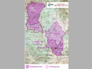
WOC2006, Denmark O-Map Seminar, Curitiba, Brazil, October-November 2006 Instructors: László Zentai (HUN), Flemming Hjorth Jensen (DEN)
Showing the orienteering map on the screen • To let the less trained spectators, televiewers enjoy (or even just understand) the broadcast. • There are too many details in orienteering maps: the spectators cannot interpret all details, so the transformed map must show clear and simplified alternatives. • The three dimensional representation can make the image more interesting, but it is more difficult to generate. • Orienteering maps are drawn by computer, but the most commonly used software does not support 3D representation, so special programming skills are required for these kinds of representations. O-Map Seminar, Curitiba, Brazil, October-November 2006 Instructors: László Zentai (HUN), Flemming Hjorth Jensen (DEN)
3D representation O-Map Seminar, Curitiba, Brazil, October-November 2006 Instructors: László Zentai (HUN), Flemming Hjorth Jensen (DEN)
3D representation The 3D terrain representation must be simplified and it is difficult to show the whole area on a screen. It is necessary to create different maps: • a most simplified one to help the general overview of the area (we can add virtual landscape features like trees, buildings, but it is not suitable to show the course); • less simplified ones to show only a part of a course (one-two legs with different route choices). O-Map Seminar, Curitiba, Brazil, October-November 2006 Instructors: László Zentai (HUN), Flemming Hjorth Jensen (DEN)
2D representation – simplified map O-Map Seminar, Curitiba, Brazil, October-November 2006 Instructors: László Zentai (HUN), Flemming Hjorth Jensen (DEN)
3D representation – simplified map O-Map Seminar, Curitiba, Brazil, October-November 2006 Instructors: László Zentai (HUN), Flemming Hjorth Jensen (DEN)
3D representation – simplified animation 2005 – Norway: Nordic Championships O-Map Seminar, Curitiba, Brazil, October-November 2006 Instructors: László Zentai (HUN), Flemming Hjorth Jensen (DEN)
Conclusions The availability of the technology is sometimes not enough: it must be less expensive; It must be easier to use. The efficient visualization of the orienteering event in an on-line broadcast requires time and skills – contradictory to the secrecy: this need even tends to alter the competition rules. This is not only sport, but a business, too. O-Map Seminar, Curitiba, Brazil, October-November 2006 Instructors: László Zentai (HUN), Flemming Hjorth Jensen (DEN)