Download
1 / 13
140 likes | 362 Vues
Groundwater Resources in the Llano Uplift Crystalline Massif Llano and Mason Counties, Texas Mishal Al- Johar November 24, 2009 CE 394K GIS in Water Resources. The Llano Uplift is characterized by GEOLOGY: Igneous and metamorphic crystalline granite, gneiss, and schist

E N D
Groundwater Resources in the Llano Uplift Crystalline Massif Llano and Mason Counties, Texas Mishal Al-JoharNovember 24, 2009 CE 394K GIS in Water Resources
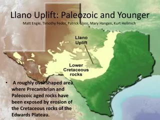
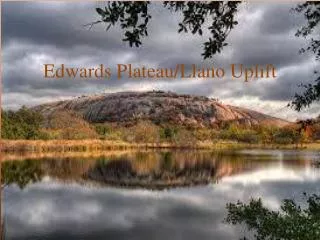
The Llano Uplift is characterized by GEOLOGY: Igneous and metamorphic crystalline granite, gneiss, and schist CLIMATE: Semi-arid LANDUSE: Rural ranch land SURFACE WATER: Several large, man-made reservoirs Smaller streams GROUNDWATER: Low porosity crystalline rocks Permeable zones occur in fractures Relatively low groundwater storage THE CRYSTALLINE MASSIFF IN THE LLANO UPLIFT IS NOT “OFFICIALLY” A MINOR AQUIFER DOES IT DESERVE TO BE?
Work completed so far: Geology (outcrops and faults) Potentiometric surface Some water quality Work to be done: Fracture trends from aerial photos More water quality Better water table map Surface water and precipitation