Download
1 / 28
280 likes | 395 Vues
Mobile Mapping with GPS and MapInfo (how we do it at Suquamish).

E N D
Mobile Mappingwith GPSand MapInfo(how we do it at Suquamish) Mobile Mapping – Suquamish Tribe
The Port Madison Indian Reservation:About 7,800 acres located across Puget Sound from Seattle. The Port Madison Indian Reservationwas set aside as part of the Point Elliott Treaty (1855) andenlarged by Executive Order in 1864.900 Tribal members total, about half living on the reservation.Total reservation population is about 7,000. Point Elliott Treaty document, dated 4 Nov 1886 Mobile Mapping – Suquamish Tribe
The Port Madison Indian Reservation W a s h i n g t o n S t a t e Mobile Mapping – Suquamish Tribe
The Port Madison Indian Reservation Kitsap County, Washington Mobile Mapping – Suquamish Tribe
GIS: Geographic Information System GPS: Global Positioning System Mobile Mapping – Suquamish Tribe
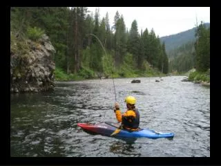
GPS is a useful tool to: * build new data in the GIS - in real time with a laptop - with just the GPS, download to PC in office * get the links needed to rubbersheet other imagery - scanned survey sheets - historical scanned maps * obtain precise location data for other projects - BLM GCDB (post-processed ‘accurate’ GPS) * real-time navigation - canoe journeys - fisheries on-the-water location work Mobile Mapping – Suquamish Tribe
If you already have a GPS, it costs you nothing (thank you, MapInfo Corp!) Plug your GPS cable into your PC; in GPS setup, choose NMEA (any version), 9600 baud, then ON (each GPS will be slightly different; 9600 baud for smoother tracking, especially in a vehicle) In MapInfo, Tools/Tool Manager, load the free Blue Marble Geotracker utility. Mobile Mapping – Suquamish Tribe
In GeoTracker, make your settings consistent with the GPS Mobile Mapping – Suquamish Tribe
Go to GPS/Live GPS Data and you should see yourself onscreen Pretty amazing - and it’s free! Mobile Mapping – Suquamish Tribe
We use a table specifically created for the purpose of data collection with GPS, pre-built with fields in place to hold GPS data. You don’t have to do that, but it allows you to filter out lesser-quality GPS data, and ‘time-stamp’ your data (for legal use later). Mobile Mapping – Suquamish Tribe
Build new data in the GIS - in real time with a laptop Using MapInfo with BlueMarble GeoTracker utility (free, included with MapInfo). Advantages: * QC your data visually during collection * Annotate features easily with full keyboard * Your database/table is DONE by the time you take the truck out of 4WD Mapping recently (and barely) opened logging roads a.k.a. ‘driveby GIS’ Mobile Mapping – Suquamish Tribe
(data collected using GPS with MapInfo and GeoTracker) Mobile Mapping – Suquamish Tribe
Documenting solid waste Infractions using the ‘driveby GPS’ method Mobile Mapping – Suquamish Tribe
How we used to do it, with a laptop, GPS, external amplified antenna, Differential Beacon Receiver (DBR) and 12v battery, all spaghetti-wired together. Now: laptop with Ashtech ProMark2 with WAAS (Hand-me-down P2-600 laptop works great with MapInfo Pro) Mobile Mapping – Suquamish Tribe
Laptops are fragile - one bad step and it’s gone (been there, done that) Laptops are big and bulky (need a lapboard or somesuch, and it’s clunky) Laptop batteries don’t last long enough (carry two - at $100-150 each) Laptop displays are difficult to read in bright daylight (a hood helps, but gets in the way) Laptops are expensive (can find them for ~$700, TabletPC $1,800-2,500) Fieldwork will damage the laptop over time (start with a used one with little residual value, and consider a three-year lifespan exceptional) Mobile Mapping – Suquamish Tribe
A Possible Next Step Pocket PC’s look ideal Smartphone best of all possible worlds? All in one Genuinely ruggedized unit like a Trimble GeoXT or Recon is VERY expensive OS seems also to be in flux (currently Windows Mobile 2003, soon updated) Battery run-time and daylight screen readability are issues for all solutions. Laptop - about $800 (without GPS) Handheld - about $500 (without GPS) GeoXT - about $3,000 Recon - about $6,000 Mobile Mapping – Suquamish Tribe
You’ll need to add to your Pocket PC: Memory - 1gb SD cards cost about $100, 2gb about $200 (very new) Bluetooth GPS (more on that) ($200) Software (also more on that) OtterCase to protect the delicate little thing ($50) or a drybag: ($30) Mobile Mapping – Suquamish Tribe
So let’s do some math: Laptop: $800 Software: $0 (use MapInfo and GeoTracker) Hood: $30 Lapboard: $50 (optional) GPS: $200 (Bluetooth wireless SiRF3) USB/Bluetooth: $30 (for non-Bluetooth laptop) TOTAL: $1,110 SmartPhone/PDA $500 (most powerful one you can get) 1gb SD card $100 ArcPad software: $500 GPS: $200 (Bluetooth wireless SiRF3) OtterCase(es): $70 TOTAL: $1,370 Surprised? Mobile Mapping – Suquamish Tribe
GPS - many improvements! Bluetooth - wireless connection so you can use the Pocket PC in it’s OtterBox ($50) and retain protection Waterproof the GPS with its own OtterBox ($20) Longer battery life these days (a full day plus on one charge) and best of all Much improved sensitivity for urban canyons and under trees (SiRF Star3 chipset devices) Track up to 20 satellites simultaneously so you never lose your location even when you drop multiple satellites All for about $200 - but no WAAS implementation yet (soon) Mobile Mapping – Suquamish Tribe
Software options and considerations: MapTech Outdoor Navigator - $20 http://www.maptech.com/products/outdoornavigator/index.cfm free unlimited download of USGS quads and NOAA nautical charts no easy data transfer ability, no ability to average points or filter for QC So - not much for GIS functionality but great fun and great value Mobile Mapping – Suquamish Tribe
Software options and considerations: OziExplorer - $85 + $30 for PocketPC functionality = $115 www.oziexplorer.com Geared for navigation, not GIS, but you can collect points and routes and transfer them to GIS via comma-delimited and DXF formats. World focused, so limited local projections available. Can scan your own map data, reads USGS, NOAA, MrSID, other formats. Enthusiastic developer, ‘screw it together’ sort of feel, but lots of features. Shareware. Mobile Mapping – Suquamish Tribe
Software options and considerations: Fugawi - $100 including PocketPC functionality www.fugawi.com (as in, “where the fugawi?”) Can export routes and points, but basically designed for navigation - not GIS Comes with a data DVD of streets, names, places … reads USGS and NOAA Good projection options - is GIS-aware, and can export SHP points/polylines Can read ChartTIFF (use Tony Cooley’s WIN2TAB.MBX in MI) and ECW Good choice for a hundred bucks, for light GIS data collection and vehicle nav. Mobile Mapping – Suquamish Tribe
Software options and considerations: TierraMapper - $100 from Geo-Information Solutions (Tucson, AZ) http://www.geoinfosol.com/PocketPC/TierraMapper/TierraMapper.html Designed for GIS data collection in Pocket Access format, and includes a tool for converting a MapInfo window to a TierraMapper-compatible file. Economical pricing and MapInfo compatibility make TierraMapper worth considering. However, no GPS controls to allow point averaging or PDOP masking for QC. Mobile Mapping – Suquamish Tribe
Software options and considerations: GBM Mobile - $500+ from Exa-Min Technologies (Australia) http://www.geobasemap.com/products/gbm_mobile.htm Designed for use with MapInfo, strong in forms creation and managing data return back into MapInfo, even with multiple field users of the same dataset. GPS integration built-in, but lacking control such as point averaging, PDOP mask. For serious GIS field data collection, especially with multiple field crews, this could be a very worthwhile product due to the data management controls. Mobile Mapping – Suquamish Tribe
Software options and considerations: ESRI ArcPad - $500 www.esri.com/arcpad True GIS functionality, good control of GPS (average points, limit bad PDOP, etc.) Have to chop your data on the PC, then tranfer to PPC - uses SHP format. If you’re doing real GIS work - this is probably your best choice. Can query parcels in the field and update databases, etc.- real GIS Mobile Mapping – Suquamish Tribe
Software options and considerations: If you do go with ArcPad, you might consider MI2AP from Avantra Geosystems Cost: about $500 http://www.avantra.com.au/mi2ap.htm MI2AP works from within MapInfo and converts an entire MapInfo Workspace into an ArcPad compatible map. Unlike the Universal Translator, the resulting Shape files retain their symbology (color, shape, symbol, etc.) reducing set up and configuration time significantly. MI2AP also provides for the creation of ArcPad forms from within MapInfo Professional. Employing forms for PDA based data collection and display greatly increases the efficiency of PDA based field data collection. When ArcPad v7 comes out in August, forms creation will be possible from the PC element rather than having to purchase the $1,000 ESRI development tool to do it. Mobile Mapping – Suquamish Tribe
Getting an accurate acreage for a local wildland fire by walking the perimeter with GPS Mobile Mapping – Suquamish Tribe
Questions? Mobile Mapping – Suquamish Tribe