Download

1 / 25
250 likes | 362 Vues
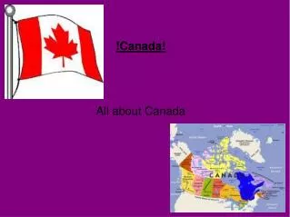
Oh…. Canada. Olga de la Cruz & Hugo Villabona. Coordinates. Capital: Ottawa 45°24′N 75°40′W *Since 1925, Canada has claimed the portion of the Arctic between 60°W and 141°W longitude, but this claim is not universally recognized. Days & Nights.

E N D
Oh… Canada Olga de la Cruz & Hugo Villabona
Coordinates Capital: Ottawa 45°24′N 75°40′W *Since 1925, Canada has claimed the portion of the Arctic between 60°W and 141°W longitude, but this claim is not universally recognized
Days & Nights • The longest day in Canada is June 21st because Canada is located in the Northern Hemisphere. This is known as the Summer Solstice. Thusly, this is the shortest night in Canada. • The shortest day in Canada usually falls on December 21st in the Northern Hemisphere because of the Winter Solstice. Hence being the longest night in the country. • All of Canada lies in the Northern Hemisphere causing the days and nights to be similar throughout.
Time Zones Tock Tick Tick Tock Canada uses six primary time zones. From east to west they are Newfoundland Time Zone, Atlantic Time Zone, Eastern Time, Central Time Zone, Mountain Time Zone, and the Pacific Time Zone. In Newfoundland the time zone is 3 hours + 30 minutes behind Greenwich Mean Time (GMT). The other time zones are in even-hours behind GMT, from East to West. The Pacific region is 8 hours behind GMT. (The GMT is also referred to as the time of the Prime Meridian) Note: In Canada, Time Zones and Daylight Saving Time are usually regulated by provincial and territorial governments. In reference to the International Date Line, the Newfoundland Time Zone is roughly 17 hours behind.
Canada Tropic of Cancer Equator Tropic of Capricorn South Pole North Pole
Minerals & Rocks Aluminum, Chrysotile, Coal, Copper, Gold, Lead, Nickel, Zinc, Silver, Potash, Diamonds, Molybdenum, Iron Ore, Limestone, Igneous Rocks, and Ice are all found in Canada
Plate tectonics and boundaries • Canada lies within the North American Plate. • Because of the movements between the North American Plate, Juan de Fuca Plate, Eurasian Plate, and the Pacific Plate Canada experiences earthquakes.
Large red triangles show volcanoes with known or inferred Holocene eruptions. Yellow triangles distinguish volcanoes of other regions. small red triangles mark volcanoes with possible, but uncertain Holocene eruptions or Pleistocene volcanoes with major thermal activity. Volcanoes Canada has examples of almost every type of volcano. Although none are erupting now, at least 3 did in the last few hundred years and numerous others have the potential to erupt in the near future. Other countries' volcanoes also can affect Canadians: eruptions in Alaska or along the west coast of the U.S.A. can impact agriculture and air travel across western Canada.
Mountain Ranges & Glaciers • In Canada, an estimated area of 200 000 square kilometers, or about 2% of the country’s area is covered by glaciers. • A huge quantity of freshwater is frozen in the polar ice caps and in high mountain glaciers. • At present there are no reliable figures on the total number of glaciers in Canada. • The vast majority of mountains in Canada lie in the western provinces of British Columbia, Alberta and the Yukon territory. • Mountains can be found all over British Columbia while those in Alberta are mainly concentrated on the eastern side of the Canadian Rockies. • The Saint Elias Mountains in the Yukon hold some of country's highest mountains, including the highest, Mount Logan at 5,959m.
Canada’s rivers are so vast that they are divided up into seven sub-groups that reference them with their drainage system. • These drainage groups include: • Pacific Ocean • Arctic Ocean • Hudson Bay • Atlantic Ocean • Gulf of Mexico Lakes & Rivers Canada has an extremely large number of lakes. The number of lakes larger than three square kilometers is estimated at close to 31,191 by the Atlas of Canada. There is no official estimate of the number of smaller lakes.
Atmospheric Pressure • The highest atmospheric pressure in Canada is found at the Atlantic Ocean 0m which reads 29.92 on the barometer • The lowest atmospheric pressure in Canada is found at Mount Logan 5,959m which reads 23.98 on the barometer The atmospheric pressure sure is low up here
Carbon Dioxide Emissions (CO2) * Million Metric Tons of Carbon Dioxide Since the year 1997 to the present Canada’s emissions of carbon dioxide have steadily increased. If the levels continue to rise, polar bears will not be able to sleep easily. The levels are not evenly distributed between the country and the cities; most of the emissions come from the cities.
Wind Patterns Between thirty and sixty degrees latitude, the winds that move toward the poles appear to curve to the east in the Northern Hemisphere. Because winds are named from the direction in which they originate, these winds are called prevailing westerlies. Prevailing westerlies in the Northern Hemisphere are responsible for many of the weather movements across Canada. Although Canada is also known to be affected by the polar easterlies winds.
The Climate Zones:Temperate & Polar • Areas with a Polar Climate are distinguished by a deficiency of warm summers. • Temperate areas have a generally mild change between summer and winter, with not extreme hot or cold. • Large areas in northern Canada and northern Alaska have Ice Cap or Polar climate, even though the majority of Canada is in a Cold-Temperate Climate Zone.
The Affects of: Mountains, Altitude &Proximity to H2O on Canada. • A major effect mountains have is to lift air as the currents skim along the ground. As the air lifts, it cools. As it cools, moisture condenses out to form clouds. As the clouds gather, they are no longer able to hold the moisture and it rains or snows. • Altitude affects Canada in a similar way. The higher you are the thinner and less denser the air becomes. So as you continue to ascend the temperature will continue to drop eventually reaching unlivable conditions. • Warm moist air from large bodies of water cause condensation when it hits land and as that condensation increases precipitation occurs. • During the summer large bodies of water tend to have a cooling affect with an onshore flow. • In the winter they generally have a warming affect although in some latitudes they lead to greater precipitation. • The Alaska Current cools the climate of British Columbia and Southern Alaska.
Marine or Continental Climate? • Marine Climate is the climate generally located along the west coasts at the middle latitudes of all the world's continents. Marine climates are differentiated by a slender, smaller range of temperatures and do not have the exceedingly dry summers of Mediterranean climates. • With a few exceptions, only the Westernmost part of Canada is affected by Marine Climate (North Pacific Ocean). • Continental Climate is climate that is set apart by winter temperatures that can support long periods of snow for more than 5 months, and moderate rain during most of the summer. • The Southern part Canada is affected by Continental Climate. Marine Climate Continental Climate
Arid is defined as a geographic area lacking sufficient water or rainfall; "an arid climate,” “a waterless well.” • Because of the massive amounts of mountains, lakes and rivers in its surroundings, Canada is known as a humid region. • As a result of Canada’s humid region, it experiences a handful of precipitation in snow and rain. • A significant climatic alteration is noticed from the south and the arctic regions of Canada. • During the warmer part of the year the majority of the snow occurs above the “60.29N” latitude and 116.18W” longitude. Whereas most of the precipitation in the form of rain occurs below the “60.29N” latitude and 116.18W” longitude. Arid or Humid? Precipitation Patterns and its References to the Latitudes in Canada.
Microclimates • A Microclimate is a atmospheric section that varies in temperature and climate from nearby atmospheric section . • Microclimates are affected by water, cities, and other factors. • Most of Canada’s cities remain cool because they do not have many warming factors like other cities do. • Thusly, the climate in Canada varies slightly based on the proximity to the water.
The Oceans, the Seas and the Bay • In the proximity of Canada you have: • The Northern Atlantic • The Northern Pacific • The Beaufort Sea • The Labrador Sea & • The Hudson Bay • The Salinity: • The Northern Atlantic: open ocean ranges from 33 to 37 parts per thousand (3.3 - 3.7%) and 39 to 42 parts per thousand by the Eastern part of Canada. • The Northern Pacific: Because it is cooler water the salinity is lower; around Canada it is usually around 35 to 38 parts per thousand. • The Beaufort Sea: 31.5% • The Labrador Sea:34.8% • The Hudson Bay: At around 30.1% Hudson Bay has a salinity that is lower than the world ocean on average. This is caused mainly by the low rate of evaporation
Canada undergoes a handful of weather disturbances. • Evidence to support volcanic activity in the future. • Three earthquakes in the past 100 years. • Seven floods since 1856 • Ten hurricanes pre 1900 and over thirty since, with the most destructive being hurricane Juan; a category 4 storm. • Severe Snow Storms • Four deadly landslides since 1903 (the frank slide) • Ten recorded tornadoes since 1946. • Countless wildfires Weather Disturbances
There are 5 different biomes in Canada. They are the Tundra, the Boreal Forest, the Temperate Deciduous Forest, the Temperate Rain Forest, and the Grasslands. The Biomes
The population in Canada is at a reproductive stage and has been for the past 100 years. It is steadily increasing by 1 million citizens every three to four years. Population=33,212,696 Median Age total: 40.1 years male: 39 years female: 41.2 years Birth Rate 10.29 births/1,000 population Death Rate 7.61 deaths/1,000 population Life Expectancy total population: 81.16 years male: 78.65 years female: 83.81 years Even though forests are very important for Canadians from a cultural and economical point of view, few people live in the forested areas. About 80% of the population live mainly in the urban areas and at the margin of the forests. Distribution of Population
Resources http://en.wikipedia.org/wiki/Canada http://www.worldatlas.com/webimage/countrys/namerica/ca.htm http://www.eia.doe.gov/cneaf/electricity/page/co2_report/co2report.html http://atlas.nrcan.gc.ca/site/english/index.html https://www.cia.gov/library/publications/the-world-factbook/geos/ca.html