Download
1 / 51
510 likes | 524 Vues
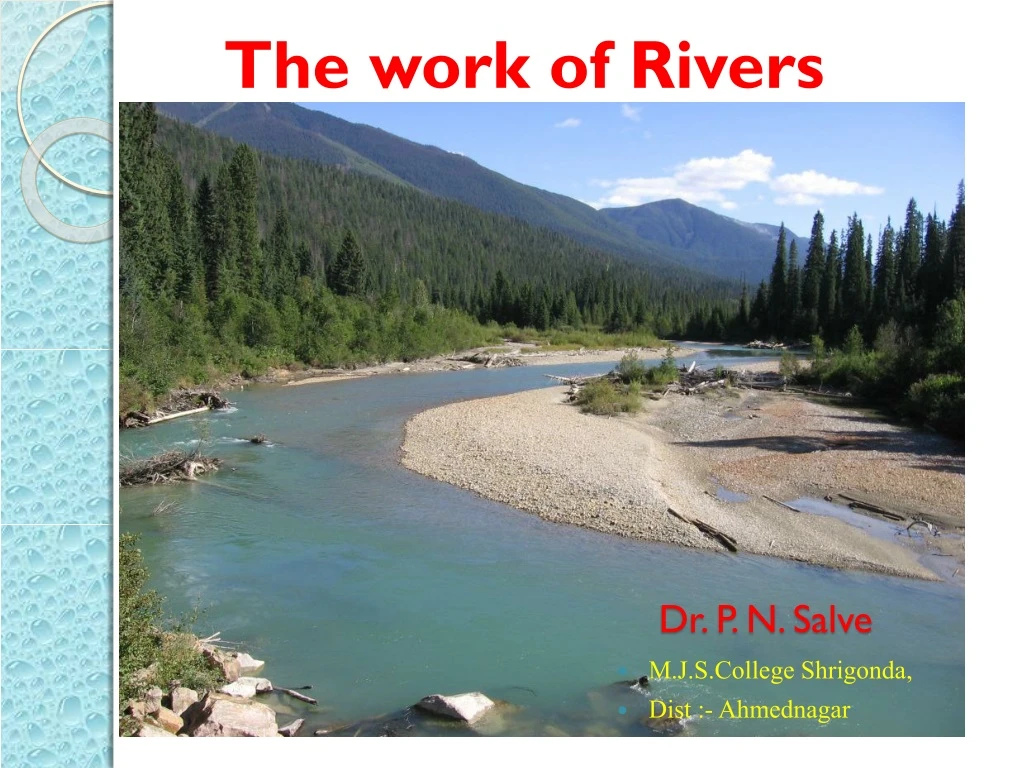
The work of Rivers. Dr. P. N. Salve. M.J.S.College Shrigonda , Dist :- Ahmednagar. River Features. Rivers are eroding, transporting and depositing constantly. The river can be divided into 3 sections – Upper Course at the Source, Middle Course and Lower Course at the Mouth of the river.

E N D
The work of Rivers Dr. P. N. Salve • M.J.S.CollegeShrigonda, • Dist :- Ahmednagar
River Features • Rivers are eroding, transporting and depositing constantly. • The river can be divided into 3 sections – Upper Course at the Source, Middle Course and Lower Course at the Mouth of the river. • The river displays different characteristics at each section.
Channel flow and sheet flow Head area erosion predominant • Longitudinal profile of a stream Mouth area, deposition mainly
Now you know a bout the processes that enable the river to change • What does the river look like?
Upper valley characteristics “V”shape valley, mostly vertical erosion Interlocking spurs Narrow, shallow channel, low velocity and discharge Large rocksthat come from upstream and from valley sides
Interlocking spurs, Robinson, Lake District River load in upper course Why are they rounded? Boulders are large and semi-rounded, due to attritionwithin the loadand abrasion with the stream bed and banks An upper course valley often has interlocking spurs, and steep valley sides
The main process at work is the downward or vertical erosion of the stream bed. This cuts into the landscape deepening the valley sides. Upper Course • Characteristics: • Deep narrow valley • (V shaped) • Interlocking spurs • Fast flowing river (erosion predominant) • Pot holes in the river bed • Rapids and Waterfalls
In the Upper Course • You see V-shaped valleys, interlocking spurs, waterfalls, gorges and rapids. • This because the erosion takes place downwards only - Vertical erosion • This mainly by abrasion and hydraulic action, making valley deeper • Most of the transport is by traction and saltation. • As the main work is vertical erosion, the water winds it way around obstacles, weaving from side to side – the point on the valley side ahead is worn away, increasing the cut into the valley side – hense V-shaped valley with interlocking spur
Waterfall formation Look at the diagram, How is a waterfall formed?
High Force waterfall, R. Tees Waterfall creates gorge as it recedes upstream by eroding the base and neck Plunge pool
Upper Course: Potholes Potholes EROSION TYPE: Vertical (by EDDY CURRENTS) Boulders broken off by erosion that sit on the river bed create swirling eddy currents as the water flows past as the river is not strong enough yet to move the boulders by TRACTION. These eddies swirl the boulder round and erode a pothole in the river bed by ABRASION.
Potholes: Potholes are formed by corrasion. Pebbles carried by the river are swirled around on the riverbed. This action erodes the rock on the riverbed forming potholes. Over time, they may widen and join with other potholes to form larger potholes, and the whole riverbed is deepened.
Middle course, R. Tees HOW DOES THIS DIFFER FROM THE UPPER SECTION?
Middle course, R. Tees Valley opens out, more gentle slopes, wider valley bottom First signs of meanders River channel wider, deeper, greater velocity and discharge
Middle Course: Meanders Meanders 1 (Aerial View) Meanders are formed because the current swings to the outside of a bend and concentrates the erosion there. Deposition occurs on the inside of the bed where there is not enough energy to carry load. EROSION TYPE: Lateral
Lower Course: Ox-bow lake Ox-Bow Lake 1 (Aerial View) Ox-bow lakes are formed when two meander RIVER CLIFFS are being eroded towards each other. These will eventually meet, causing the river to then flow across the bottom of the diagram. EROSION TYPE: Lateral
Lower Course: Ox-bow lake 2 Ox-Bow Lake 2(Aerial View)
Ox Bow lake on Mississippi Meander Loop on the Colorado River
Fast flowing water has more energy River cliff forms Slip-off slope
Slow, shallow water and deposition on the inside of the bend Deep, fast water and erosion on the outside of the bend
Creation of oxbow lake Creation of oxbow lake
Meandering Rivers WHAT IS A MEANDER?
Meander, R. Lavant, Chichester WHICH WAY IS THIS MEANDER MOVING? Floodplain Slip-Off Slope River Cliff Pebble deposits on the inner meander bend where there is low energy
As the outer banks of a meander continue to be eroded through processes such as hydraulic action the neck of the meander becomes narrow and narrower. WHERE IS EROSION TAKING PLACE? River Cliff F A E B B Slip-off slope C D
Oxbow lakes • Eventually due to the narrowing of the neck, the two outer bends meet and the river cuts through the neck of the meander. The water now takes its shortest route rather than flowing around the bend. • Deposition gradually seals off the old meander bend forming a new straighter river channel. • Due to deposition the old meander bend is left isolated from the main channel as an ox-bow lake. • Over time this feature may fill up with sediment and may gradually dry up (except for periods of heavy rain). When the water dries up, the feature left behind is known as a meander scar.
What happens to the river when it moves to the middle course • Gradient becomes less steep • River continues to erode vertically a bit but more LATERAL erosion now occurs in MEANDERS • The meanders MIGRATE. What do you think that means? • Name three effects it have on the valley.
Lower Course: Severn Valley HOW DOES IT DIFFER FROM THE MIDDLE COURSE?
Lower Severn Valley Very wide floodplain Well developed meanders with bars in the channel indicating high sediment load Very gentle valley side gradients
How are they formed? The river before the flood at regular height. The river whilst flooding
There is an increase in friction between the water leaving the channel and the floodplain when a river overflows. The water is shallower on the river banks and valley floor, thus this is why deposition of load occurs. After repeated flooding causing the deposition of silt onto the banks, this eventually settles which over time builds up to form a levee. The coarser material is deposited first, and is positioned closer to the river. After repeated flooding, the river bed and levees are raised due to the constant process of the deposition of silt. Over time, this eventually causes the river to rise above level of flood plain. This is called an ‘aggraded bed’.
The Nile Delta from space River Nile Triangle shape Bird-Foot
Estuary Formation HOW DOES THIS DIFFER FROM A DELTA? RAISED VALLEY SIDES