Download
1 / 27
281 likes | 870 Vues
Distance measurement methods. measurement with a tapeoptical methods a) measurement of a parallactic angle b) stadia range finderelectro-optical methods a) phase distance meter b) distance meter measuring transit time. 2. 1. Distance measurement with a tape . tape leng

E N D
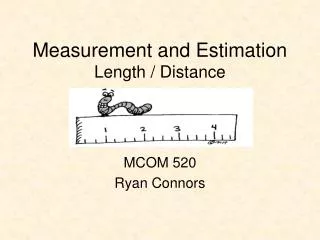
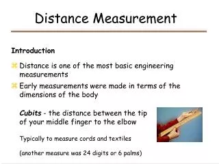
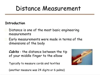
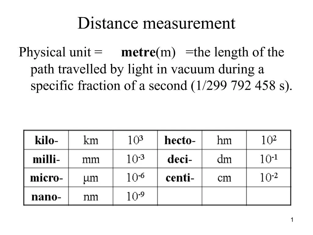
1. Distance measurement Physical unit = metre (m) = the length of the path travelled by light in vacuum during a specific fraction of a second (1/299 792 458 s).
1
2. Distance measurement methods measurement with a tape
optical methods
a) measurement of a parallactic angle
b) stadia range finder
electro-optical methods
a) phase distance meter
b) distance meter measuring transit time
2
3. 1. Distance measurement with a tape tape length 20 � 50 m, the smallest division 1 mm
material � steel, invar (Ni, Fe), plastic
measured distance is split into sections which are shorter than the tape length, these sections should be in a straight line
horizontal distance is measured (it is assured by a plummet)
measurement is always performed twice � forth and back in a flat terrain or down from the top twice 3
4. 4
5. Errors of measurement with a tape if the real tape length is not known: the tape should be calibrated,
if the temperature during a measurement is not the same as the temperature during the calibration: the temparature correction should be introduced
ot = (t � t0). a . d,
d � measured distance,
a � thermal line expansion coefficient,
t � temperature during the measurement,
t0 � temperature during the calibration, 5
6. if the sections are not in a straight line,
if the tape is stretched less than 50 N or more than 100 N,
if the tape is not horizontal,
if the tape is sagged: it depends on the tape length
if a wrong value is read on the tape
Accuracy of the distance measurement with a tape is about 3 cm for 100 m (1: 3000 of a measured distance). 6
7. 2a) Measurement of a parallactic angle 7
8. horizontal stadia rod of known length l is placed perpendicular to the measured distance D
horizontal angle d is measured by a theodolite
horizontal distance is calculated
accuracy � 1 mm for 100 m (1:100 000) 8
9. 2b) Stadia range finder � horizontal line of sight 9
10. there are 2 short lines = stadia lines in the field of view of all theodolites and levelling instruments
angle d is invariable (it is given by the distance between stadia lines and by the focal distance f), a rod interval l is measured (it is read on a levelling rod)
10
11. measured distance D is horizontal
usually k = 100
if the line of sight is not horizontal, a rod interval l and a zenith angle z are measured and then
accuracy � 0,1 m for 60 m (1:600) 11
12. Stadia range finder � slope line of sight 12
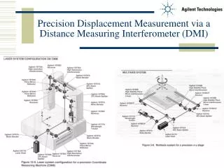
13. 3. Electro-optical distance measurement there is a transmitter of electromagnetic radiation on a point and a reflector on another one
reflector: 1. trigonal reflector
2. arbitrary diffuse surface
principles of distance measurement:
1. evaluation of a phase or frequence of modulated electromagnetic radiation,
2. signal emission and transit time measurement. 13
14. slope distance is measured with an electronic distance meter = length of the join between the instrument and the prism (target)
additive constant of the instrument and the target set = systematic difference between measured and true distance given by the positions of instrument�s and target�s reference points. The additive constant is given by the producer of the instrument and it should be introduced to a measurement.
electronic distance meter can be embeded in so called total station (electronic theodolite + electronic distance meter) 14
15. Accuracy of electronic distance meters s = X + Y ppm
X �invariable part of the standard deviation,
Y �variable part of the standard deviation (it depends on the value of a measured distance)
E.g. s = 3 mm + 2 ppm
the standard deviation of measured distance is 7 mm for the distance 2 km (= 3 + 2*2) 15
16. 3a) Phase distance meter 16
17. distance meter signals a modulated wave with the phase f0 and a wave with the phase f1 is turned back. The distance is characterized by the phase difference ?f.
the wave has to be longer than measured distance (it is not possible to determine a number of the whole waves)
more than one wavelength are usually used for measurement, e.g. wavelengths 1000 m, 10 m, 1 m and then the values 382 m, 2,43 m, 0,428 m give the result 382,428 m. 17
18. 3b) Distance meter measuring transit time signal is emitted by the distance meter and transit time t is measured
high accuracy of the transit time measurement is needed therefore these distance meters are less often used 18
19. Corrections of measured distances physical correction of a distance � for measurements with electronic distance meters
mathematical reduction of a distance � for coordinate calculations 19
20. Physical correction wavelength depends on atmosphere which the signal comes through, it depends on atmospheric temperature and pressure mainly
value of physical correction is set in a distance meter (it is calculated using formulas given by the producer of the distance meter)
it is possible to enter the temperature and the pressure to the most of modern distance meters and the correction is calculated automatically 20
21. Mathematical reduction Measured distance d which is shorter than 6 km has to be:
1. reduced to a curvature on the reference sphere (to so called �sea level horizon�),
2. reduced to the plane of the cartographic projection (e.g. S-JTSK) 21
22. 1. Mathematical reduction to the sea level horizon 22
23.
r � reference sphere radius (6380 km)
h � sea level height (elevation) 23
24. 2. Distance projection reduction (S-JTSK)
for short distances
The scale error value m is calculated or found out using the scale error isolines map.
24
25. 25
26. 26
27. 27