Download
1 / 22
240 likes | 515 Vues
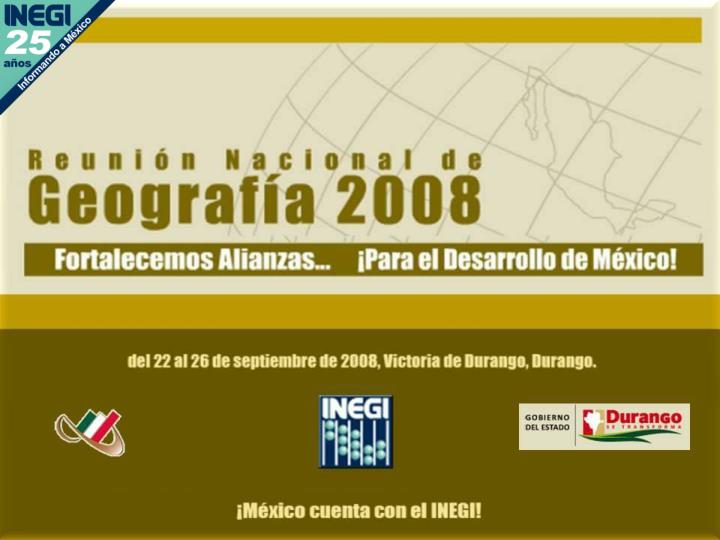
“ EVOLUCION Y MEJORA CONTINUA DE LOS PROCESOS Y PRODUCTOS FOTOGRAMÉTRICOS DE LA DGG DEL INEGI ”. Eje Rector: Ciudadanización de la Información. C. Rodrigo Ramírez Gordiano INEGI. Durango, Durango, 25 de septiembre de 2008. Contenido. Antecedentes. Insumos. Procesos Fotogramétricos:.

E N D
“EVOLUCION Y MEJORA CONTINUA DE LOS PROCESOS Y PRODUCTOS FOTOGRAMÉTRICOS DE LA DGG DEL INEGI” Eje Rector:Ciudadanización de la Información C. Rodrigo Ramírez Gordiano INEGI Durango, Durango, 25 de septiembre de 2008
Contenido Antecedentes Insumos Procesos Fotogramétricos: Periodo de 1968 a 1992 Periodo de 1993 a 2003 Periodo de 2004 … Reingeniería
Antecedentes En 1968, el Gobierno Federal planteó la necesidad de contar con información cartográfica de cobertura nacional, para este compromiso se crea la CETENAP hoy DGG. Debía realizar la carta topográfica del país, para este reto se inicio la capacitación de un grupo de personas que fueron los iniciadores de los procesos fotogramétricos, con los cuales se crea el Departamento de Fotogrametría. Desde su inicio y a través del tiempo los compromisos de cobertura nacional han sido los siguientes: Origínales de la Carta Topográfica: 1:50,000 Ortofotos Digitales: 1:20,000 Insumos para la Carta Topográfica: 1:20,000 Ortofotos Digitales: 1:10,000
Insumos La Fotografía Aérea • En Blanco y Negro • Escala: 1:50 000 • 1:80 000 • Vuelo SINFA • escala : 1:75 000 Vuelo SINFA Escala: 1:40 000
Insumos Se obtiene realizando mediciones directas en el terreno ELECTROTAPE DM-20 Equipo para medir distancias por medio de onda corta GPS para fotogrametría a partir de 1994 El Control Terrestre
Procesos Fotogrametricos1968-1992 INSUMOS PROCESOS PRODUCTOS USUARIO Departamento de Edición Laboratorio Fotográfico Originales de restitución Altimetría Planimetría Hidrografía Triangulación Aérea Fotografía Aérea Restitución Control Terrestre Laboratorio Fotográfico Ortofotos Analógicos Ortofotos
Procesos Fotogramétricos 1968-1992Restitución TRAZO DE CURVAS DE NIVEL La restitución de curvas de nivel se realizaba directamente en la minuta ESTEREOSIMPLEX C-2
Procesos Fotogrametricos1993-2003 INSUMOS PROCESOS PRODUCTOS USUARIOS Fotografía Aérea Triangulación Aérea Base de Datos Actualización Ortofotos Digitales Escala 1:20,000 Control Terrestre Escaneo Modelo Digital del terreno (MDT) Ortofotos
Procesos Fotogramétricos 1993-2003Ortofoto GENERACIÓN DE ORTOFOTOS Rectificación de la fotografía
Procesos Fotogramétricos 1993-2002Ortofoto ORTOFOTO ESC. 1: 20,000 • Escala de vuelo • 1:75 000 • Formato geográfico: • latitud 7’ 30” • Longitud 6’ 40” • Superficie promedio 160 km2 • Resolución 1.5 m
Procesos Fotogramétricos 2004--- INSUMOS PROCESOS PRODUCTOS USUARIOS Ortofotos Digitales Escala 1:10,000 Escaneo Fotografía Aérea Base de Datos Información Topográfica Modelo digital del terreno (MDT) Triangulación Aérea Control Terrestre MDT Altimetría Ortofotos Cubierta de altimetría
Procesos Fotogramétricos 2004---Ortofoto En la estación fotogramétrica se generan: Modelo digital de superficie (MDS) Modelo Digital del Terreno (MDT) Cubierta de altimetríaOrtofoto
Procesos Fotogramétricos 2004---Ortofoto Escala de vuelo 1:40,000 Formato geográfico: latitud 3’ 45” longitud 3’ 20” Superficie promedio 4.3 km2 Resolución 1.0 m ORTOFOTO ESCALA 1:10,000
Reingeniería REINGENIERÍA EN LOS PROCESOS DE: Escaneo de Fotografía Aérea Triangulación Aérea Insumos para Cartografía 1:20,000
Reingeniería Escaneo de Fotografía Aérea Escaneo por Diapositiva
Reingeniería Escaneo de Fotografía Aérea Escaneo por rollo
Reingeniería 0º 0º 0º 180º 180º 180º L-371 DIC - 07 272297C L-369 DIC - 07 272297C L-367 DIC - 07 272297C L-370 DIC - 07 272297C L-368 DIC - 07 272297C L-372 DIC - 07 272297C D420 E14B3706 E428 G426 E428 E428 E428 E14B3704 E14B3703 E14B3702 G413 D415 E430 B435 G418 G427 E431 G417 G419 G414 E428 G412 E429 G428 E14B3701 Triangulación Aérea 05 07 06 03 02 01 09 04 08 05 03 04 06 08 07 09 01 02 05 07 06 03 02 01 09 08 04 05 03 06 09 04 07 08 01 02 01 05 03 09 08 07 06 04 02 05 02 03 04 06 07 08 09 01 25 Puntos de Control Terrestre
Reingeniería 0º 180º 180º 0º 0º 180º L-367 DIC - 07 272297C L-369 DIC - 07 272297C L-371 DIC - 07 272297C L-372 DIC - 07 272297C L-370 DIC - 07 272297C L-368 DIC - 07 272297C G427 D415 G412 D420 E14B3706 B435 G419 E429 G414 Triangulación Aérea 05 07 06 03 02 01 09 04 08 05 03 04 06 08 07 09 01 02 05 07 06 03 02 01 09 08 04 05 03 06 09 04 07 08 01 02 01 05 03 09 08 07 06 04 02 05 02 03 04 06 07 08 09 01 9 Puntos de Control Terrestre usando GPS aerotransportado
Reingeniería Insumos para la Carta 1:20,000 MDT Fotogramétrico Cubierta de Altimetría Ortofotos Es lenta la obtención de los insumos
Reingeniería MDS Fotogramétrico Ortofotos La obtención de las Ortofotos es rápida El MDT y Cubierta de Altimetría se generarán con otra tecnología Insumos para la Carta 1:20000
Gracias¡ rodrigo.ramirez@inegi.org.mx