Download
1 / 74
740 likes | 1.04k Vues
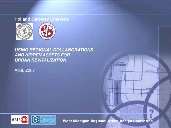
Holland Gateway Charrette USING REGIONAL COLLABORATIONS AND HIDDEN ASSETS FOR URBAN REVITALIZATION April, 2007. West Michigan Regional Urban Design Charrettes. Introduction.

E N D
Holland Gateway Charrette USING REGIONAL COLLABORATIONS AND HIDDEN ASSETS FOR URBAN REVITALIZATION April, 2007 West Michigan Regional Urban Design Charrettes
Introduction • In 2005, a large area of study involving properties and corridors of mutual concern was the focus of the AIA/WMSA’s first collaborative charrette process involving the City of Holland and Holland Charter Township
This current 2007 Charrette process builds on the 2005 effort by expanding the involvement of City and Township participants while narrowing and intensifying the focus on a critical gateway area linking our two communities.
This charrette process presents a wonderful opportunity for the broader community as it brings together leadership and engaged property owners, businesses, residents, and potential investors from both municipalities in a process that provides for greater understanding of conditions and opportunities for change.
The charrette area has: Two residential neighborhoods with homes and property in declining condition; Two older commercial corridors that are in declining condition, are unattractive, and have congested roadways with access challenges; and An obsolete industrial facility that has recently been sold with approximately 600,000 square feet of enclosed space on 42 acres of property.
The west edge of the study area: adjacent to Hope College and Downtown Holland, and is the location of the area’s AMTRAK train station, regional bus service, and soon home to the area’s MAX transit system. To the east US-31 and Chicago Drive provide easy access throughout the region. To the north the heart of the Macatawa Greenway corridor.
Revitalizing and redefining neighborhoods. Enhancing corridor character; Linking neighborhoods and commercial areas with the greenway corridor; Changing socioeconomic conditions; Defining community-supportive commercial and civic redevelopment opportunities; and Revitalizing core community properties. Challenges
1. Preserve Urban Centers 2. Design on a Human Scale 3. Create Neighborhood Identity 4. Encourage Mixed-Use Development 5 Provide Choices Of Housing Types 6. Build Vibrant Public Spaces 7. Vary Transportation Options 8. Protect Environmental Resources 9. Conserve Landscapes Objectives
Design Matters: As the AIA policy statement expresses, “Architecture and urban design profoundly affect people”. The engagement of the AIA in this process, along with the involvement of other professionals and concerned citizens and property owners, advances the initiative in this gateway area tremendously. It is sincerely hoped that by inspiring this process and by adding visual images and representation, we are inspiring not only interest in this area but in the importance of design in other efforts within our community. Realization
Cyclical Process “ The visioning process is a logical progression of steps which taken together will establish the future goals and direction for a community.” Bill Johnson, ASLA; co-founder JJR, Inc.
Area Facts Collected • Citizen Open House • Wed April 11, 2007
Citizen Open House • Key Ideas Offered: • Preserve Federal Residential District • Programs to improve residences and property • Walking Access to Greenway
Citizen Open House • Traffic Problems: Chicago Drive, 8th Street & US-31 • Improve Infrastructure: Sidewalks, Lighting, and Drainage • Calm Traffic • Improve Aesthetic • Add Bike Paths • Park for Kids to Play
Citizen Open House • Encourage Commercial Development along corridors • Hart & Cooley Redevelopment • Hope College potential expansion • Concerns about specific properties
Positive Facts • Diversity of Stakeholders with Strong Anchors: Hope, Hart, Commercial, Federal, Greenway Diversity of Physical Environment Urban Form: Grid Transitional Area with opportunities and options Multi-jurisdictional Real Estate Opportunities Redevelopment, Public Private Mix Arterial Access US 31, Chicago Drive Encourage Walk Ride
Positive Facts Rail Station: Regional Connection Amtrak Leverage Existing Assets: Windmill Island, Greenway, Hope College Neighborhoods: Livability Community, Diversity Greenway
Area Negative Facts • Real Estate Risk/Exposure/ • Transitional Risks • Vehicular/Pedestrian Mix-Dangerous • Crossings • 8th/Chicago Drive Convergence • Navigational Confusion • Billboards • Commercial Railroad Spurs • No Greenway Connection from Chicago Drive • Conflict of Commercial vs. Natural • Residential Decline • Future Commercial in Federal • Zoning Contributes to decline • Residential Pedestrian Infrastructure • Chicago Drive is Ugly
No Greenway Connection from Chicago Drive Conflict of Commercial vs. Natural
Area Needs • Student Housing • Mid Range Housing-Quality Affordable Housing • Gateways: City/Township, Downtown, Hope College, Highways • Civic Facilities such as school, church & playgrounds • Community Gathering • Nature/Outdoor Recreation • Sense of Place • Part of a neighborhood • Part of a larger community
What Are the Hidden Assets? • Greenway • Urban Infrastructure – Grids • Adequate Street Capacity • Neighborhoods • Hope College • Downtown Connection • Communities with a Collaborative Spirit • Strong History of Private-Public Partnership • 42 Ac. site available for redevelopment within a Mile of the CBD • Smaller available commercial properties to complement • Established Business in the area. • Easy Access to a major State Highway
Area Goals • Transportation – Add & Diversify • Build on existing bus service with expanded high density service (BRT or Trolley) • Non-Motorized, Rail, Paths • Pedestrian Scale/Walkability • Chicago Drive/8th Street Enhancement • Aesthetics, Crossings, Linkage • Level of Service • Fairbanks (North) Enhancement • Determine best use • Leverage and connect to Greenway
Area Goals • Development: New and Appropriate • Synergistic, Compatible, Connected • Federal District Enhancement • Improve infrastructure, infill, and amenities • Redesign for Vehicle Access • Greenway Connections • Visual, Residential, Physical, Accessible • 8th/Chicago Convergence • N/S Linkage-Resolve Conflicted Interchange • Branding the Gateway (District) • Downtown Connection, Marketing, Way-finding
Uncovering Concepts #1 Hart and Cooley – Industry Closing Industrial Reuse? Renovate and Reuse for Mixed-Uses Minor League – West Coast Baseball #2 Federal Area – Tired Neighborhood Residential Rebirth-Infill and Renovation Infrastructure Redefinition Neighborhood Protection Walkable Access Outside Neighborhood #3 Fairbanks Area Redefine Land Use Plan Fairbanks/8th Street Intersection Hering Property Solution Mixed Use Recipe #4 8th Street - Russ’ to Lincoln Traffic Calming Land Use Compatibility Urban Form AREA #1 AREA #2 AREA #3 AREA #4
Area Ideas Consolidation of Study Areas #1 and #2 Hart/Cooley – Federal District Access – Shift Chicago Drive Corridor New “Northern Entrance” Provides New Access “Straightens 8th Street into Linear Shopping New Opportunity for Bus Rapid Transit Protects and Separates Residences Boulevard Chicago Drive, 8th, and Clover Improves Access to “New” Hart & Cooley