Download

1 / 13
130 likes | 315 Vues
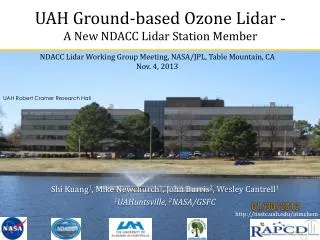
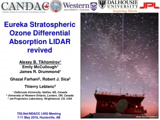
NDACC Lidar Working Group Meeting , NASA/JPL, Table Mountain, CA Nov. 4, 2013. UAH Ground-based Ozone Lidar - A New NDACC Lidar Station Member. UAH Robert Cramer Research Hall. Shi Kuang 1 , Mike Newchurch 1 , John Burris 2 , Wesley Cantrell 1 1 UAHuntsville , 2 NASA/GSFC.

E N D
NDACC Lidar Working Group Meeting, NASA/JPL, Table Mountain, CA Nov. 4, 2013 UAH Ground-based Ozone Lidar -A New NDACC Lidar Station Member UAH Robert Cramer Research Hall Shi Kuang1, Mike Newchurch1, John Burris2, Wesley Cantrell1 1UAHuntsville, 2NASA/GSFC http://nsstc.uah.edu/atmchem
Outline • 1. Introduction to the location • 2. Introduction to the UAH O3 lidar instrument • 3. Other synergistic instruments at UAH • 4. Future plans
The Location Overview (34.7250N, 86.6450W) 200m ASL ~100 clear days and ~100 cloudy days per year Surrounded by large cities. Simulated and obs (circles) organic carbon at surface in 2010. [Cooper et al., 2007] Summertime upper tropospheric O3 maximum above Huntsville Leibensperger et al. ACP 2012
Current UAH Ozone Lidar Configuration The UAH O3 DIAL currently measures O3 with two λ (289-299), three telescopes, and four altitude channels. This system profiles O3 up to ~12 km with a temporal resolution 2-10 min and a vertical resolution of 150-750 m. We have plans to add a third λ for more accurate PBL O3 retrievals. 30Hz, 5-7 mJ/pulse z 40cm Telescope 10cm x PMT 4 Solar & ND filters 2.5cm 10% 289/299 2 Pin hole or iris Pulse generator 90% 1 3 289/299 289/299 289/299 Beamsplitter 289/299 laser Licel TR Trigger Photodiode Gate Gate Function generator Trigger UAH O3 DIAL
Laser Transmitter Upgraded the transmitter from dye lasers to Raman-shifted lasers for a more stable output, quicker initialization, and easier operation. Data after May 2013 are mostly taken with the 289-299nm pair. 266 Pump Current: 266 YAG pumped Raman-shifted (289-299nm) Previous: 532 YAG pumped dye lasers (285-291nm)
Receiver and Detector Added a 1’’ channel in Feb. 2013. 1’’ receiver (Ch-1) 100m-1km 16’’ receiver (Ch-4) 3-12km Measurable alt range 4’’ receiver (Ch-2 and Ch-3) 500m-1.5km, 1-5km Laser outgoing mirror 3 telescopes and 4 photomultiplier (PMT) channels
Validation The retrieval accuracy ranges from better than 10% in the low and mid troposphere and better than 20% in the upper troposphere with 2-10 min temporal integration. Against sondes in [Kuang et al. 2011a] Preliminary results in [Kuang et al. 2013] Confirmed by the extensive coincident lidar/sonde obs. in 2013 summer SEAC4RS. Alt (km) O3 (1012molec cm-3) Figure 11. Comparison of the low-altitude (solid) and high-altitude (dash) channel aerosol-corrected retrievals with the coincident ozonesonde (dot) measurements. [Kuang et al. 2011a IEEE-TGRS] [Kuang et al. 2013 Applied Optics]
Synergistic Instruments at UAH Ceilometer Sfc Sodar 915 profiler MPR Courtesy of Kevin Knupp http://vortex.nsstc.uah.edu/mips/system/ Ozonesonde, T, P, O3, RH, wind 915: SNR, vertical velocity, spectral width, horizontal wind, Doppler spectra Ceilometer: backscatter, cloud base height MPR: T, water vapor, cloud water Sodar: SNR, spectral width, horizontal wind Surface; T, RH, P, wind, solar radiation Source: [Karan and Knupp, 2006] Halo Doppler wind lidar: wind velocity, backscatter, scanning capability
Synergistic Instruments at UAH Image from the manufacture Wisconsin HSRL (Ed Eloranta et al.) deployed at Huntsville in 2013 summer: backscatter, color ratio, depolarization ratio. Surface O3 monitor, high temporal O3 mixing ratio
Future Plans • 1. Taking data on the NDACC schedule and achieving data using the NDACC protocol. • 2. Improving the retrieval precision by adding a third wavelength (283.6nm) . • 3. Adding 289nm narrow-band and 283-289nm band-pass filters. • 4. Continuing scientific studies using the ozone lidar data.
Table 1. Characteristics of the UAH ozone lidar. * This is equal to the range interval for reported ozone.
Planned Configuration of the UAH Ozone Lidar The UAH O3 DIAL currently measures O3 with two λ (289-299), three telescopes, and four altitude channels. We have plan to add a third λ for more accurate PBL O3 retrievals. This system profiles O3 up to ~12 km with a temporal resolution 2-10 min and a vertical resolution of 150-750 m. Planned configuration for UAH O3 DIAL