Download
1 / 14
140 likes | 236 Vues
The Convective Structure of Hurricane Humberto During Landfall: A Study of Cloud-to-Ground Lightning. Holly A. Anderson Tropical Meteorology II April 14, 2008. Data and Methodology.

E N D
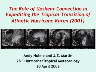
The Convective Structure of Hurricane Humberto During Landfall: A Study of Cloud-to-Ground Lightning Holly A. Anderson Tropical Meteorology II April 14, 2008
Data and Methodology • The goal of this study is to analyze the spatial and temporal distributions of lightning and the relationships between reflectivity heights and lightning frequency during hurricane landfall. • Data Sources: • Storm track and intensity at 6-hourly intervals provided by “best-track” data from the National Hurricane Center (NHC). • Cloud-to-ground (CG) lightning strike data provided by the National Lightning Detection Network (NLDN). • WSR-88D data in VCP121 mode from Houston, Texas (KHGX). • RUC model analysis data at 20-km resolution. • Warning Decision Support System – Integrated Information (WDSS-II) was used to both display data and merge radar and RUC data to provide a look into the relationships between the storm’s environmental characteristics and radar reflectivities.
CG Strikes on the Day of Landfall Red Green 00 UTC 23 UTC • A cluster of lightning is observed around 0300 UTC just southeast of the Houston radar site as Humberto rapidly intensifies to Category 1 hurricane status just offshore. The NHC states that Humberto is a record-breaking intensifying storm during this time. • A second cluster of lightning is observed near the eye wall as it makes landfall at approximately 0700 UTC.
Radial Distribution of Flashes 178 flashes 1559 flashes Negative eyewall flashes are concentrated in the center, whereas positive strikes are more spread out. Positive strikes located outwards of the eyewall are observed, verifying the outward tilt of the eye wall.
Convective Structure and Lightning Locations • Molinari et al. (1999) describes three types of convection found in the typical hurricane: 1. Deep convection with localized updrafts and downdrafts and reflectivity maximums of 30-50-dBZ above the freezing level. • Associated with frequent negative flashes 2. Moderate convection with maximum reflectivities below the freezing level and a rapid decrease in reflectivities above the freezing level. • Associated with low frequency of negative lightning 3. Stratiform precipitation adjacent to active (or previously active) convection. • Associated with frequent positive flashes
Radar and Lightning at Landfall - Negative flashes + Positive flashes • Most of the ground flashes occurred in rainbands before landfall, and in the eyewall after landfall.
Lightning in the Eye Wall • The first eye wall flash, seen at 0610 UTC begins just as the eye wall hits the coastline. The last flash, at 0723 UTC, occurs as the dBZ heights fall.
Pete Wolf’s Lightning Initiation Scheme • Many studies have shown that lightning is probable when the 40-dBZ level reaches the -10°C isotherm. Temperatures around -10°C allow supercooled water, ice, and graupel to collide and produce the charge separation required for lightning. • Plan-views of radar reflectivities at the -10°C isotherm (calculated from RUC data) could be valuable for predicting the occurrence of lightning.
Lightning in the Eye Wall • The reflectivities at the -10°C isotherm nearly perfectly match the locations of CG lightning. • As the eye wall moves onshore, lightning activity initially increases due to frictional convergence. • As the hurricane moves away from its warm, moist oceanic energy source, convection decreases, dBZ heights fall, and lightning frequencies decrease.
Lightning in the Outer Bands • Similar to patterns observed in the eyewall, lightning is observed in reflectivity areas of 40-dBZ. • Reflectivity height falls in the outer bands reflect decreases in lightning. • The majority of strikes are negative, but positive strikes are seen radially outwards in areas of stratiform precipitation and/or adjacent to convective cells.
Conclusions • Frictional convergence upon landfall causes an increase in convection, increasing dBZ heights and increasing CG lightning frequency. • As the storm continues moving over land, warm, moist oceanic fluxes no longer feed the storm, the dBZ heights fall and CG strikes cease. • The outward tilt of the eye wall is seen by the patterns of positive CG strikes located radially outward from negative strikes. • Lightning and convection patterns in Hurricane Humberto support both Molinari’s three convective regimes and Wolf’s -10°C/40-dBZ lightning initiation scheme.
References • Molinari, J., P. Moore, and V. Idone, 1999: Convective Structure of Hurricanes as Revealed by Lightning Locations. Mon. Wea. Rev., 127, 520–534. • Wolf, P., 2006: Anticipating the Initiation, Cessation, and Frequency of Cloud-to-Ground Lightning, Utilizing WSR-88D Reflectivity Data. NOAA/National Weather Service, Jacksonville, Florida. • Lyons, W.A., and C.S. Keen, 1994: Observations of Lightning in Convective Supercells within Tropical Storms and Hurricanes. Mon. Wea. Rev., 122, 1897–1916. • Molinari, J., P. Moore, V. Idone, R. Henderson, and A. Saljoughy, 1994: Cloud-to-ground lightning in Hurricane Andrew. J. Geophys. Research, 99, NO. D8, 16665–16676.