Download
1 / 12
330 likes | 1.77k Vues
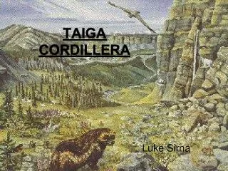
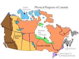
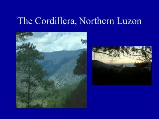
Western Cordillera . By: Alden Cheung By: Mathusan Srimurugan The cordillera region has a mountain belt that stretches 500m. Land Shape. Western Cordillera consist on British Columbia Area944,735 km² Population of 4.4million Yukon Area 482,443 km² Population 33,897 Western Alberta

E N D
Western Cordillera By: Alden Cheung By: MathusanSrimurugan The cordillera region has a mountain belt that stretches 500m
Land Shape • Western Cordillera consist on • British Columbia • Area944,735 km² • Population of 4.4million • Yukon • Area 482,443 km² • Population 33,897 • Western Alberta • Area 661,848 km² • Population 3,645,257
Size 800 km Wide 49-69 Degrees north 114-141 Degrees West Area 1.6 million km2 The cordillera region has a mountain belt that stretches 500m
Minerals/Rocks • Metallic Minerals: found in igneous rocks (Ex iron + Silver). • Non-Metallic Minerals: some metamorphic and sedimentary (Ex. potash + asbestos + mica). • Energy Minerals: California = offshore. Utah + Colorado = oil shale (Ex. Petroleum, coal, natural gas).
Water Bodies • Surrounded by the Pacific ocean • Fraser river (B.C) • Mackenzie river (Yukon) • Gulf of Alaska • Beaufort Sea
Soil As a result, the soils here are loess, a form of crushed rock and silt. These materials make for very rich farmlands
Vegetation • Douglas fir • Forage grass • White spruce • Lodge pole pine • Ponderosa pine • many other grasses, rains a lot and the soil is good • coniferous trees such as pine trees are scattered around the mountains • Depending on the height of the mountain, there could be some trees or no trees (to cold to grow)
North-South: a drop in the temperature, going up on the latitude • East-West: Moderate Temperature (near ocean) • Temperature is much warmer in the interior (affects land mass rather than ocean) • 21 c- 32c in the summer and -2c to -4c in the long winters • Average Temperature north of the ecozone is 0.5ºC, South 7.5ºC • The western side of the Coast Mountains receives 1200 to 1500mm of precipitation (annual precipitation) Climate
Fishing (West Coast) Two main fishes Salmon(#1 Catch)-Sockeye(#1 Species) Problems: Pulp and paper (Needs lots of water, pollution on water) Solutions: Salmon Farming (inbreeding) Mining Copper is Primary Bingham Mine (Worlds largest open pit copper mine) BC is second behind Alberta for natural gas Coal: Shipped to Japan as well, Robert’s Bank Super port Industry
Tourism • Cordillera Mountains Attractions, Puerto Rico's Cordillera Central Mountains are made up of peaks and valleys, with heights rising 4000 ft / 1220 m • Hiking (Rockies 14,440 ft/4,400 m, extends 1,600 km/990 mi) • Mountain Biking • Skiing • Snowboarding
Key Cities • There are 3 main cities that the western cordillera consists of: • White Horse • Area 416.54 km2 • Population 23,276 • Vancouver • Area 2,877 km² • Population 603,502 • Victoria • Area 19.68 km² • Population 78,055