Download
1 / 33
410 likes | 895 Vues
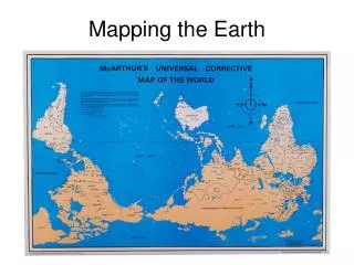
Mapping the Earth. Why Study Maps?. Why do we need maps? What types of maps are there? How have maps changed?. Cartography. The art of map making. Maps contain symbols, descriptions, legends or keys, scales, and compass direction. North always points to the top of the map. Scales.

E N D
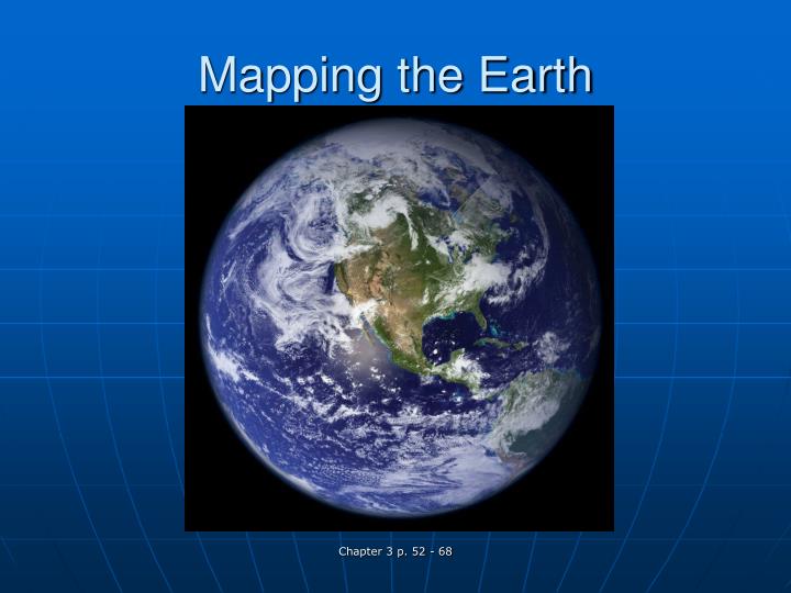
Mapping the Earth Chapter 3 p. 52 - 68
Why Study Maps? • Why do we need maps? • What types of maps are there? • How have maps changed? Chapter 3 p. 52 - 68
Cartography • The art of map making. • Maps contain symbols, descriptions, legends or keys, scales, and compass direction. • North always points to the top of the map. Chapter 3 p. 52 - 68
Scales • A scale indicates the relationship between the distance on the map to the actual distance. • A scale can be represented as graphical, fractional, or verbal. Chapter 3 p. 52 - 68
Lines of Latitude • Lines of latitude describe positions north or south of the equator. • Lines of latitude are also sometimes called parallels because they never intersect with each other. Chapter 3 p. 52 - 68
Latitude • Equator 0° latitude • Latitudes north of the equator are labeled °N • Latitudes south of the equator are labeled °S • Poles are 90°N or S, which is the highest possible latitude line. Chapter 3 p. 52 - 68
Lines of Longitude • Lines of longitude describe positions east or west of the prime meridian. • Lines of longitude are sometimes called meridians. • Longitude or Meridians are semicircles that run from the north pole to south pole. Chapter 3 p. 52 - 68
Longitude • Prime meridian 0° longitude • Degrees longitude always begin from the prime meridian. • Longitudes east of the prime meridian are labeled °E. • Longitudes west of the prime meridian are labeled °W. • Longitude lines run east and west until they reach 180° known as the International Date Line. Chapter 3 p. 52 - 68
Finding Direction • Using latitude and longitude lines we can determine locations. • Similar to plotting points on a graph. • Use units in degrees, minutes, and seconds. • Use compass directions north, south, east, and west. Chapter 3 p. 52 - 68
Using Units • The smaller the unit the more specific the location becomes, similar to telling time on a clock. • Degrees, minutes, seconds (like Hours, minutes, seconds) Chapter 3 p. 52 - 68
Units • 60 min. in 1 deg. (like 60 min. in 1 hr.) • 60 sec. in 1 min. Chapter 3 p. 52 - 68
Map Projections • Flat representation of the Earth’s curved surface. • Because the Earth is curved all maps result in distortion in some manner size, shape, or direction. Chapter 3 p. 52 - 68
Map Projections • Larger the area being shown the greater the distortion. • Most accurate part of the map=where the paper meets the globe. • Farther the paper is from the globe=more distortion Chapter 3 p. 52 - 68
Type of Map Projections • Cylindrical • Wrap a cylinder of paper around a globe. • Meridians appear as straight lines and have equal space between them. • Like a perfect grid pattern. • Accurate near the equator and distorted at the edges. • Advantages: Locate positions easier and shapes of small areas are well preserved. Chapter 3 p. 52 - 68
Types of Map Projections • Conic • Form a cone with a piece of paper and place it on a globe. • Cone touches one parallel. • Polyconic • Many conic maps used to increase accuracy with each cone touching a different latitude. • Advantage: Relative size and shape of small areas on the map are nearly the same as those on the globe. Chapter 3 p. 52 - 68
Types of Map Projections • Azimuthal • Place a flat sheet of paper on a globe. • The paper only touches one point on the globe. • Advantages: navigate air travel • Great circles appear as straight lines, therefore, by drawing a straight line between two points navigators can find a great circle route shortening the distance. Chapter 3 p. 52 - 68
Think Pair Share Chapter 3 p. 52 - 68
Topographic Maps • Topo maps show the surface features of the earth, both natural and constructed features. • Topo maps also show elevations • Sea Level = 0 ft. • The elevation is depicted by contour lines. • Contour lines never intersect and always close on themselves. Chapter 3 p. 52 - 68
Topographic Maps • The contour line interval is the distance from one contour to another. The interval is provided in the maps legend. • Relief is the difference in elevation between the highest and lowest point. • Bench marks can often times help in determining specific points on the map. Chapter 3 p. 52 - 68
Landforms • Contour lines that form a V indicates a valley, the V points upstream. • The closer the contour lines are to each other the steeper the landform will be. • Depression contours are closed loop contours that have short perpendicular lines inside the loop that point toward the depression. Chapter 3 p. 52 - 68
Geologic and Soil Maps • Geologic maps indicate the rock type, age, folds, and faults. • Soil maps classify and describe soils located in a given area. Chapter 3 p. 52 - 68