Download
1 / 31
330 likes | 489 Vues
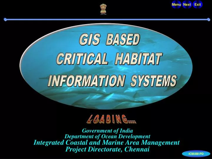
. Menu. Next. . Exit. GIS. BASED. CRITICAL. HABITAT. INFORMATION. SYSTEMS. . L O A D I N G. Government of India Department of Ocean Development Integrated Coastal and Marine Area Management Project Directorate, Chennai. ICMAM-PD. . . . About us ICZM - An Overview

E N D
. Menu Next . Exit GIS BASED CRITICAL HABITAT INFORMATION SYSTEMS . L O A D I N G.... Government of India Department of Ocean Development Integrated Coastal and Marine Area Management Project Directorate, Chennai ICMAM-PD
. . . • About us • ICZM - An Overview • Critical Habitats • Mangroves • Coral Reefs • Seagrass • Nesting Grounds • Critical Habitat Information System (CHIS) • Objectives • Components of CHIS • CHIS for • Mangroves ecosystems (Sundarbans, Coringa, Pichavaram, Gulf of Khambat) • Coral Reefs and seagrass (Gulf of Mannar, Kadmat, Malvan , Gulf of Kachchh) • Vantage Area of Biodiversity ( Islands off Karwar, Islands off Cochin) • Turtle Nesting Grounds (Gahirmatha) • Conclusion
. . . About us The Department of Ocean Development (DOD) has initiated a programme namely, Integrated Coastal and Marine Area Management (ICMAM) with the objective applying the scientific tools and techniques for the best long-term and sustainable use of coastal natural resources and its natural environment. As a part of this World Bank assisted programme, the task of development of Critical habitat Information System (CHIS) for critical habitats like coral reefs, mangroves, etc, was undertaken. DOD established a Project Directorate during 1998-99 at Chennai to implement this programme.
. . . Integrated Coastal and Marine Area Management - an overview One particular coastal natural resource or activity can not be managed in isolation as it has impact on others or affected by others - therefore, activities have to be managed in unison to sustain them. Ideal way to sustain any resource or activity is adoption of concept of Integrated Management. Integrated Coastal and Marine Area Management - an overview SALIENT FEATURES OF ICMAM Is a planning and coordinated process, which deals with development and management of coastal marine resources and areas. Provides an opportunity to allow policy orientation and development of management strategies to address the issue of resource use conflicts and to manage the impacts of human intervention on the environment by incorporating human and social concerns in the planning process. Provides institutional and legal framework, focuses on environmental planning and management, coordinates various agencies concerned to work together towards a common objective.
. . . Critical Habitats
. . . Critical Habitats - Threatened Ecosystems Critical habitats are identified as areas, which are vital to the survival of the species at some phase of its life cycle or to the survival of the community, because of the ecological processes, which occur within it (IUCN, 1976). Critical habitats include feeding, nesting, breeding and nursery areas of estuarine and marine animals; major sources of food and nutrients for feeding areas else where (e.g. mangroves); or areas that are particularly rich in species (e.g. coral reef); or highly productive areas (e.g. seagrass); or areas of special scientific interest. CRITICAL HABITATS Mangroves Seagrass Nesting Grounds for Turtles Coral Reefs
. . . the years. Threats to Critical Habitats
. . . Mangrove Ecosystems Mangroves are trees and shrubs that grow in tropical and subtropical tidelands in areas that are frequently inundated with salt water due to tidal activity of gulfs, seas and oceans. Mangroves are able to thrive salt water inundation because of specialized rooting structures (such as prop roots and pneumatophores), specialized reproduction (vivipary or live birth) and the ability to exclude or excrete salt. • SALIENT FEATURES OF THE MANGROVE ECOSYSTEM • Provides a valuable physical habitat for a variety of flora and fauna. • Organic matter exported from mangrove habitat - utilized as a food source by innumerable organisms. • Mangroves act as a buffer against storm-surges. • Stabilize coastal shorelines and prevent erosion and loss of land.
. . . • Mangrove ecosystem are subjected to undue stress due to : • Antropogenic activities such as use of mangroves for fuel, • cattle grazing etc • Reclamation of land for activities such as aquaculture and other • developmental purposes • Pollution Threats to Mangrove Ecosystem
. . . Status of Mangroves in India • The mangrove areas in India are generally categorized as deltaic, estuarine, backwater, sheltered and insular bay. The total area of mangroves in India is estimated at 6740 sq. km. This covers about 7% of the world's mangroves. The World's total mangroves span over 30 countries with a total area of 99,300 sq. km. • Distribution of mangroves in India • S.No. State/Union Territory Area in • Sq.km • 1. West Bengal 4200 • 2. Andaman and Nicobar islands 1190 • 3. Maharashtra 300 • 4. Gujarat 260 • 5. Andhra Pradesh200 • 6. Goa 200 • 7. Orissa 150 • 8. Tamil Nadu 150 • 9. Karnataka 60 • 10. Kerala Coast 30 • TOTAL 6740 • Source: (MoEF, 1989)
. . . Coral Reefs • Coral reefs are the most productive ecosystem in the world . • SALIENT FEATURES OF THE CORAL ECOSYSTEM : • Occur along shallow, tropical coastlines where the marine waters are clean, clear and warm • Contribute to fisheries, as approximately one third of world’s fish species are reported to be living here • Support tourism industries • Serve as natural protective barriers, deterring beach erosion, retarding storm surges etc.
. . . . . . Threats to Coral Reef Ecosystem Coral reefs all over the world are subjected to undue stress due to • Erosion and sedimentation • Coral bleaching • Predation of Crown-of-thorns (star fish) and sponge infestations • Coral mining • Dynamiting and indiscriminate fishing activities • Derdging activities • Unplanned and unregulated tourism activity
. . . Status of Coral Reef in India • In India, the Coral reefs occur principally in the Gulf of Mannar, • Gulf of Kachchh, Lakshadweep and Andaman & Nicobar • group of islands. • Coral species diversity in India • Totally 214 species of corals have been identified along the Indian coast. • The species diversity of corals in India is given below: • Name of the AreaGeneraSpecies • 1. Gulf of Kachchh 24 37 • 2. Gulf of Mannar & Palk bay 36 128 • 3. Lakshadweep islands 37 103 • 4. Andaman & Nicobar islands 43 134 • 5. West coast patches 17 29
. . . Seagrass ecosystem Seagrasses are marine plants belonging to monocotyledonous families, i.e, Hydrocharitaceae, Cymodoceaceae and Potamogetonaceae. • SALIENT FEATURES OF THE SEAGRASS ECOSYSTEM • Normally found in shallow areas where photosynthesis occurs • Seagrass beds are highly productive and act as breeding and nursery grounds for many epiphytic fauna and feeding grounds for important marine mammals (Dugong dugong) and turtles. • Seagrass roots bind sediments and prevent erosion. • Play important role in providing nourishment, nutrients to the habitat
. . . Threats to the Seagrass ecosystem • Seagrass beds are damaged by unfavourable conditions such as excessive siltation, turbidity, pollution, etc. • Extensive areas of seagrass beds are being disturbed by indiscriminate fishing activities such as stake net fishing and intensive trawling operations.
. . . Status of Seagrass ecosystem in India • Seagrass species diversity in India • Totally 14 species of seagrass have been identified along the Indian coast. The species diversity of Seagrass in India is given below: • Name of the Area Species • 1. Gulf of Mannar 12 • 2. Lakshadweep islands 7
. . . Nesting Grounds The coast of Orissa is the most important sea turtle nesting area in India, and possibly the most important Olive ridley nesting site in the world. The nesting area includes Bhitarkanika Wildlife Sanctuary and Gahirmatha Marine Sanctuary, which are of International repute. About 0.2 to 0.7 million olive ridley turtles visit this beach during December - April for mass nesting every year. Five of the seven species of endangered sea turtles live in Indian waters. These species are the Olive ridley, green, hawksbill, leatherback, and loggerhead turtles.
. . . Critical Habitats Information System One of the activities identified for capacity building under ICMAM is “Development of Critical Habitat Information System (CHIS) using GIS”. An expert committee identified about 32 sites along the Indian coastline as “critical habitats” that need protection and conservation. During the IX five year plan 11 critical habitats were taken up for study and Critical Habitat Information System has been developed. The 11 critical habitats fall under are the following ecosystems namely Mangroves ecosystems Coral Reefs and Seagrass ecosystems Vantage Area of Biodiversity Turtle Nesting Grounds
. . . Objectives The major objectives for the development of the critical habitat information system are : • to provide a baseline data and information on the present status of the area concerned • to analyse changes that have occurred over the years, comparing the past data, wherever possible, • to provide suitable measures including management actions for prevention of degradation, if any, based on the factors that might have caused the changes.
. . . CHIS Components of the Information System Satellite data and Field data were selected as primary sources of information and GIS and RDBMS were used to analyse and develop the complete information system. Image processing, GIS and database softwares were used for the development of CHIS for all the eleven habitats.
. . . Mangrove unchanged Mangrove to other categories Other categories to mangroves Kakinada Bay Coringa mangroves Bay of Bengal Gautami Godavari river Remote Sensing Remote Sensing is defined as the measurement of object properties on the earth's surface using data acquired from aircraft and satellites. It is therefore an attempt to measure objects at a distance rather than in situ. These systems provide repetitive coverage of the earth, which provides periodical monitoring of earth and effects of human / natural activities on it. Thematic maps such as landuse/landcover, geomorphology etc for various critical habitats were generated by analysing the satellite data. As per requirement IRS 1A, 1C, ID and Landsat -TM were generally used and analysed to extract the required thematic maps using ERDAS-IMAGINE 8.4 image processing software.
. . . Field Survey It is the primary source of collection of data about the habitat. Detailed survey was undertaken in almost all the critical habitat under study using Differential Global Positioning System(DGPS) , Scuba and Skin diving. Underwater images of the ecosystem were recorded using Remotely operated vehicle (ROV). The ground/Sea truth data so collected was later used to classify the remote sensing data. A number of organisations were involved in the collection of data on various parameters of interest including the biodiversity of the critical habitats during the years 1998 - 2001.
. . . RDBMS • RDBMS is the acronoym for “Relational Database Management Systems” and is essentially a set of collected data stored in the form of tables and a set of programs to access it. The field data collected from various sources were stored as separate tables in the Oracle database and were linked using a common-id identifier. Tables were created to hold information • on • Physio-chemical data on water quality • Biological data • Microbiological data • Socio-economics
. . . Geographical Information Systems GIS is an excellent tool to store, manipulate, analyse, retrieve and to present the data in a geographical and spatial manner. It can hold both spatial and non-spatial data. GIS allows holding various information as separate themes. Overlay facility in GIS enables analysis of relationship and changes between different themes. At present, GIS is used for wide range of applications including planning, landuse and geomorphology of land and coastal areas.
. . . CHIS for Mangrove Habitats Sundarbans, Pichavaram, Coringa and Gulf of Khambat are the four critical habitats studied with respect to their mangrove ecosystems. SUNDARBANS, West Bengal Largest mangroves formation in India and over 35 species are known to occur here. In the present study the total area under mangrove vegetation alone in the Sundarbans Tiger Reserve area and D.F.O 24 Parganas (South) was calculated using Remote Sensing data and was found to be 1737 sq.km CORINGA, Andhra Pradesh Coringa is the second largest mangrove formation along east coast , next to Sundarbans. 15 species of mangroves have been recorded in this region. In the present study it has been observed that there has been significant reduction in mangrove cover over the decade between 1988 and 1998 wherein mangrove area has reduced from 13359 to 11815 ha. Click here for CHIS for Mangrove Habitats PICHAVARAM, Tamil Nadu In the Pichavaram mangrove forest 10 species of mangroves have been recorded. In the present study it has been observed that there is a marginal gain in mangrove area between 1987 and 1998 which is mainly attributed to the afforesatation work carried out here. Gulf of Khambat, Gujarat Mangroves are found growing on the intertidal mudflats and occupy an area of about 54sq.km
. . . CHIS for Mangrove ecosystems Click the white dots on the map to open the relevant CHIS • Mangroves ecosystems • Sundarbans,West Bengal • Coringa, Andhra Pradesh • Pichavaram, Tamil Nadu • Gulf of Khambat, Gujarat Sundarbans Gulf of Khambat Coringa Pichavaram
. . . CHIS for Coral Reef Habitats Of the 11 critical habitats selected for study, 4 areas have been exclusively choosen for their coral reef and seagrass ecosystems. They are Gulf of Mannar, Tamil Nadu Gulf of Mannar is India’s first Marine Biosphere Reserve and128 species of corals have been recorded from this area in the past. In 1999-2000, 46 species of corals have been recorded with less percentage of live coral coverage and extensive areas of dead corals. The coral reef and seagrass areas around the islands of Gulf of Mannar were calculated and were found to be be 100 and 85.5 sq.km respectively based on 1998 IRS 1D satellite data. Kadmat, Lakshdweep The reef zonation of the Kadmat island has reef flat, reef slope and lagoon and 45 species of corals have been recorded in the past, However, in the present study only 9 species of live corals have been recorded and the live coral coverage was less than 1%. Click here to open CHIS for Coral Habitats Gulf of Kachchh, Gujarat Stony corals of Gulf of Kachchh form the coral area in the North-West coast of Arabian Sea. Diversity of living corals in the Gulf of Kachchh is poor with 39 species under 24 genera. Malvan, Maharashtra Corals are found attached on rocky substratum in inter-tidal and sub-tidal regions. Only hermotypic corals were found in this region.
. . . CHIS for Coral reef and Seagrass ecosystems Click the blue dots on the map to open the relevant CHIS Click the white dots on the map to open the relevant CHIS • Coral reefs & seagrass • ecosystems • Gulf of Mannar, Tamil Nadu • Malvan, Maharastra • Gulf of Kachchh, Gujarat • Kadmat, Lakshadweep Gulf of Kachchh Malvan Gulf of Mannar Kadmat
. . . CHIS for Vantage Areas of Biodiversity Cochin Backwaters Cochin Backwaters has been experiencing high level of anthropogenic pressure during the last five decades. The present study shows that there is a decline in the Backwater area and floral and faunal diversity due to anthropogenic activities. The area of backwaters in 1912 was 315 sq. km which has shrunk to 157 sq. km by 1989 and to 132 sq. km. Click the white dots on the map to open the relevant CHIS Islands off Karwar The Karwar group of islands are rocky with sandy shore and proximal to intertidal, estuarine region forming an ideal location for diverse marine organisms characteristic of rocky, sandy inter-tidal and estuarine regions. The presesnt study indicates that Karwar is a pristine environment with rich floral and faunal diversity. Karwar Cochin
. . . CHIS for Nesting Grounds Click the white dot on the map to open CHIS for Gahirmatha Gahirmatha Gahirmatha beach located in the Bhirtarkanika Wildlife Sanctuary supports the largest known nesting ground of olive ridley turtle in the world. About 0.2 to 0.7 million olive ridley turtles visit this beach during December - April for mass nesting every year. However, in the last 20 years, large scale mortality and shifting of nesting is being observed. The present study deals with the shifting of the mass nesting site and the major threats faced by the nesting turtles. Gahirmatha
. Menu Back . Exit CONCLUSION Application of GIS for management depends upon sound scientific understanding of the governing processes and integration of spatial and attribute data of concern to that critical habitat. The Critical Habitat Information System developed using remote sensing and GIS has demonstrated that these tools could be effectively used for monitoring and managing critical habitats under threat. ICMAM-PD