Download
1 / 25
280 likes | 574 Vues
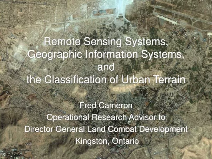
Remote Sensing Systems, Geographic Information Systems, and the Classification of Urban Terrain. Fred Cameron Operational Research Advisor to Director General Land Combat Development Kingston, Ontario. Outline. Introduction and Historical Material Ellefsen’s Study from 1980-86

E N D
Remote Sensing Systems, Geographic Information Systems, andthe Classification of Urban Terrain Fred Cameron Operational Research Advisor to Director General Land Combat Development Kingston, Ontario
Outline • Introduction and Historical Material • Ellefsen’s Study from 1980-86 • Military Doctrine • Sensors • Geographic Information Systems (GIS) and Associated Analytical Tools • Queen’s University Study • Geographical Information Systems and Remote Sensing • Metadata and Interoperability – DIGEST Standard • Artificial Intelligence and Rule Based Systems • Categorization, Land Cover, Land Use, and Semantics • Models, Simulation, and Operational Research
Urban Terrain Zone Classification • Ellefsen’s Study, circa 1987 • ‘Procedures’ and ‘Definitions’ • ‘Urban Morphology’ • ‘The Growth of Cities’ and ‘Structures and Materials’ • ‘Classifications’ • ‘Quality Control’ / ‘Validation’ – Comparison to Ground Truth • Recommendations
Ellefsen’s Recommendations • Develop terrain databases for many world cities • For theoretical studies • To have an inventory for operations • Develop spatial models of urban terrain • Anticipate new types of feature • Construction techniques will continue to advance • Local conditions may induce innovative techniques • Share the knowledge on urban characteristics widely • Direct the concept of urban terrain zones at combat development and weapon development communities Source: Ellefsen, Urban Terrain Zone Characteristics, 1987
Urban Construction: Example of Options Source: Ellefsen, Urban Terrain Zone Characteristics, 1987
Some Factors Influencing Construction Options • Epoch of construction • Local knowledge of architects and engineers: structures and materials • Availability of materials • Abilities of the workforce • Local ‘political considerations’ • Mood of the citizens and their leaders • Zoning restrictions • Desire for ‘public display’
Zone A3 (attached houses) Zone A1 (core area) Zone A2 (apartments, hotels, core periphery) Zone A9 (old core, vestigial) Ellefsen’s Categories – A Sample Source: Ellefsen, Urban Terrain Zone Characteristics, 1987
Modified Ellefsen Categories • FM 3-06.11 (supercedes FM 90-10-1) Combined Arms Operations in Urban Terrain, US Army,February 2002 • FM 34-130 July 1994 Intelligence Preparation of the Battlefield, US Army, July 1994 • Jamison Jo Medby, Russell W. Glenn, Street Smart: Intelligence Preparation of the Battlefield for Urban Operations, RAND, MR-1287-A, 2002 • Sean J. A. Edwards, Mars Unmasked: The Changing Face of Urban Operations, RAND, MR-1173-A, 2000 Source: FM 3-06.11, Chapter 2 Urban Analysis
LIDAR Workstation IFSAR Workstations IFSAR Antennas Sensors – Example: The Rapid Terrain Visualization (RTV) Aircraft Source: US Army’s Rapid Terrain Visualization Project, Mr. Mike Hardaway, Technical Manager LiDAR Light Detection and Ranging IFSAR Interferometric Synthetic Aperture Radar
Collection Specifications LiDAR Light Detection and Ranging IFSAR Interferometric Synthetic Aperture Radar Source: Turner and Moscoco, 2002
Level I (Current Archive) Level II (SRTM) Level III (RTV) Level IV (RTV) Level V (RTV) 90 m spacing 30 m spacing 10 m spacing 3 m spacing 1 m spacing Notional Difference in DTED Resolution DTED = Digital Terrain Elevation Data SRTM = Shuttle Radar Topographic Mission RTV = Rapid Terrain Visualization project Source: US Army’s Rapid Terrain Visualization Project, Mr. Mike Hardaway, Technical Manager
LiDAR - Multiple Laser Returns • Assume: • first return is from top of tree canopy • last return is from the ‘ground’ Source: US Army’s Rapid Terrain Visualization Project, Mr. Mike Hardaway, Technical Manager
Example: Line of Sight from LiDAR Data • ArcGIS Military Analyst methods applied to LiDAR data from Toronto Source: Harrap and Lim, ‘Terrain Classification for Military Operations in Urban Areas’, 2003
Example: View Field from a Point Field of view (green) from top of the Provincial Legislature in Toronto Source: Harrap and Lim, ‘Terrain Classification for Military Operations in Urban Areas’, 2003
Example:Building Extraction to GIS Shapes • With some semantic assumptions, extraction of features can build GIS data with minimal intervention by an operator • LIDAR Analyst, developed by Dr. Vincent Tao at York University, Toronto, does a good job on urban areas as shown. Source: Harrap and Lim, ‘Terrain Classification for Military Operations in Urban Areas’, 2003
Pan-chromatic Imagery Classification by Alternate Methods Classification by eCognition Bonn, Germany Pickering, Ontario Example from eCognition Source: Birgit Mittelberg ‘Pixel Versus Object:A method comparison for analysing urban areas with VHR [very high resolution] data’ see http://www.definiens-imaging.com
Roles and Understanding • Level of understanding is determined by process • For Example (after Pigeon, 2002) • Sniper needs to have high spatial and environmental texture resolution (i.e., the semantics of the immediate cover environment) • Search and Rescue (SAR) pilot needs to have low spatial accuracy and high environmental texture resolution (i.e., the semantics of the landing zone environment) • Blast models (physical) need medium to high spatial accuracy and accurate semantics of the target area
Modeling, Simulation, and OR Analysis • For Theoretical Analysis in Simulation: • Need representative terrain… but also • Need to know selected terrain is representative • Need to know ‘land use’ for entity behaviour • For Rehearsal Analysis in Simulation: • Need actual terrain • Need to know ‘land use’ for entity behaviour • For Mathematical Analysis: • Need terrain with appropriate characteristics • Do not necessarily need extensive raw data on terrain, but need to know that assumptions in the model (sensor ranges, weapons ranges, lethal effects, etc.) are appropriate
Models Covered by the MOUT FACT Assessment • Integrated Unit Simulation System (IUSS) • “constructive, force-on-force model, for assessing the combat worth of systems and sub-systems for both individuals and small unit dismounted warfighters in high-resolution combat operations” • CombatXXI • “high-resolution, closed-form analysis tool for the assessment of new technologies” • “replacement for CASTFOREM” • AMSAA Infantry MOUT Simulation (AIMS) • “small unit combat simulation designed to support AMSAA systems performance analyses of infantry systems” • OneSAF Objective System • “composable, next generation computer-generated force (CGF) that can represent a full range of operations, systems, and control processes from the individual combatant and platform level to battalion level” Source: https://www.moutfact.army.mil/frameset.asp?sec=research MOUT FACT = Military Operations in Urban Environment Focus Area Collaborative Team
Assessment of Current Models • Indirect Fire - Issues: effects on buildings, building contents, roads, bridges and subterranean infrastructure • Tactical Communications - Issues: VHF radios, lack of propagation studies • Mobility - Issues: NATO Reference Mobility Model V.2, decision-making on alternative paths through terrain • Direct Fire - Issues: clearing buildings and hallways, deformable surfaces, non-lethal weapons, collateral damage, short-range engagements • Wide Area Surveillance - Issues: radar, acoustics, SIGINT • Search and Target Acquisition - Issues: ACQUIRE model, background noise, terrain and urban propagation, cues, shadows, rules of engagement, individual v. crew performance, and multiple targets Source: Crino, ‘Representation of Urban Operations in Military Models and Simulations’
Adequate Needs Improvement Poor Model Assessment Findings Source: Crino, ‘Representation of Urban Operations in Military Models and Simulations’
Conclusions • Dramatic remote sensing improvements for urban environments, e.g., LiDAR, IFSAR, multi-spectral and hyper-spectral cameras • Rapid development in functionality of Geographic Information Systems, including imagery handling and automatic and semi-automatic classification • Operational research practitioners need better understanding of cities and how they operate • Coincidentally, so do military clients
References • Scott T. Crino, ‘Representation of Urban Operations in Military Models and Simulations’ in Proceedings of the 2001 Winter Simulation Conference, Dec 2001 • Dispatches – “Training for Urban Operations”, Vol 9, No 2, Army Lessons Learned Centre, Kingston, Ontario, May 2002 • J-P Donnay, MJ Barnsley, and PA Longley, Remote Sensing and Urban Analysis, Taylor and Francis, London and New York, 2001 • Richard Ellefsen, Urban Terrain Zone Characteristics, US Army Human Engineering Lab, Aberdeen, MD, 1987 • Rob Harrap and Kevin Lim, ‘Terrain Classification for Military Operations in Urban Areas’, Queen’s University, Kingston, 2003 • Jamison Jo Medby and Russell W. Glenn, Street Smart: Intelligence Preparation of the Battlefield for Urban Operations, RAND, MR-1287-A, 2002 • Bryan Mercer, ‘Comparing LIDAR and IFSAR: What can you expect?’ Proceedings of Photogrammetric Week 2001 • Birgit Mittelberg ‘Pixel Versus Object:A method comparison for analysing urban areas with VHR [very high resolution] data’ Brochure from eCognition, see http://www.definiens-imaging.com • Luc Pigeon, ‘Concept of C4I data fusion command center for urban operations’ in Proceedings of the 7th International Command and Control Research and Technology Symposium, Quebec, Sep 2002 • Jeffrey T. Turner and Christian P. Moscoso, ‘21st Century Terrain – Entering The Urban World’, Rapid Terrain Visualization Website: https://peoiewswebinfo.monmouth.army.mil/JPSD/rtv.htm , 2002