Download
1 / 7
70 likes | 223 Vues
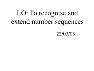
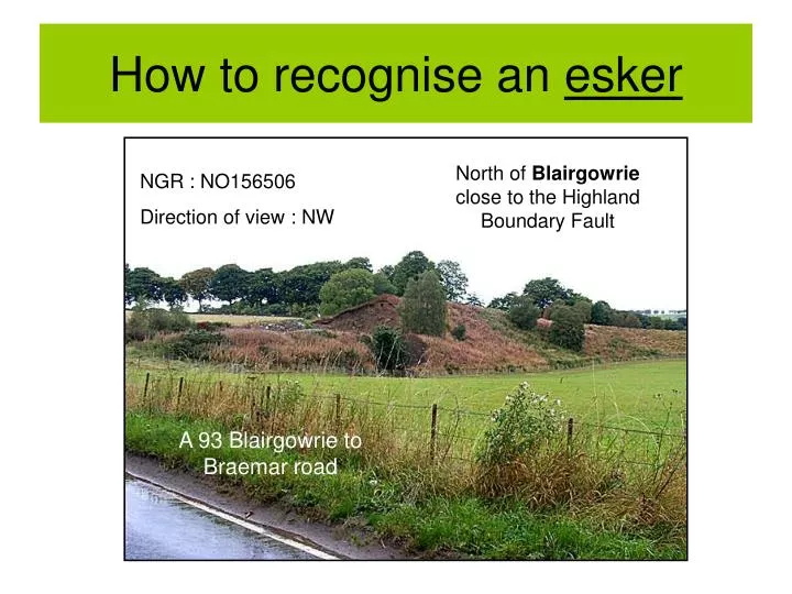
How to recognise an esker. North of Blairgowrie close to the Highland Boundary Fault. NGR : NO156506 Direction of view : NW. A 93 Blairgowrie to Braemar road. Look for the clues!. Too low for the OS map to pick it out. Long, low, winding ridge. Exposed face might reveal more.

E N D
How to recognise an esker North of Blairgowrie close to the Highland Boundary Fault NGR : NO156506 Direction of view : NW A 93 Blairgowrie to Braemar road
Look for the clues! Too low for the OS map to pick it out Long, low, winding ridge Exposed face might reveal more Vegetation contrast
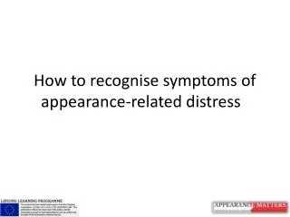
More clues… and questions Man-made or natural? Sediments – not rock Arch shaped in cross section We need a closer look!
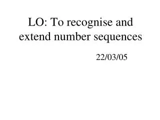
Look at the sediments Are the sediments sorted? Fine sediments Coarse sediments Now check elsewhere on the free face
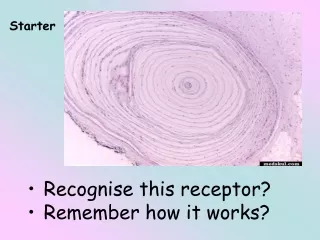
Some more good evidence Coarse Fine Coarse Very coarse Fine Rounded stones Sorted layers of sediment
Put the clues together • Low winding ridge in the landscape • In an area that once was ice covered • Vegetation changes • Arch shaped cross section • Sorted sediments (so not man made or direct deposition by ice) • Rounded sediments (water worn) • Fluvioglacial in origin
…and what have you got? An esker!