Download
1 / 22
260 likes | 549 Vues
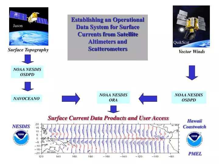
Establishing an Operational Data System for Surface Currents from Satellite Altimeters and Scatterometers. Jason. Topex/ Poseidon. QuikScat. Surface Topography. Vector Winds. NOAA NESDIS OSDPD. NOAA NESDIS ORA. NOAA NESDIS OSDPD. NAVOCEANO.

E N D
Establishing an Operational Data System for Surface Currents from Satellite Altimeters andScatterometers Jason Topex/ Poseidon QuikScat Surface Topography Vector Winds NOAA NESDIS OSDPD NOAA NESDIS ORA NOAA NESDIS OSDPD NAVOCEANO Surface Current Data Products and User Access Hawaii Coastwatch NESDIS PMEL
Total surface current velocity superimposed on sea surface temperature
NOAA IGDC DATA FLOW NAVY IGDR IMPROVE CORR. TAI ORBIT ADJ, ADJUST AGAINST PREVIOUS NGDC CYCLE NGDC NIGDC