Download
1 / 58
580 likes | 748 Vues
Global Climate Life on Land Biomes. Chapter 2. Outline. Intro Temperature, Atmospheric Circulation, and Precipitation Climate Diagrams Soil Horizons Terrestrial Biomes. Restoration using Natural History.

E N D
Global Climate Life on LandBiomes Chapter 2
Outline • Intro • Temperature, Atmospheric Circulation, and Precipitation • Climate Diagrams • Soil Horizons • Terrestrial Biomes
Restoration using NaturalHistory • Janzen studied natural history of tropical dry forests in Costa Rica to aid restoration efforts. • Guanacaste tree (E. cyclocarpum) has no current dependable dispersers, thus trees produce massive numbers of fruits. • Last native dispersers went extinct 10,000 years ago. • Cattle and horses (exotics) now act as dispersers.
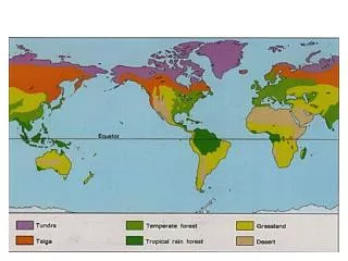
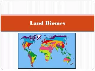
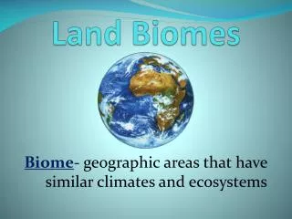
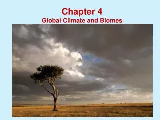
Terrestrial Biomes • Biomes are distinguished primarily by their predominant plants and are associated with particular climates. • Geographic and seasonal variations in temperature and precipitation are fundamental components.
Temperature, Atmospheric Circulation, and Precipitation • Spherical shape and tilt of earth’s axis cause uneven heating of earth’s surface. • Drives air circulation patterns and consequently precipitation patterns. • Warm, moist air rises. • Cools, condenses, and falls as rain. • Cooler, dry air falls back to surface. • Rainforests found near equator. • Major deserts found near 30o N / S.
Temperature, Atmospheric Circulation, and Precipitation • Coriolis effect causes apparent deflection of winds clockwise in the N hemisphere and counterclockwise in the S hemisphere.
Climate Diagrams • Summarize climatic information using a standardized structure. • Temperature plotted on left vertical axis. • Precipitation plotted on right vertical axis. • 10o C equivalent to 20 mm precipitation. • Relative position of lines reflect water availability. • Adequate moisture for plant growth when precipitation above temperature.
Soil : Foundation of Terrestrial Biomes • Soil is a complex mixture of living and non-living material. • Classification based on vertical layering (soil horizons). • Profile provides a snapshot of soil structure in a constant state of flux.
Soil Horizons • O horizon: Organic Layer freshly fallen organic material - most superficial layer. • A horizon: Mixture of minerals, clay, silt and sand. • B horizon: Clay, humus, and other materials leached from A horizon - often contains plant roots. • C horizon: Weathered parent material.
Soil – considerations • Parent material • Time (age) • Climate • Biotic processes – humus • Topography • pH (hydrogen ion concentration)
Climate • major factors: temp, ppt. • high in both high rate of nutrient cycling • high ppt. leeching • high biologic processes characteristic of warm conditions high CO2 production carbonic acid acts on rock causing decay, nutrient release
Biotic processes - Impact formation of humus • acts to: • bind soil particles • retain water • maintain soil structure under varied moisture conditions
pH (acidity) impacts: • Nutrient availability • May increase nutrient toxicities • Decrease deficiencies • Different species adapted to different conditions • Microbial activity • Affects nutrient cycling – breakdown of organic matter
Nutrient loss: impacted by • water flow • underlying geology • vegetation present • soluble nutrients lost more quickly following removal of vegetation (Hubbard Brook studies)
Consequences of Vegetation removal: • increased water runoff • increased nutrient loss • pollution of adjacent aquatic ecosystems • soil erosion • Closed system: nutrients contained/cycled w/i system • open system: nutrients move out of system • All systems are open!
Tropical Rainforests • Most occur within 10o latitude of equator. • Little temperature variation between months. • Annual rainfall of 2,000 - 4,000 mm relatively evenly distributed. • Quickly leaches soil nutrients. • Mycorrhizae help gather nutrients. • Organisms add vertical dimension. • Harbor staple foods and medicines for world’s human populations - increasingly exploited.
Tropical rain forest • Found worldwide (at least in times past) around the equator • Extremely high levels of rainfall • Poor nutrient content in soils due to high levels of rainfall • Tremendous plant diversity; large trees have shallow root systems evolved to be able to quickly absorb nutrients as soon as they become available (due to decay of dead things), before the rains wash them away. • Typical vertebrates: You name it! More than 50% of all the earth's terrestrial animal species are found in the tropical rainforest. Picture: monkeys, toucans, parrots, reptiles of all types, amphibians, and representatives of just about any major animal group.
Tropical Dry Forest • Usually located between 10o - 25o latitude. • Climate more seasonal than tropical rainforest. • Soils generally richer in nutrients, but vulnerable to erosion. • Shares many animal and plant species with tropical rainforests. • Heavily settled by humans with extensive clearing for agriculture.
Tropical Savanna • Most occur north and south of tropical dry forests within 10o - 20o of the equator. • Climate alternates between wet / dry seasons. • Drought associated with dry season leads to lightning-caused wildfires. • Soils have low water permeability. • Saturated soils keeps trees out. • Landscape is more two-dimensional with increasing pressure to produce livestock.
Desert • Major bands at 30o N and 30o S latitude. • Occupy about 20% of earth’s land surface. • Water loss usually exceeds precipitation. • Soil usually extremely low in organic matter. • Plant cover ranges from sparse to absent. • Animal abundance low, but biodiversity may be high. • Strong behavioral adaptations. • Human intrusion increasing.
Desert • Extremely arid. Very hot in the daytime; in some regions, extremely cold at night • High nutrient levels in the soil due to very little rainfall • Sparse plant life due to very low humidity and available water • Plantlife is evolved to have special adaptations to store and avoid losing water. • typical plants: cactus, Yucca, xeriphytic shrubs of various species, spectacular explosion of flowering annuals comes with the spring rains • typical vertebrates: drought-tolerant mammals such as desert foxes, burros, jackrabbits, high diversity of snakes and lizards, tortoises, Roadrunner and some other desert-adapted birds (plenty of hawks and eagles)
Mediterranean Woodland and Shrubland • Occur in all continents except Antarctica. • Climate cool and moist in fall, winter, and spring, but can be hot and dry in summer. • Fragile soils with moderate fertility. • Trees and shrubs typically evergreen. • Fire-resistant plants due to fire regime. • Long history of human intrusion. • Cleared for agriculture.
Mediterranean scrub forest • Found in arid regions with Mediterranean climate (e.g., southern California, Spain, European and African areas bordering the Mediterranean Sea; southern tip of Africa, southwestern tip of Australia) • Winters are rainy and mild; summer days are long, hot, and very dry • Characterized by periodic, seasonal fires • Major plant forms: Dense, spiny, evergreen shrubs (some of these produce seeds that will germinate and grow only after they've been through a fire.) • Typical vertebrates: mountain lion, coyote, mule deer, various rodents, many lizards, snakes, migratory birds, etc.
Temperate Grassland • Extremely widespread distribution. • Annual rainfall 300 - 1,000 mm. • Experience periodic droughts. • Soils tend extremely nutrient rich and deep. • Thoroughly dominated by herbaceous vegetation. • Large roaming ungulates. • Bison vs. cattle
Temperate grasslands • Characterized by distinct seasonal changes, moderate rainfall, extremely rich, organic soil. • Major plant forms: annual grasses and flowering plants; some areas with more standing water become marshes characterized by small trees such as willows, cottonwoods, etc. • Very fertile land, but with harsh seasonal variations: hot summers, cold winters • Most of these grasslands have been converted to farmland for human use, but some native grasslands have been preserved. • Typical vertebrates: American Bison (sometimes erroneously called "buffalo"), prairie dog, jackrabbit, fox, coyote, deer, many migratory birds (especially predatory birds such as hawks and falcons), etc. Many animals undergo winter hibernation.
Temperate Forest (Old Growth) • Majority lie between 40o and 50o latitude. • Rainfall averages 650 - 3,000 mm. • Fertile soils • Long growing seasons dominated by deciduous plants. • Short growing seasons dominated by conifers. • Biomass production can be very high. • Many major human population centers.
Temperate Forest • Found south of the coniferous forest in areas of relatively high rainfall and relatively high elevation, but with longer day length than in coniferous regions • Major plant form: deciduous (i.e., trees that seasonally drop their leaves) flowering trees and shrubs. • Typical temperate deciduous forest areas are the northeastern U.S. and most of Europe. • Typical vertebrates: deer, wolf, bear, foxes, many migratory birds, squirrels, rabbits, etc. Somewhat higher species diversity than coniferous forest. Some species hibernate through the winter, when food is scarce in the snowy landscape.
Boreal Forest (Taiga) • Confined to Northern Hemisphere. • Covers 11% of earth’s land area. • Thin, acidic soils low in fertility. • Generally dominated by evergreen conifers. • Relatively high animal density. • Historically, low levels of human intrusion.
Taiga • Found south of the arctic and tundra regions, primarily in the northern hemisphere • Northern boreal forest receives tremendous snowfall in winter; the conical shape of pines may help them shed snow and avoid damage to their branches from the weight of snow. • Highly endangered, these ecosystems are being rapidly logged out, especially in North America. • Also found along the the Andes of South America • Major plant form: evergreen, coniferous trees such as pines, firs, spruce, etc. (Cone-bearing trees). Under the trees grow shrubs, mosses, ferns, etc. • Relatively high levels of rainfall, but short days in the winter. • Typical vertebrates: deer, wolf, bear, foxes, many migratory birds, squirrels, rabbits, etc. Higher species diversity than tundra.
Tundra • Located just south of the polar regions in the northern hemisphere. • High winds and cold temperatures prevail • Climate typically cool to cold and dry with short summer season. • 200 - 600 mm precipitation.
Tundra • Arid (as are the polar regions) • Characterized by PERMAFROST: a permanently frozen layer of soil, which may be deeper in summer than in winter, but still prevents the growth of large trees with deep root systems. Low decomposition rates. • Human intrusion historically low, but increasing as resources become scarce. • most plants are scrubby and small • lichens (fungus/algae symbiosis) are a major photosynthetic food source • Supports substantial numbers of native mammals: reindeer/caribou, Snowy Owls, Grizzly Bear, Brown Bear, Wolf, Arctic Fox, Ptarmigan (a partridge-like bird), migratory birds, lemmings (small rodents), voles (another rodent).