Download
1 / 10
120 likes | 263 Vues
LAND GOVERNANCE IN SUPPORT OF THE MDGS: RESPONDING TO NEW CHALLENGES The Social Tenure Domain Model: From Concept to Implementation The World Bank , Washington DC March 11, 2009 Peter Rabley and Alex Piliptchak International Land Systems (ILS), Inc. Cadastre Domain Model.

E N D
LAND GOVERNANCE IN SUPPORT OF THE MDGS: RESPONDING TO NEW CHALLENGES The Social Tenure Domain Model: From Concept to ImplementationThe World Bank, Washington DCMarch 11, 2009Peter Rabley and Alex PiliptchakInternational Land Systems (ILS), Inc
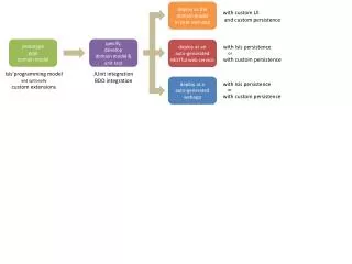
Cadastre Domain Model The standard model evolved to a robust model suitable for practical implementations Cadastre 2014 CCDM LADM 1998 2009
Land Administration Model (LADM) Information model and conceptual schema parties parcels rights, responsibilities, and restrictions spatial sources (surveys) spatial representations (geometry) Terminology Country Examples Social Tenure Data Model (STDM)
LADM Strength and Weakness Comprehensive core model Versioning and dynamic aspects Robust support for spatial representations Coherent linkage to external sources Terminology Fundamental property rights
Social Tenure Model (STDM) A specialization of LADM Relationships between people and land Limited cadastral coverage Different terminology Simplified core classes
ILS LRS and MultiCadastre A common data model LRS parties parcels rights, responsibilities, and restrictions MC spatial sources (surveys) spatial representations (geometry) Evolved through assimilation of multiple regional and national models MC LRS
Typical Implementations Different levels of specialization Simple (DSS/MC) Limited specialization of RRR classes Limited versioning (not all objects are versioned) Optional spatial representation Complex (LRS/MC) Full spectrum of RRR classes and related application logic Full versioning
Summary LADM has matured and ready for practical implementations though some issues may still need to be improved STDM specialization of LADM is similar in many aspects to the models implemented by ILS
Thank you Peter Rabley, President Alex Piliptchak, ILS Senior Consultant prabley@landsystems.com apil@landsystems.com International Land Systems (ILS), Inc 8401 Colesville Rd, Suite 630 Silver Spring, MD 20910, USA www.landsystems.com