Download
1 / 19
190 likes | 199 Vues
ESIP Disaster Lifecycle Cluster Jan 8 th , 2015 Architecture Implementation Pilots (AIP). Bart De Lathouwer Open Geospatial Consortium bdelathouwer@opengeospatial.org. Agenda. Background (What is AIP) Recent results (relevant for Disasters Management ) Opportunities in future (AIP-8).

E N D
ESIP Disaster Lifecycle ClusterJan 8th, 2015Architecture Implementation Pilots (AIP) Bart De Lathouwer Open Geospatial Consortium bdelathouwer@opengeospatial.org
Agenda • Background (What is AIP) • Recent results (relevant for Disasters Management) • Opportunities in future (AIP-8)
Architecture Implementation Pilot • „The GEOSS Architecture Implementation Pilot (AIP) develops and deploys new process and infrastructure components for the GEOSS Common Infrastructure (GCI) and the broader GEOSS architecture.“ • AIP is an agile, evolutionary development process, that proves the maturity of the infrastructure components. • Need to establish a good set of standards and results that show web access to large sets of EO data.
Architecture Implementation Pilot • AIP-7 • 24 participants (80+ organizations, incl. private sector & SME) • In-Kind contributions • Strategy & Focus • Based on user needs, Plenary feedback and help decision making
What to remember (summary): • What is the Architecture Implementation Pilot (AIP) • Pilots future components of the GEOSS Common Infrastructure (runs on a yearly cycle) • An interoperable environment based on open standards! • Agile development
AIP results • Related to Disaster Management: • Disaster reduction with EO-derived information • Water (drought / flood) • Authentication and Single Sign On • Crowd Sourcing http://www.ogcnetwork.net/pub/ogcnetwork/GEOSS/AIP5/index.html http://www.ogcnetwork.net/pub/ogcnetwork/GEOSS/AIP6/index.html http://www.ogcnetwork.net/pub/ogcnetwork/GEOSS/AIP7/index.html
AIP-5 DM scenario Participants support • Global- and regional-scale data related to disasters and vulnerabilities • Urbanization and human settlements parameters • Contributions to the GEOSS Data-CORE • Services structured to encourage full participation of end-users • Countries / regions that need to be involved in the generation of their own disaster management resources • Services for nearreal-time processing of satellite acquisitions, like near real-time satellite tasking • Deliver more dynamic disaster related product generation workflows and more responsive collaboration. • Select events for Demo capture and acquire imagery (thru AIP-5: EO-1, Radarsat, Formosat, GeoEye…)
Disaster Management cycle • Many activities by many players • Many ad hoc arrangements • Limited effectiveness, efficiency • How new suppliers can plug in their data / services • How new users can tap into these data / services • What resources are shared … missing … interdependent … isolated • Need to establish partnerships, standards, vocabulary, etc., in advance of disaster events • Need a precise, common understanding of processes, resources, and needs Graphic based on World Economic Forum, 2011, “A vision for managing natural disaster risk: proposals for public/private stakeholder solutions,” p. 21.
GEOSS and CEOS coordination on DM • GEO and CEOS are advancing the use of Earth Observations (EO) in Disaster Management (DM) • Systems in GEOSS informing risk management and disaster reduction with EO-derived information. • Architecture Implementation Pilot (AIP) to describe, interconnect, capitalize, share • CEOS developing GEOSS Architecture for the Use of Satellites for DM and Risk Assessment • GA.4.Disasters • Coordinated GEOSS and CEOS activities
GA.4.Disasters:Computational Viewpoint • Priority service types for satellitedata in disaster management • Data Access • Data Processing • esp. Image Interpretation • Portrayal • Sensor Tasking • User Management • esp. for sensor tasking • Constraints and requirements for satellite data services in DM • Near-real-time performance • Cross-community interoperability • Easy access by a variety of users • Service-oriented approach vs. push / broadcast
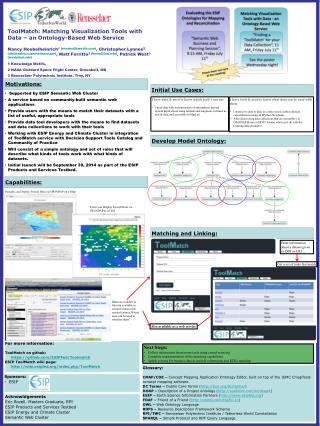
AIP-7 Results • GEOSS Water Services • 48 hour flood prediction • In collaboration with Disaster Management and Agriculture SBA’s • World-wide participation • WaterML2
AIP-7 Results • Crowd Sourcing for Disasters Management • Open GeoSocial API (NASA) • Citizen Science • In-Situ • Security • SSO
AIP-7 Results • Ocean • Plankton App • Ocean Observation App • Reversal of the computing paradigm • We “download the earth” to many times for local processing. Upload the process to the data!
AIP-7, Community Portals Paper • As good and necessary as the GEOSS Portal is, communities still wish to develop their own interface to relevant data and services • Provides visibility to their particular program • Supports integration of EO and non-EO data • Enables integration of specialized community services (e.g. helper applications, data processing, sensor webs, model webs…) • Ideally Community Portals will utilize GCI for discovery and access of GEOSS resources • GCI can enable CPs to present a community-specific view of GEOSS data, services, standards, etc. • Communities will need assistance • GCI documentation, recommendations, best practices, tutorials, etc.
GEOSS AIP-8 • Creation and deployment of light, web or mobile apps using GEOSS resources (earth obs. datasets) supporting SBA’s • Beyond visualization, Interactive, data analytics, simulations, graphs, tables, … • Engage with Community Portals • Call for AIP will be published on Jan 23rd. • Published via GEO, OGC, ESIP, … • Kickoff March 23 in Norfolk VA • Adjacent to GEOSS Science and technology workshop • Questions? info@opengeospatial.org